
Route: Luskentyre
Area: Outer Hebrides, Harris
Date of walk: 8th March 2024
Walkers: Andrew and Gilly
Distance: 2.2 miles
Ascent: 100 feet
Weather: Sunny
After this morning’s walk up Ceapabhal there remained time for another short walk in the afternoon. We decided on a stroll along Tràigh Losgaintir (Luskentyre beach), which has been voted the finest beach in the UK
We parked at the end of the minor road through Losgaintir (Luskentyre) and followed a path through the dunes onto the sands of Tràigh Rosamol, the northernmost part of Luskentyre Sands. We turned left to walk along the beach and as we did so we looked back to Beinn Dhubh, which brought back memories of a fabulous walk six years ago when we’d returned to the start via Tràigh Losgaintir
Navigation was a simple matter of walking along the beach with the sand dunes on our left. The island of Taransay was well seen across the sea, as were the mountains of North Harris. The beach curved round to the south and further along we made our way up to the dunes to head inland
When we reached a cemetery we turned left alongside the fence (with the graves on our right) and then followed a track which brought us onto the road. From here it was a short stroll back to the start
NOTE: tide times will dictate the exact route along the sands. Don’t be tempted to stray too far out as the tide comes in very quickly. The route is impassable at high tide, so check tide times before setting off on this walk
Click on the icon below for the route map (subscribers to OS Maps can view detailed maps of the route, visualise it in aerial 3D, and download the GPX file. Non-subscribers will see a base map)

Scroll down – or click on any photo to enlarge it and you can then view as a slideshow

On the way to the start of the walk we stopped the car to admire the wonderful view over Seilebost to Luskentyre. The beaches merge at low tide and it's hard to tell which is which

The walk will take us along a section of the beach to the left of the houses


A few minutes later, the start of the walk as we cross the dunes above Luskentyre sands...


We arrive on the beach, here looking across to Taransay

Beinn Dhubh on our right - we turn away from it and start the walk along the Traigh Rosamol, the northermost part of Luskentyre sands


Beinn Dhubh - we have fond memories of a walk up there six years ago, when we'd returned via the beach

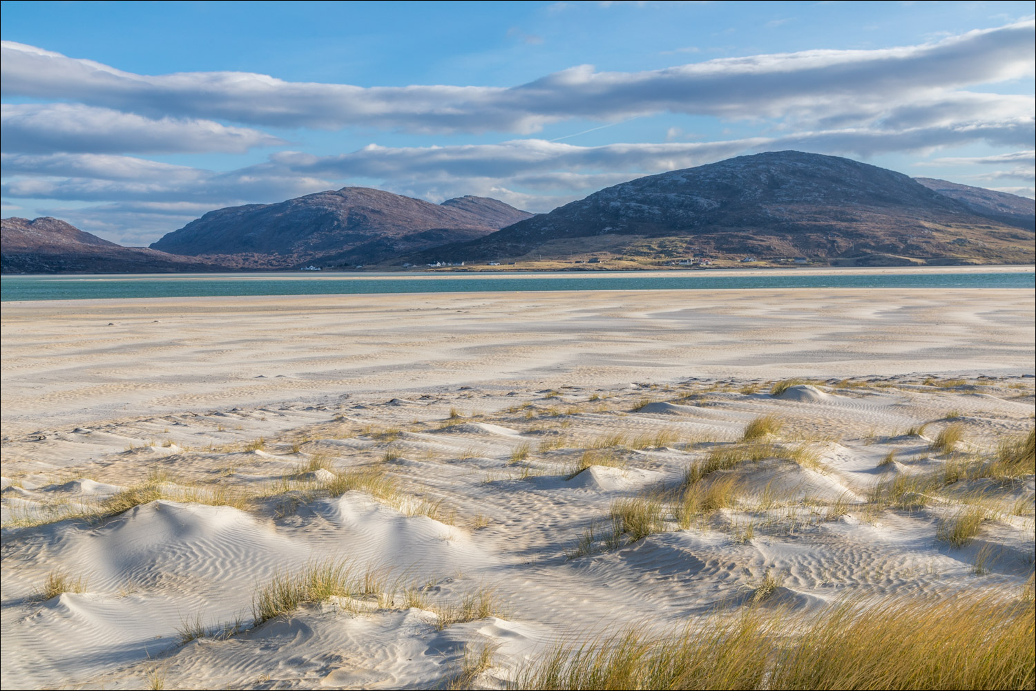
We round a headland where Traigh Rosamol ends and Traigh Losgaintir (Luskentyre) begins

The mountains of North Harris behind us...


Views of South Harris beyond the dunes...


All too soon we have to head up to Luskentyre village

We pass by the village cemetery

A final view from Luskentyre to Seilebost

The return leg is along the quiet road through the scattered settlement of Luskentyre

Almost back to the start of a short but sweet walk
Follow the link for more walks in Scotland (44)
