
Route: Sale Fell
Area: North Western Lake District
Date of walk: 17th May 2019
Walkers: Andrew
Distance: 3.0 miles
Ascent: 800 feet
Weather: Sunny spells at first, gradually clouding over
Sale Fell is situated in the far north west of Lakeland, and marks the end of the district. Its isolated position means that there are seldom many folk around
I drove along the charming Wythop Valley and parked in one of the roadside spaces near St Margaret’s Church. The gentle climb starts immediately and before long there were some good views of Bassenthwaite Lake. The path continued beside Wythop Woods, part of which has been felled along this section. I was keen to revisit Lothwaite and the ridge along it, as we’d had some fabulous views from here on previous visits. I followed the grassy path to Lothwaite and walked along the ridge towards the subsidiary hill of Rivings. It was a great disappointment to find that the wonderful view across Bassenthwaite Lake into the Lake District has been ruined by tree felling operations, and an ugly bare hill is now part of the scene
I then continued uphill, past Rivings, to the summit of Sale Fell. There are good views from here towards the Skiddaw fells but they are inferior to those from Lothwaite, and it would be a shame for anyone to omit Lothwaite from the route – despite the tree felling, there is plenty to enjoy from this lovely ridge, including views of Scotland on a clear day
I started the gentle descent in the direction of Bassenthwaite, soon joining up with my original ascent path. From here I retraced my steps back to the start
This is a short and simple walk which may lack the drama of the better known lakeland fells, but it’s thoroughly enjoyable and the perfect way to spend an hour or two in this peaceful and far flung corner of the district
For other walks here, visit my Find Walks page and enter the name in the ‘Search site’ box
Click on the icon below for the route map (subscribers to OS Maps can view detailed maps of the route, visualise it in aerial 3D, and download the GPX file. Non-subscribers will see a base map)

Scroll down – or click on any photo to enlarge it and you can then view as a slideshow

View across the Wythop Valley from the roadside parking area at the start of the walk

I follow the path uphill through the gorse

Tiny St Margaret's Church

A bench in need of restoration with a peep of Bassenthwaite Lake

The gradients on this walk are very gentle, and this is as steep as it gets

Hawthorn blossom...


I pass through this gap in the wall

Binsey beyond Bassenthwaite

Looking back to Embleton on the other side of the Wythop Valley

The hawthorn trees were a special feature along this section of the walk...


A hazy view back to Scotland in the distance

I pass through this gate onto open fellside and will follow a path beyond the stand of trees

Looking back to Sale Fell - I'm walking away from it at this stage and will climb it via the ridge on the left

Lothwaite, which I'd been looking forward to, as the views from here are superior to those from Sale Fell itself

The lovely view over Bassenthwaite Lake to Skiddaw

This is the view I'd been looking forward to - a photo taken 2 years ago...

...and one from last year...

...and now today. My heart sinks, and there is now a permanent blot on the landscape of one of my favourite walks

All is not lost however, as Scotland and the Solway Firth are well seen from here on a clear day

Looking down into the valley below...


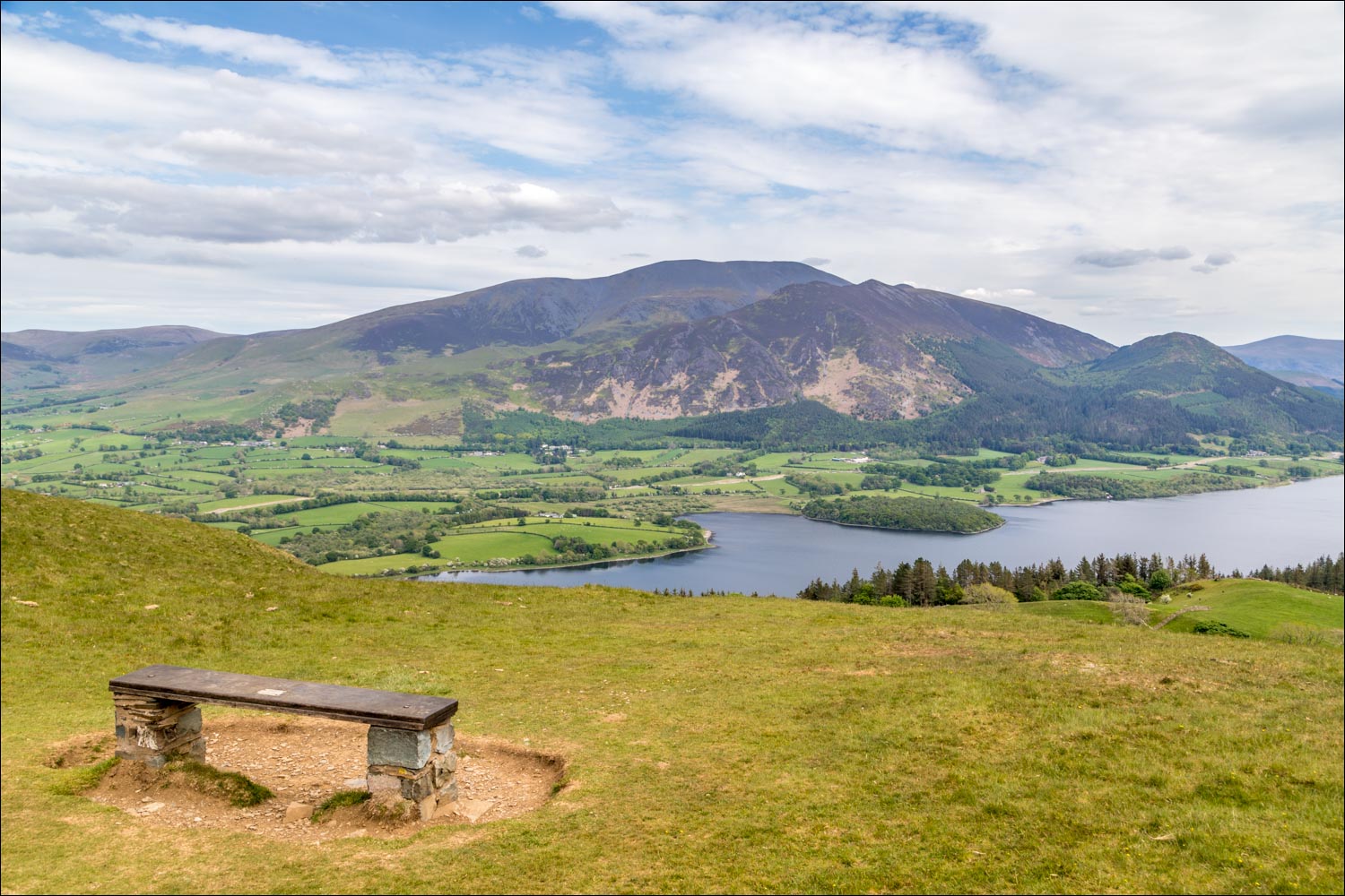
Bench with a view

I turn towards Sale Fell and follow the easy path to its summit

A cairn below the summit looking out to sea

The summit (if that's the right word) is just beyond the dry stone wall

From Sale Fell, looking into lakeland

Zooming in on the Solway Firth and Scotland

Bonnie contemplates the way down, which is in the direction of Bassenthwaite Lake

Looking across to our earlier path up to Lothwaite

We retrace out steps back to the start

St Margaret's Church comes into view again

The end of a wonderful short walk
