
Route: Muker to Thwaite
Area: Yorkshire Dales
Date of walk: 27th June 2018
Walkers: Andrew
Distance: 4.7 miles
Ascent: 600 feet
Weather: Sunny, cloudless, very hot
I parked in the public car park by Straw Beck at the edge of Muker, and after walking into the village and past the church I followed a path beside the River Swale, part of the well known Pennine Journey. A glance at the OS maps will show the walk to Thwaite can be made shorter, but the reason for my choice of paths was to walk through some of the Muker meadows, a series of wildflower meadows which are protected as a Site of Special Scientific Interest. I was just in time, as haymaking was in progress all around the valley and it won’t be long before the remaining meadows are harvested in order to provide winter fodder for livestock. The detour was a worthwhile one and it was a beautiful, albeit short, section of the walk
Just beyond Rampsholme Bridge I reversed my direction of travel, turning sharp left by a stone barn, and joined a path leading gently uphill. This in turn joined a metalled track which took me uphill to Kisdon, the highest point of the walk at around 1,200 feet, from where there are extensive views along Swaledale
From here I could see Thwaite in the distance and a simple descent took me into the quiet village. By now I was parched, thanks to a combination of sweltering heat and a climb, and I realised that I’d stupidly left my water in the car. Luckily refreshments are available in Thwaite and I was able to slake my thirst at the excellent Kearton Tearooms
I retraced my steps back through the village and then joined a path through the meadows beside Straw Beck. The path ended at the valley road, but after a couple of minutes I turned off and walked through a campsite to join another path through the fields which took me directly back into Muker, and the end of a thoroughly enjoyable walk
For other walks here, visit my Find Walks page and enter the name in the ‘Search site’ box
Click on the icon below for the route map (subscribers to OS Maps can view detailed maps of the route, visualise it in aerial 3D, and download the GPX file. Non-subscribers will see a base map)

Scroll down – or click on any photo to enlarge it and you can then view as a slideshow

St Mary's Church Muker at the start of the walk

I head north out of the village along a path which is part of 'A Pennine Journey'

Stone barns in the fields...


Looking back to Ramps Holme Bridge over the River Swale (I don't cross the bridge)

Looking back over the River Swale as I reverse my direction of travel and head south...


I pass by another old stone barn

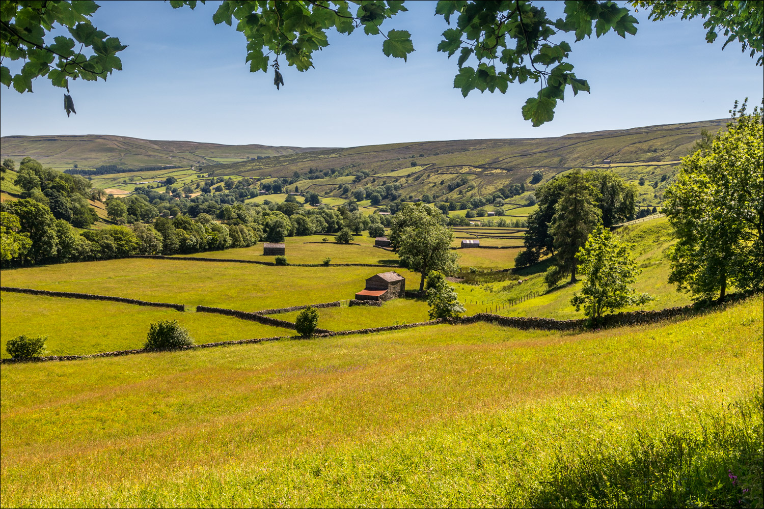
Swaledale...


Muker again, but I turn right here to head uphill...


Looking back into Swaledale

More old stone barns...


I continue along the Pennine Way...


I descend towards Thwaite...


Thwaite, and from here I start the return leg back to Muker

Straw Beck

I follow the path along the valley floor...


Approaching Muker...


Back to Muker, and the end of a lovely walk

Spotted flycatcher in the garden before I set off to Muker
Follow the link for more walks in the Yorkshire Dales (21)
