
Route: Circuit of Crummock Water
Area: Western Lake District
Date of walk: 29th June 2018
Walkers: Andrew
Distance: 8.4 miles
Ascent: 800 feet
Weather: Sunny and very hot
I awoke to another cloudless sky – the weather has been like this for weeks now. I decided to walk around Crummock Water again, as it was far too hot for a fell walk and I guessed that the temperature would be approaching 30C by midday. It was good to leave fleeces, gloves and waterproofs at home in the certain knowledge that they wouldn’t be needed, although the weight saved was replaced instead by sunhat, suncream and as much water as I could comfortably carry
I parked as usual in the National Trust car park at Scale Hill and followed the track to the foot of the lake. There were only one or two other people about, as I’d made an early start. I set off in an anti-clockwise direction as the views down the lake are more extensive in that direction
After reaching the foot of the lake I followed the easy lakeshore path which turns towards Mellbreak and then follows its eastern foot. This section is normally very boggy, but not so today thanks to a lack of rain for 6 weeks or so. When I reached Scale Bridge I crossed over the beck and followed the path into Buttermere village. Beyond the village there’s a short road section, and to minimise contact with tarmac I took the path over Hause Point below Rannerdale Knotts. This brought me down to the Buttermere road again. I could have avoided the road again by diverting into Rannerdale and taking the path to Cinderdale Common, but decided instead to carry on along the road – it was too hot for detours, even minor ones
At Cinderdale Common I turned off the road to join a path leading down to the eastern shore of Crummock Water which I followed back to the foot of the lake, and from here I retraced my steps along the track back to the start
For other walks here, visit my Find Walks page and enter the name in the ‘Search site’ box
Click on the icon below for the route map (subscribers to OS Maps can view detailed maps of the route, visualise it in aerial 3D, and download the GPX file. Non-subscribers will see a base map)

Scroll down – or click on any photo to enlarge it and you can then view as a slideshow

The day before the walk, it was good to see lots of activity from the endangered Spotted Flycatchers in the garden - they appear to have bred successfully...

...and in our neighbour's garden, a Pied Flycatcher has caught a caterpillar for its young

Next day, the start of the walk as I follow the main track from the car park to the foot of Crummock Water

Lanthwaite Wood

I arrive at the lakeshore

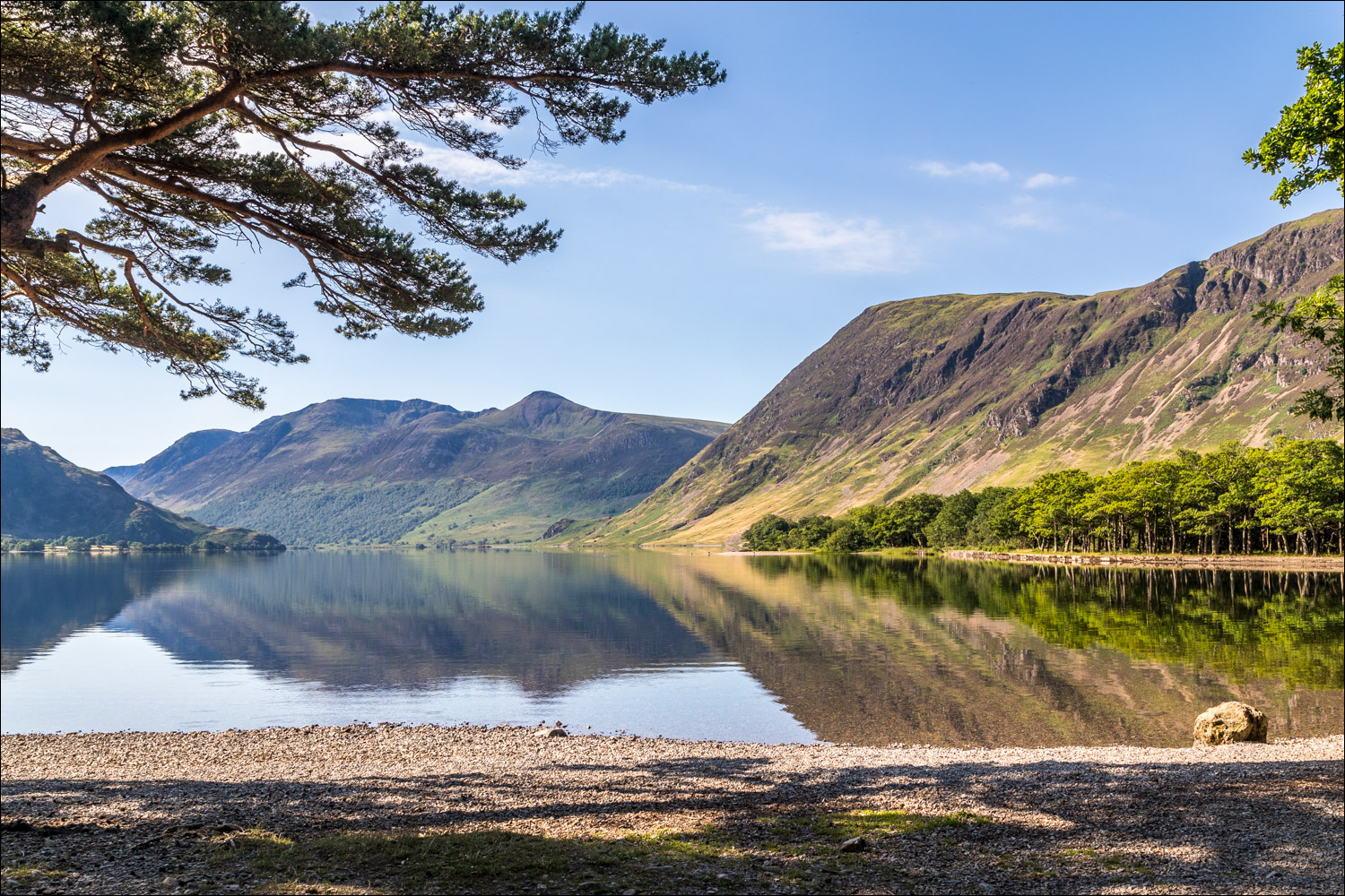
View along the lake with the High Stile range in the distance and Mellbreak on the right

I cross the footbridge over the River Cocker at the point where it starts its journey

I set off anti-clockwise around the lake

Looking across to the boathouse on the far shore, which I'll pass at the end of the walk

The lake is as calm as a millpond along this section...

A stand of old pine trees below Mellbreak

The path takes me past the pine trees

Looking across to Grasmoor

Mellbreak

Crummock Water reflections...


I walk along the shingle beach

View to the head of the lake

Looking back to Whiteside and Grasmoor

I continue along the western shore of the lake

High Ling Crag...

...and Low Ling Crag

A circular sheepfold by Scale Beck which is shown on the OS maps, and some interesting clouds above

I cross the bridge over Scale Beck

Fleetwith Pike, as I approach the head of Crummock Water

I cross another footbridge...

...which is aimed directly at Fleetwith Pike

Buttermere Dubs, which flows between Crummock Water and Buttermere

I cross ancient Scale Bridge

Buttermere Dubs

The path to Buttermere village

Entering Buttermere village...

...and leaving it, with a view to High Stile above Cragg House Farm Cottages

A short road section, part of which may be avoided by using the track through the woodland ahead

I leave the road to make the gentle climb up to the hause below Rannerdale Knotts

Looking back down to Woodhouse Islands, with High Stile and Red Pike above them

Wood House, nestled in a wonderful location near the head of Crummock Water

High Ling Crag again as I round the hause

From here I descend to the Buttermere road, which I follow for 10 minutes or so (this could be avoided by diverting into Rannerdale at the end of the descent)


I leave the road to join a path leading down to the shore of Crummock Water

Looking back to Rannerdale Knotts and Red Pike

Mellbreak

Further along the lakeshore path

I pass by the boat house

View from the National Trust car park at the end of the walk - Mellbreak and the River Cocker
