
Route: Mellbreak
Area: Western Lake District
Date of walk: 1st January 2019
Walkers: Andrew
Distance: 6.3 miles
Ascent: 1,800 feet
Weather: sun and blue skies
I parked in the small parking space by Church Bridge, just beyond the famous Kirkstile Inn, and walked towards Mellbreak along the lane. Seen from this approach, the fell looks like a pyramid and its north face appears quite formidable.
Beyond Kirkgate Farm the lane deteriorates into a stony track which leads into the isolated valley of Mosedale. I left the lane at a firebreak in the woods and started the climb up the initially grassy slopes of Mellbreak. I then arrived at the steep scree section which at times is a case of two steps up, one step down. The main gully has become very eroded and several minor paths have emerged as walkers have sought out easier ways to the top. If in doubt, it’s best to follow those paths which trend from right to left. Walking poles are useful on the steep ascent, though they become a hindrance further up where there are a couple of rocky sections. The lovely retrospective views over Loweswater and Lorton Vale gave me a good excuse to stop and catch my breath as I toiled up the fellside
I eventually emerged at the north top and made the easy but juicy walk across the saddle to the south top ¾ mile away. The views from the ridge are restricted by its width, but there’s a wonderful feeling of isolation. Once I arrived at the south top the views opened up again, and the prospect over Crummock Water to Buttermere and Fleetwith Pike was glorious
I descended in the direction of Scale Force and then followed Scale Beck to the shore of Crummock Water. After walking along the shore of the lake, with Mellbreak towering above to my left, I climbed up towards Flass Wood and made my way back to the start via High Park and Low Park. It was the perfect start to a new year of walks
For other walks here, visit my Find Walks page and enter the name in the ‘Search site’ box
Click on the icon below for the route map (subscribers to OS Maps can view detailed maps of the route, visualise it in aerial 3D, and download the GPX file. Non-subscribers will see a base map)

Scroll down – or click on any photo to enlarge it and you can then view as a slideshow

The day before the walk a family outing to Lanthwaite Hill, or Unicorn Mountain as our granddaughter Phoebe calls it. Mellbreak is on the right of the photo

Looking back to the Kirkstile Inn and Church Bridge at the start of my first walk of 2019

I pass by Kirkgate Farm

I follow the track towards Raven Crag at the foot of Mellbreak

Looking back over Lorton Vale

Whiteside, and Grasmoor to the right

Lowpark below, which I'll pass through at the end of the walk

I leave the track here to head up through this firebreak in the trees

Looking back to Redhow Crags in Lorton Vale

The Kirkstile Inn and Church Bridge, where I'd started the walk

Lorton Vale again from a very steep and loose section of the ascent

Two walkers below following the same route, the only other people I encountered until the end of the descent (it was good to chat to you both, if you ever read this)

Mellbreak's next door neighbour, Hen Comb

Early morning light on the Kirkstile, Low Fell and Lorton Vale

Lorton Vale again

Crummock Water comes into view

Looking back to a rocky promontory and to Loweswater village below

A detour to the 'lovely peep around a corner' as described by Wainwright

The foot of Crummock Water

Loweswater, and a hazy view of the coast beyond

Grasmoor

North top of Mellbreak

The Loweswater fells from another cairn on the north top

Whiteside, Hopegill Head and Grasmoor

Hen Comb as I set off along the saddle shaped ridge of Mellbreak

A small tarn on the soggy path from north to south

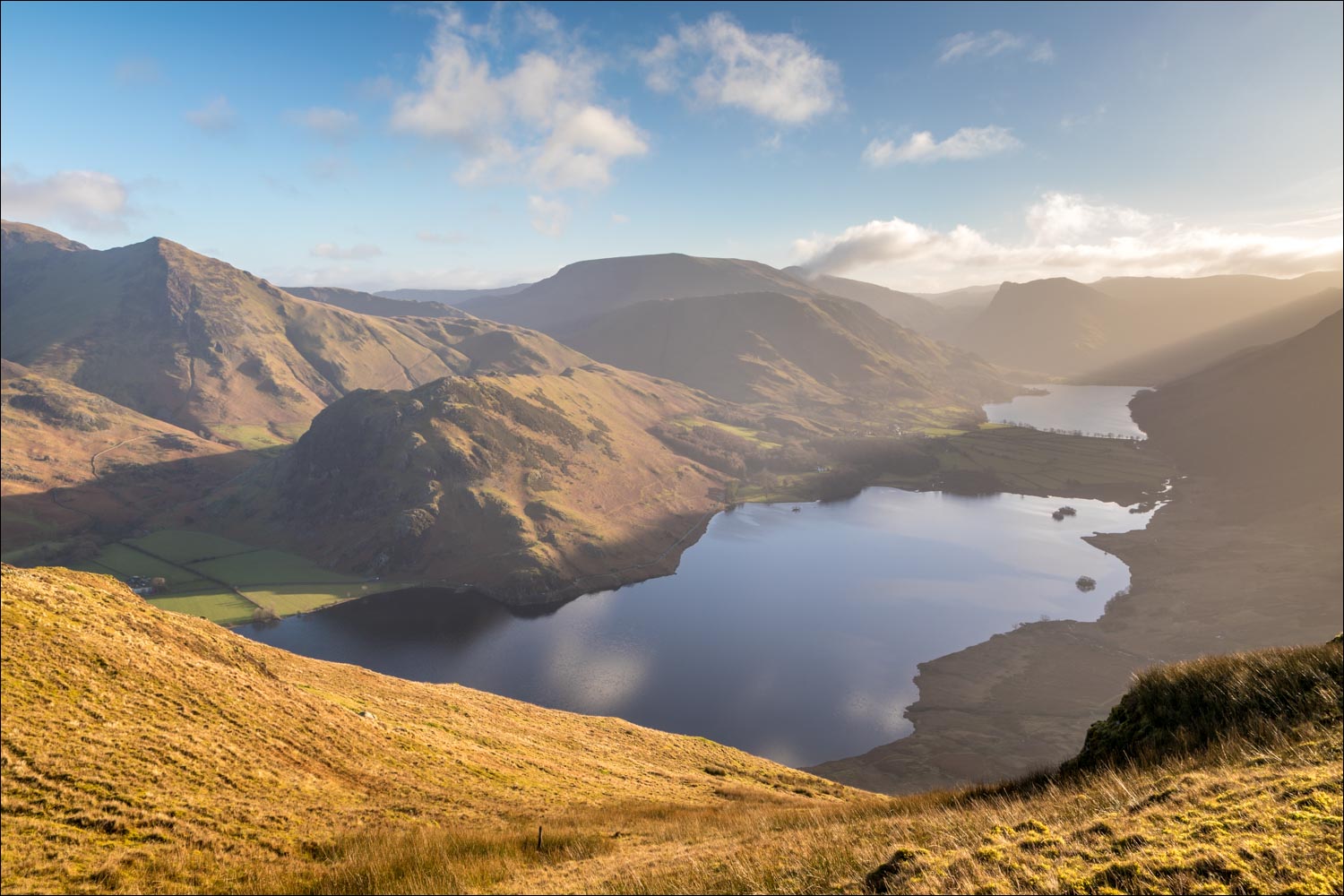
Buttermere from the south top of Mellbreak

A short detour to capture this view over Crummock Water and Buttermere

Scale Knott, but there is no way down from there and it's necessary to deviate away from the lake in the direction of Mosedale

Mosedale and Hen Comb

I cross this old wire fence - the pointed outline of Fleetwith Pike is at the head of the valley

Whiteless Pike as I turn east to head down to Crummock Water

I follow a rough path with Scale Beck on my right

Sheepfold near the shore of Crummcok Water, with Rannerdale Knotts above it

I arrive at the shore of Crummock Water

Fleetwith Pike in the distance

Low Ling Crag, a narrow finger of land which protrudes into the lake...


Looking back to Low Ling Crag...


Near the foot of the lake I leave the lakeshore to head back towards Loweswater village

A view back to Grasmoor from the lane beyond Lowpark

Back to the car park at Church Bridge and a view of the imposing north face of Mellbreak
