
Route: Lorton Vale
Area: Western Lake District
Date of walk: 4th August 2022
Walkers: Andrew and Gilly
Distance: 4.1 miles
Ascent: 500 feet
Weather: Sunshine and cloud
Lorton Vale is a chain of valleys stretching from Cockermouth in the north to Buttermere in the south. The middle section, with the villages of High Lorton and Low Lorton at its centre, may lack the drama of the Buttermere area but is full of rural charm and is an ideal place for a quiet walk. During the entire walk we only met four other walkers, and these were all local friends and neighbours
There are several free parking spaces by the phone box at the crossroads in High Lorton. We set off in a clockwise direction so as to have the best views ahead of us as we progressed. I’d encourage anyone following this walk to call in at the Lorton Village Shop (also known as the ‘Shed with a View’). The shop is a focal point of the community and deserves as much support as possible. We climbed out of the village via Boonbeck and Scales and joined the mid level path which runs along much the valley. The section near High Swinside holiday cottages is beautiful, with wonderful views along and across the valley, shown at their best today thanks to clear light, sunshine and big skies
Beyond High Swinside we joined the gated road for a short distance and then rejoined the path, which curves round the foot of Lorton Dodd. We crossed Hope Beck via the new footbridge – a great addition to the path as fording the beck used to be quite tricky after rain. We then carried on round the foot of Dodd along a path which is juicy at the best of times
It’s hard to leave such an enchanting path, but we did do so at Miller Place in order to start the return leg. We walked down the outgang from the fellside and followed the quiet lane through Hopebeck. Just beyond Hopebeck we took a path across the fields back into High Lorton. It was two hours well spent in perfect unspoilt countryside
For other walks here, visit my Find Walks page and enter the name in the ‘Search site’ box
Click on the icon below for the route map (subscribers to OS Maps can view detailed maps of the route, visualise it in aerial 3D, and download the GPX file. Non-subscribers will see a base map)

Scroll down – or click on any photo to enlarge it and you can then view as a slideshow

We walk out of High Lorton and call into the village shop for some essentials - flapjack being one of them

After passing by the village hall we turn right for Boonbeck and Scales

Looking along Whit Beck to the 'Lorton Yew', immortalised by William Wordsworth: "There is a Yew-tree, pride of Lorton Vale which to this day stands single, in the midst of its own darkness, as it stood of yore." Sadly the tree has suffered storm damage and is half the tree it used to be

The bridge over Whit Beck from a small communal garden area

We leave High Lorton and follow the lane uphill, leaving it near the tree ahead

We follow this path to the small settlement of Scales

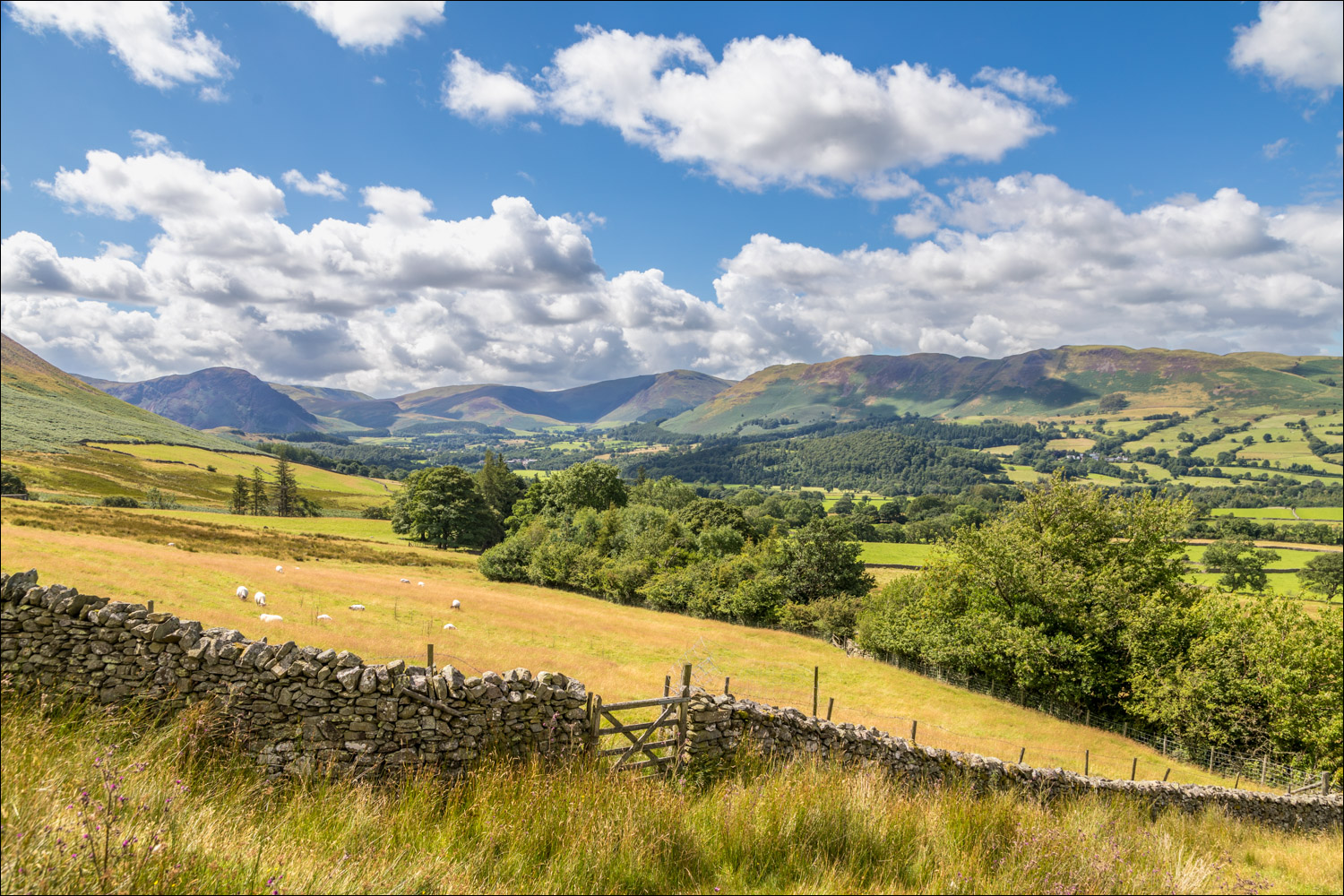
Looking along Lorton Vale, with the saddleback shape of Mellbreak to the left

Beyond Scales we head south along the valley...


A view across the valley to Low Fell and Fellbarrow

We pass through High Swinside Holiday Cottages, which enjoys one of the best views in the Lake District

We follow the access road out of High Swinside

Sweet Lorton Vale

Heather clad Hopegill Head and Whiteside


We leave the gated road from High Swinside and follow this path, initially in the direction of Whiteside

Lorton Vale again

Looking back, Criffel in Scotland is visible in the distance

Lorton Dodd on the left

We cross the new footbridge over Hope Beck - thanks to all who organised this

View across Lorton Vale from the bridge over Hope Beck

The path contours around the fellside as we head in the direction of the Loweswater Fells

Low Fell on the far side of the valley

The valley path continues for many a mile, but we leave it at Miller Place (mid-picture) to start the return leg

A pastoral scene looking across the vale to Low Fell and Fellbarrow

We descend the outgang beside Miller Place...


At the end of the outgang we turn right and follow the lane towards Hopebeck....


We leave the lane here to follow a path through the fields

Lorton Dodd


Another view back to Lorton Dodd

We follow the lane from Low Swinside for a short distance

Heading back to High Lorton....


Looking back to a barn below Hopegill Head, Whiteside and Lorton Dodd

High Lorton ahead

A final look back along the valley

We arrive back in High Lorton
Later that day…
