
Route: Lanthwaite Hill
Area: Western Lake District
Date of walk: 25th February 2020
Walkers: Andrew
Distance: 2.1 miles
Ascent: 400 feet
Weather: Cloudy, with sunny patches and a couple of hail showers
Lanthwaite Hill, also known as Brackenthwaite Hows, is one of my favourite places in the Lake District. This walk has featured on my site many times, but I take the view that no two walks are ever the same – changing seasons and variations in the light and weather make for an infinite number of possibilities – and there’s always something new to be seen
The hill and surrounding woodland have recently been purchased by the National Trust, which will preserve this place for future generations
I parked as usual in the National Trust car park at Scale Hill. Instead of taking the obvious track ahead, which leads directly to the north shore of Crummock Water, I turned left up a steepish path through Lanthwaite Wood. At a junction I turned left again to continue uphill, climbing a steep rocky staircase along the way. It was good to see a red squirrel scampering around in the woodland
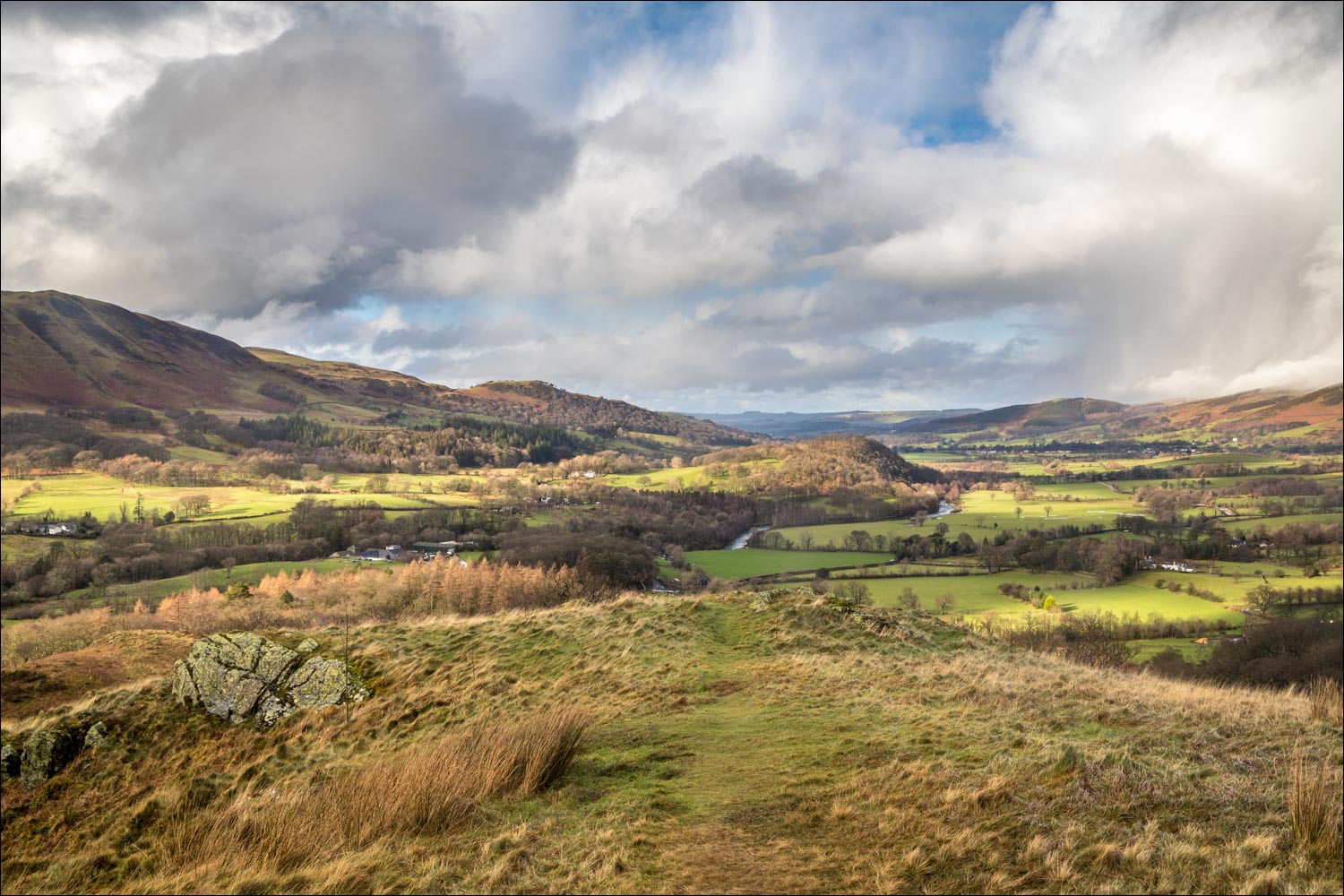
After leaving the woods via a deer gate I was soon at the top of the hill, admiring the superb views over Lorton Vale, Loweswater and Crummock Water. I then followed the easy path back down into Lanthwaite Wood, following a path which hugs the edge of the woods, giving good views across to Lanthwaite Green
The path descends to the eastern shore of Crummock Water, and when I arrived at the lakeshore I followed the path to the foot of the lake, from where there were more good views towards Mellbreak and Rannerdale Knotts. From this point there are two ways back to the start – a path which follows the bank of the River Cocker, and the wide track leading through Lanthwaite Wood. The riverside path was not an option today in view of the recent floods, so I followed the main track back to the start of the walk
For other walks here, visit my Find Walks page and enter the name in the ‘Search site’ box
Click on the icon below for the route map (subscribers to OS Maps can view detailed maps of the route, visualise it in aerial 3D, and download the GPX file. Non-subscribers will see a base map)

Scroll down – or click on any photo to enlarge it and you can then view as a slideshow

A very full River Cocker seen from the Scale Hill car park at the start of the walk, with Mellbreak in the background

The track through Lanthwaite Wood - I'll return that way but here turn sharp left uphill

It's a short but quite steep climb to the top of Lanthwaite Hill

I leave Lanthwaite Wood via this deer gate

I follow the path to the top, with aptly named Whiteside in the background

Whiteside

Looking across to Lorton Vale as I approach the top of the hill

Whiteside again

A hailstorm passes over Lorton Vale

Lanthwaite Green at the foot of Grasmoor...


The River Cocker below as the hailstorm passes over Lorton Vale

The same scene a minute later as the storm blows across the valley

Crummock Water and Mellbreak from the top of Lanthwaite Hill

Loweswater from Lanthwaite Hill

Looking back along the path I'd followed, with Low Fell in the background

Rannerdale Knotts, and Great Gable mid picture

I descend into Lanthwaite Wood below

There are various paths leading into the wood, but I keep to its edge and follow the course of this dry stone wall...


The path leads down to the shore of Crummock Water

I arrive at the boathouse on the east shore of the lake

Another hail shower passing across the foot of Mellbreak

I follow the path to the foot of Crummock Water...


Crummock Water

Looking back to the boathouse through another shower of hail

The big toe of Mellbreak

A hail shower passes across Crummock Water...


It's time to turn my back on the lake and return to the start along the track through Lanthwaite Wood
