
Route: Dalemain to Dacre
Area: Eastern Lake District
Date of walk: 18th April 2019
Walkers: Andrew and Gilly
Distance: 3.0 miles
Ascent: 300 feet
Weather: Same as yesterday – sunny and warm but very hazy
We were hoping to climb a fell today, but a high level walk would have yielded no views whatsoever thanks to a thick blanket of haze which has been lying over the district this week. Our thoughts turned to Dalemain, one of our favourite places. We’ve been coming here for over 20 years and there’s always something new to see in the beautifully laid out and tended gardens. Combined with a short walk to nearby Dacre, this would fit the bill perfectly
We arrived just after opening, which was 10am today, and made our way around the gardens. We knew we’d be too early in the season to see the Himalayan blue poppies which are a feature of Dalemain – click here to see a previous visit with some photos of these beautiful plants at their peak. However there was much else of interest, including a wonderful display of daffodils in the lower gardens by Dacre Beck
After meandering around for an hour or two, it was time to get on with the walk, which is no more than a leisurely stroll along the estate road from Dalemain to Dacre, passing through rolling farmland. There are good views in all directions, but the long distance ones were ruined by the haze. Less than 1 hour after setting off we arrived in Dacre and looked round the small church of St Andrew’s. There’s often a pub near a church and we were glad to notice that the pub in Dacre – the Horse & Farrier – has re-opened under new management. In the interests of consumer research, and also because we were hungry and thirsty, we paid it a visit – and I can highly recommend the pub for its food and friendly service
Suitably refreshed, we retraced our steps along the estate road back to Dalemain to end a short but very enjoyable walk
For other walks here, visit my Find Walks page and enter the name in the ‘Search site’ box
Click on the icon below for the route map (subscribers to OS Maps can view detailed maps of the route, visualise it in aerial 3D, and download the GPX file. Non-subscribers will see a base map)

Scroll down – or click on any photo to enlarge it and you can then view as a slideshow

Red squirrel in the west of the district before we headed east

Fallow deer in the walled deer park near the entrance to Dalemain

We pass through the cobbled courtyard

The pink facade of Dalemain Mansion, which dates back to 1744, and has been the family home of the Hasell family since 1679 – eleven generations

We walk around the side of the mansion

On a previous visit here, a mallard was using this urn as a nest


A Silver Fir, which is officially the largest in the country. It was planted in about 1840, has a girth of 19 feet, and stands over 85 feet tall

Looking across to the surrounding parkland

Some photos of the formal part of the gardens...


We climb down the steps to the woodland area by the bank of Dacre Beck

Here be dragons, if you look carefully

Daffodils...


Red squirrel at the door of Dalemain as we set off to Dacre (I'd seen a live one in the garden, but it disappeared before I could capture a photo)

Looking across to the deer park, which has been home to fallow deer since the mid-18th century

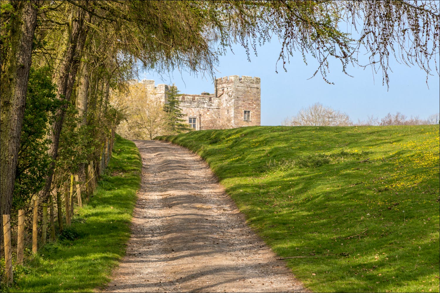
The track to Dacre - a map isn't necessary and it would be impossible to get lost here...


New born lambs...


We follow a line of trees which were planted in the year of the Queen's coronation...


Dacre Castle comes into view

The castle is part of the Dalemain Estates, and is a private house

Dacre village - we turn sharp right here to follow a public footpath to the church of St Andrew

inside the grounds of the church...


Window in the chancel engraved by Sir Laurence Whistler, and dedicated to the memory of Sylvia McCosh of Dalemain

We leave the church and pass by the old school house - 'builded' 1749

Time for refreshments - the excellent Horse & Farrier, an 18th century coaching inn

Cheers Keith

Suitably refreshed, we leave Dacre...

...and retrace our steps along the track to Dalemain
