
Route: Boredale and Howe Grain in Martindale
Area: Far Eastern Lake District
Date of walk: 17th April 2019
Walkers: Andrew and Gilly
Distance: 6.3 miles
Ascent: 1,500 feet
Weather: Sunny, warm but very hazy
I planned today’s walk with a view to avoiding the Easter Bank Holiday crowds, and could think of no better place than remote Martindale. This area, in the far east of the district, contains two of my favourite valleys, Howe Grain and Boredale, which can only be reached by driving along the narrow lanes on the east side of Ullswater and then up the steep zigzags to Martindale Hause
We parked by Martindale Old Church (St Martin), and were pleased to note that only one other car was parked there. We crossed nearby Christy Bridge and followed the lane along Howe Grain as far as Dale Head. The valley lane, and that along its neighbour, Boredale, is almost completely traffic free. Both are dead ends, and there are only a handful of houses and farms along both valleys
The area is home to the oldest red deer herd in England, and as we approached Dale Head it was a thrill to see a large group of them. From Dale Head we followed the easy slanting path up the slopes of Beda Fell up to Boredale Hause. Ullswater came into view here, as did the Helvellyn range, but the long distance views – which would normally be spectacular – were spoiled by a thick haze
From the hause we descended into Boredale. The path is quite steep, loose and stony near the top but the gradient soon levels out and before long we were on the valley floor. We joined the lane beside Boredale Beck, and enjoyed another sighting of red deer as went along. Near the end of the valley there’s a sting in the tail, with a short but steep ascent over the big toe of Beda Fell (this could be avoided by continuing along the valley road, but it would be at the cost of extra mileage)
The path then gently descended back into Howe Grain, and we enjoyed some lovely views along the valley as we strolled back to the car to end a wonderful walk, during the course of which we’d only seen a small handful of other walkers
For other walks here, visit my Find Walks page and enter the name in the ‘Search site’ box
Click on the icon below for the route map (subscribers to OS Maps can view detailed maps of the route, visualise it in aerial 3D, and download the GPX file. Non-subscribers will see a base map)

Scroll down – or click on any photo to enlarge it and you can then view as a slideshow

Red squirrel in the garden before we set off to the east of the district

The start of today's walk...


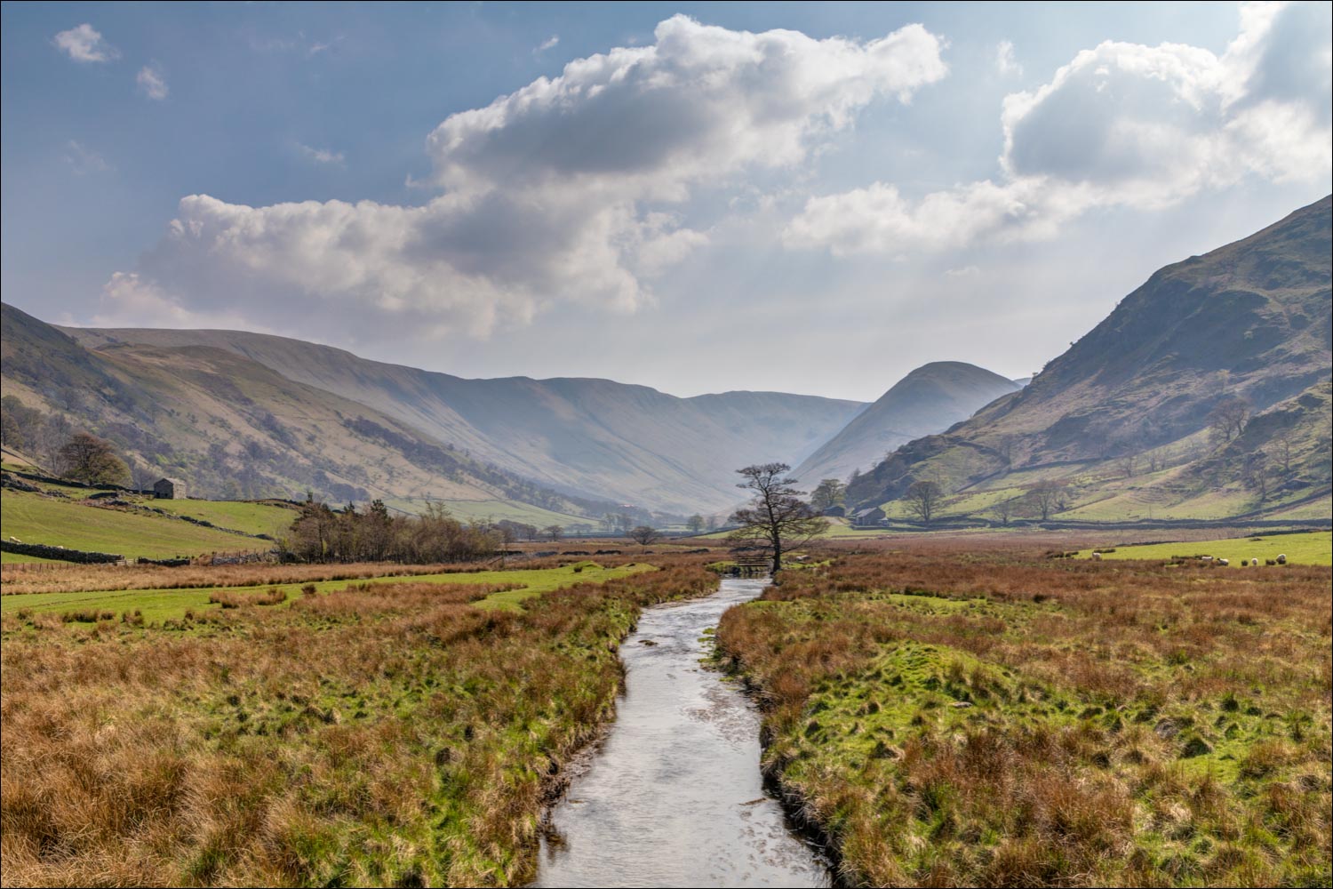
We cross Christy Bridge in the valley of Howe Grain

Looking along Howegrain Beck to the head of the valley

We pass by the old stone barns of Knicklethorns

We follow the lane along the valley, which is traffic free

New born lambs

Looking up to Howstead Brow on Beda Fell, we have our first sighting of the Martindale red deer (the photo was taken with a telephoto lens and cropped - the deer were some distance away and hard to spot)

Old barns in Howe Grain...


Looking back

On the other side of the valley, more red deer

The herd makes its way along the valley, fording Howegrain Beck in order to make progress

The area is known as 'Martindale Deer Forest', a deion which is now a misnomer


A buzzard being buzzed by a crow

We arrive at Dale Head, where Howe Grain divides into two subsidiary valleys - Bannerdale and Rampsgill

We turn right at Dale Head to start the climb up to Boredale Hause

Looking back to Dale Head at the start of the ascent

We leave the dry stone wall to branch off to the right

The head of Bannerdale

Looking back to Loadpot Hill

The path follow the flanks of Beda Fell...


Beyond Bedafell Knott we have our first glimpse into Patterdale, with Helvellyn and Catstycam on the right - sadly it's very hazy and the views are poor

The final vestiges of snow on Helvellyn

Glenridding, as we approach Boredale Hause

Gilly looks up to Place Fell before we embark on the descent into Boredale

The start of the descent into Boredale, quite steep and loose at first...

...but before long the path levels out

A peacock butterfly

We reach the valley floor

Boredale Head, where we join the deserted lane along the valley...


More red deer on the flanks of Beda Fell

We cross the bridge over Boredale Beck

When we reach the cottage ahead, we will leave the road and climb over Howstead Brow

Start of the ascent, which is short but quite tiring coming at the end of the walk

Looking back down into Boredale

It's worth the effort, as there are lovely views from Howstead Brow - here looking over Ullswater....

...back along Boredale...

...and now into Howe Grain, with the Old Church at journey's end bottom left

Gowbarrow Fell on the far side of Ullswater

We descend back into Howe Grain...


The old barns at Knicklethorns again

Looking along Howegrain Beck as we re-cross Christy Bridge

Back to the start - the tiny church of St Martins
