
Route: Loweswater and Holme Wood
Area : Western Lake District
Date of walk: 2nd March 2019
Walkers: Andrew, Gilly, Rob and Sarah
Distance: 5.7 miles
Ascent: 1,000 feet
Weather: Mostly cloudy with some sunny patches
This is one of our favourite local walks which, in the space of 6 miles, manages to cram in a huge variety of scenery including farmland, ancient woodland, a lake, a tarn, open moorland and a lonely valley. Along the way there are wonderful views over the Solway Plain looking north (including Scotland in clear weather) and to the high lakeland fells looking south
Rain was forecast for the afternoon, so we made an early start and parked as usual at Maggie’s Bridge where there is space for 8-10 cars. Instead of heading directly to Loweswater we followed the track to High Nook Farm, where Alfred Wainwright used to stay when he was researching his Guide to the Western Fells. After passing through the farmyard we carried on to the head of the valley before joining the wonderful terraced path above Holme Wood, which is an ancient coffin road from Loweswater to St Bees. The views from here are wonderful
The path contours around the sides of Carling Knott and Burnbank Fell and reaches a height of over 1,000 feet – higher than one or two lakeland fells. However the climbing is so gentle that it’s hardly noticed. We carried on towards Fangs Brow, on the very edge of the Lake District, before turning back at Iredale Place and following the path past Jenkinson Place and Hudson Place. We then walked back through Holme Wood, and along the shore of Loweswater, passing by the bothy as we did so
The last section was an easy stroll along the track between Watergate Farm and Maggie’s Bridge. We’ve followed this route on numerous occasions at every time of the year and never tire of it
For other walks here, visit my Find Walks page and enter the name in the ‘Search site’ box
Click on the icon below for the route map (subscribers to OS Maps can view detailed maps of the route, visualise it in aerial 3D, and download the GPX file. Non-subscribers will see a base map)

Scroll down – or click on any photo to enlarge it and you can then view as a slideshow

A brief visit to Rydal Water earlier in the week, where a large flock of Canada Geese enhanced the scenery...


A couple of days later, the start of the walk as we leave Maggie's Bridge car park and head towards High Nook Farm

Beyond the farm now, and looking back to Low Fell...

...and to Lorton Vale as we gain height

We reach the head of the valley, where we turn right

A view back along our path

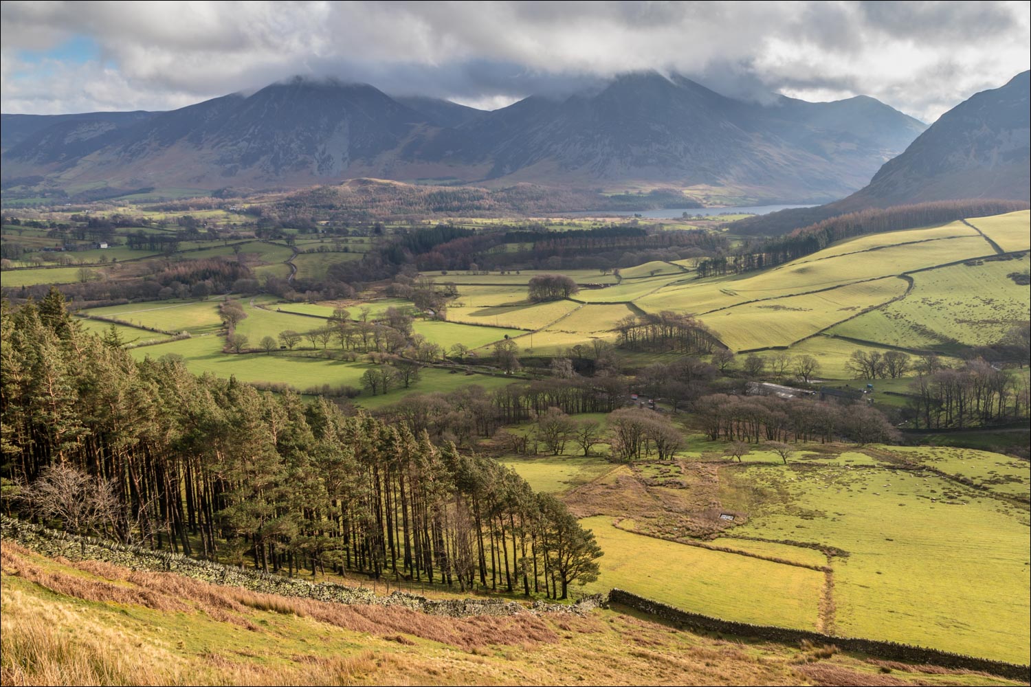
Looking across to Whiteside and Grasmoor in the clouds

We climb up the old coffin road in the direction of Holme Wood

Looking down on the path we'd followed earlier...

...and another view back along our path - High Nook Tarn is in the background and had been out of sight until we reached this higher vantage point

The foot of Crummock Water as we approach the edge of Holme Wood

Looking back to Gavel Fell

Green fields at the foot of Mellbreak

Hen Comb top right and our earlier path below

We follow the old coffin road above Holme Wood....


Sarah near the bridge over Holme Beck

Holme Wood, Loweswater and Crummock Water

A couple of photos for the family album - Rob and Auntie Gilly...

...and Rob and Sarah, who have recently announced the wonderful news that they are engaged to be married

After that short rest at The Bench we continue our walk - this is looking back along the path

On the fringe of the Lake District now - on a clear day Scotland would be visible in the distance

A view back into lakeland

Fangs Brow ahead, but we will turn right before it to start the return leg of the walk

Graythwaite and Graythwaite Wood

Heading towards Loweswater now, we walk above Iredale Place...


Bonnie and Eva on the lane between Iredale Place and Jenkinson Place

We pass above Jenkinson Place

Loweswater ahead

An ancient row of hawthorn trees before Hudson Place

We turn right here as we arrive at the lane to Hudson Place

We follow the shoreline path along Loweswater

A brief detour to the water's edge...


Rob and Sarah looking forward to their wedding, and Eva looking forward to a swim in the lake...


We cross the footbridge over Holme Beck

Holme Wood, managed by the National Trust

Holme Wood bothy, available to rent from the Trust


Looking along the foot of Loweswater (which is unusual as its waters drain towards the lakeland fells)

We follow the easy track back to Maggie's Bridge

A last look back towards Watergate Farm as we reach the end of a wonderful walk
