
Route: Loweswater and Holme Wood
Area : Western Lake District
Date of walk: 13th May 2017
Walkers: Andrew and Gilly
Distance: 5.7 miles
Ascent: 1,000 feet
Weather: Sunny, then clouded over
This is one of our favourite local walks which in the space of 6 miles manages to cram in a huge variety of scenery including farmland, ancient woodland, a lake, a tarn, open moorland, a lonely valley and along the way offers wonderful views over the Solway Plain looking north (including Scotland in clear weather) and to the high lakeland fells looking south
We parked as usual at Maggie’s Bridge where there is space for 8-10 cars and, instead of heading directly to Loweswater, followed the track to High Nook Farm – Alfred Wainwright used to stay here when he was researching his Guide to the Western Fells. After passing through the farmyard we carried on to the head of the valley before joining the wonderful terraced path above Holme Wood – the views from here are fabulous
The path reaches a height of over 1,000 feet, higher than one or two lakeland fells, but the climbing is so gentle that it’s hardly noticed. We carried on towards Fangs Brow, on the very edge of the Lake District, before turning back at Iredale Place and following the path past The Place. We then walked back through Holme Wood, and along the shore of Loweswater, where we were treated to a 4th wonderful display of bluebell in 4 days running
We’ve followed this route on numerous occasions at every time of the year and never tire of it – I hope that the photos which follow will show why this is so…
For other walks here, visit my Find Walks page and enter the name in the ‘Search site’ box
Click on the icon below for the route map (subscribers to OS Maps can view detailed maps of the route, visualise it in aerial 3D, and download the GPX file. Non-subscribers will see a base map)

Scroll down – or click on any photo to enlarge it and you can then view as a slideshow

Red squirrel in the rain on the morning of the walk


It brightened up later on, so after parking at Maggie's Bridge we followed the track to High Nook Farm

Further along the track

Looking across Highnook Beck - we cross the beck higher up the valley and follow the path by the dry stone wall

Looking back to Low Fell

Approaching the head of the valley

The path rises along the flanks of Carling Knott, giving ever improving views...

The toe of Mellbreak

Low Fell and a glimpse of Loweswater

Looking back to High Nook Tarn

Panorama of Whiteside, Grasmoor, Mellbreak and Lorton Vale - click or tap to see a larger picture

Whiteside, Grasmoor and Mellbreak again as the path gains height

We pass above Holme Wood

Looking back, Crummock Water comes into view

Burnbank Fell ahead, and beyond it a change of scenery

Looking over Holme Wood to Loweswater and Crummock Water

The foot of Loweswater below

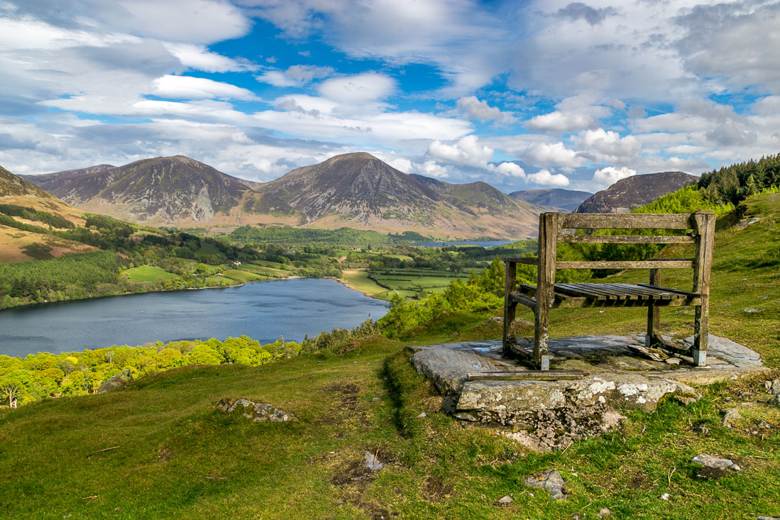
A bench with a view...


Looking back along the path

The Solway Plain ahead - the Solway Firth and Scotland may be seen on a clear day

The edge of the Lake District

A fell pony

Near Fangs Brow we start the return leg, and descend in the direction of Iredale Place

As we pass above Iredale Place Loweswater comes into view again

We follow a line of gnarled hawthorn trees

The path emerges at a small lane leading to Hudson Place

The farm cat

We join a path leading down to the shore of Loweswater...


Entering Holme Wood

We follow the main track through the wood, though there is alternative one which keeps to the lakeshore

More bluebells - the fourth display we've seen in the last 4 days


We cross Holme Beck

We continue through the wood, admiring the broad mix of trees


Approaching the end of the woodland path

Some light rain as the head of Loweswater is reached

We follow the track back to Maggie's Bridge

The result of recent timber operations - the car park is just beyond the log stacks
