
Route: Crummock Water and Lanthwaite Hill
Area: Western Lake District
Date of walk: 3rd January 2016
Walkers: Andrew, Gilly, Nicola, Rob, David and Sarah
Distance: 3.0 miles
Ascent: 400 feet
Weather: Overcast and dull, a few spots of rain
We opted for another favourite local walk today and parked in the National Trust car park at Scale Bridge. Instead of heading along the wide track to the foot of Crummock Water, we turned uphill and climbed up the steep rocky staircase which leads to the top of Lanthwaite Hill (or Brackenthwaite Hows as the OS calls it)
The views over Crummock Water, Loweswater and Lorton Vale were as good as ever though the dull weather didn’t show them in a good light. We descended into Lanthwaite Wood and skirted round the edge of the wood before following a narrow path down to the shore of the lake
We then followed the lakeshore path to the foot of Crummock Water before walking back to the start
This is a wonderful short walk even when the weather is poor
For other walks here, visit my Find Walks page and enter the name in the ‘Search site’ box
Click on the icon below for the route map (subscribers to OS Maps can view detailed maps of the route, visualise it in aerial 3D, and download the GPX file. Non-subscribers will see a base map)

Scroll down – or click on any photo to enlarge it and you can then view as a slideshow

The River Cocker as it flows past the car park at Scale Hill and Mellbreak beyond

We climb up through Lanthwaite Wood

We ascend the rocky staircase

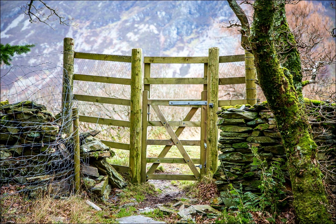
The deer gate at the edge of the wood leads onto Lanthwaite Hill

Beyond the hill is Whin Ben leading up to Whiteside


Views in all directions from Lanthwaite Hill - Lorton Vale…

…Loweswater…

…and Crummock Water in black and white

A friendly fellow walker took this photo of me, Nicola, Gilly, Sarah, David and Rob - with Bonnie trying to get in the picture too

Rannerdale Knotts and Lanthwaite Wood in mono as we descend from Lanthwaite Hill

We follow a path which skirts round the edge of Lanthwaite Wood


Looking across to Lanthwaite Green and Gasgale Gill

We reach the boathouse on the shore of Crummock Water, where the dogs enjoy a New Year swim

After the swim comes The Shake…


Introducing Winnie

We follow the path along the lakeshore

View from the foot of Crummock Water

We return to the start along this track through Lanthwaite Wood

Back home, a red squirrel in the garden
