
Route: Buttermere
Area: Western Lake District
Date of walk: 6th January 2016
Walkers: Andrew and Gilly
Distance: 5.6 miles
Ascent: 500 feet
Weather: sunny
We parked in the National Trust car park at Long How. Instead of walking straight into Buttermere vilage as normal, we made a brief diversion through the woods at Long How, almost as far as the head of Crummock Water, before turning back to cross the land between the two lakes. This area had been underwater last month following the recent floods. There was plenty of debris around and the ground was still sodden but perfectly walkable
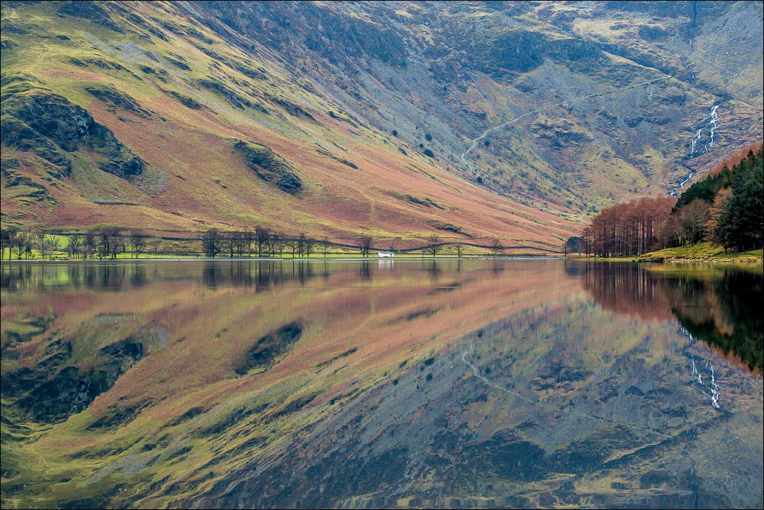
After arriving in Buttermere village we started out on the circuit of the lake in an anti-clockwise direction – for some reason we always do the walk this way round. When we reached the lakeshore the water was completely still and the surrounding mountains were shown as if in a mirror, a wonderful sight
The weather improved as we went along and by the time we reached the head of the lake there was sunshine and blue skies, most welcome after weeks of torrential rain and some of the worst flooding since records began
We’ve done this walk numerous times and always enjoy it. Today was no exception – a wonderful couple of hours well spent
For other walks here, visit my Find Walks page and enter the name in the ‘Search site’ box
Click on the icon below for the route map (subscribers to OS Maps can view detailed maps of the route, visualise it in aerial 3D, and download the GPX file. Non-subscribers will see a base map)

Scroll down – or click on any photo to enlarge it and you can then view as a slideshow

Start of the walk from Long How, just outside Buttermere village

We follow the path through Long How Wood

At the edge of the wood we turn left to walk across the land separating Crummock Water and Buttermere

Herdwick ram

We pass by the Fish Inn in Buttermere village

The track to the foot of the lake

Sourmilk Gill

Buttermere reflections…


Fleetwith Pike and Haystacks at the head of the lake

We cross the footbridge over Buttermere Dubs

Sourmilk Gill


We follow the inviting lakeshore path


Warnscale Bottom and the head of Buttermere

Highland cattle - these are gentle creatures and we don’t need to move off the path as they pass on by


Bringing up the rear

Turn right for Haystacks, but our path lies straight ahead today

Warnscale Beck

We follow the path across the head of the lake towards Gatesgarth Farm

From the bridge over Warnscale Beck, looking towards Warnscale Bottom

Looking back to Haystacks

There follows a short road section beyond Gatesgarth

A group of cormorants

Further round the lake

Scarth Gap between Haystacks and Seat

The High Stile Range


High Stile

Fleetwith Pike

Mellbreak


Into the tunnel we go…

…and out again at the other end

We carry on along the lakeshore path

Crepuscular rays, or God’s Fingers - depending on whether you are a scientist or a poet

Fleetwith Edge

Approaching Buttermere village


The final photo of the walk, Crag Houses, and our circuit is almost complete

Back home, a red squirrel in the garden…


…and a flock of herdies being shepherded down the lane

