
Route: Tom Heights and Tarn Hows
Area: Southern Lake District
Date of walk: 25th October 2025
Walkers: Andrew and Gilly
Distance: 4.2 miles
Ascent: 700 feet
Weather: A perfect autumn day
We’ve followed various routes around Tarn Hows in the past, click here for the last visit in November 2023 which is the classic circuit of the tarn. Thanks to an abundance of paths in these parts there are numerous alternatives, and today we decided to try a new one for us, one which would include an ascent of Tom Heights, a rugged little fell which rises above the shore of Tarn Hows. Standing at 883 feet it doesn’t quite qualify as a Wainwright fell, but the views from it are superior to many of the higher fells
We parked in the National Trust car park at Glen Mary. From there we crossed a footbridge over Tom Gill to start the climb up to Tarn Hows. The gill would be our companion throughout the climb and we passed by several attractive waterfalls along the way. After about 30 minutes we arrived at the shore of Tarn Hows. The tarn was originally three separate bodies of water but was combined into one in the 1860’s. Click here to learn more about its interesting history
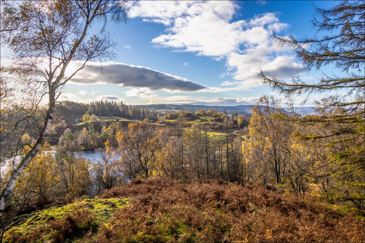
We turned left along the lakeshore path but after a short distance and, before the first outcrop, turned off to follow a faint path to the left leading uphill to Tom Heights. This junction is easily missed and the path up the fell isn’t indicated, nor is it shown on the OS maps. The views were lovely in all directions and continued to improve as we gained height. We eventually arrived at the summit, marked by a cairn, and made our way down through some juicy terrain to join the Cumbria Way. We followed this for a short distance and, on arriving at Tarn Hows, we turned left to walk around Rose Castle Plantation. Beyond the plantation there’s a choice of two paths. The obvious and very easy path keeps to the lakeshore, but we branched off to the left to take a higher path. This has far better views and is much quieter – it’s a heavenly section of the walk. Click here for a panorama
Beyond Tarn Hows the path continues to a lane, but we avoided following the lane by keeping to a path closer to the tarn, which then descended back to the shore of the tarn. At the end of the tarn we descended down a delightful path which ran parallel with our original ascent path. This brought us back down to Glen Mary and the end of a magical walk
Click on the icon below for the route map (subscribers to OS Maps can view detailed maps of the route, visualise it in aerial 3D, and download the GPX file. Non-subscribers will see a base map)

Scroll down – or click on any photo to enlarge it and you can then view as a slideshow

The start of the walk from the car park at Glen Mary as we cross over Tom Gill and head right uphill

We pass by several waterfalls in Tom Gill

The end of the climb up to Tarn Hows, which was fairly steep and rocky in places

We arrive at the popular lakeshore path and turn left, but only for a short distance before forking off to follow a faint path uphill

Looking across The Tarns

Looking back to Tarn Hows at the start of the climb up to Tom Heights

The path is a faint one and is not shown on the OS maps

Another view back to Tarn Hows

Further along the undulating path - the gradient is a gentle one and there are no difficulties

On the return leg we'll be taking the higher of the two paths on the far side of The Tarns

Looking south, Coniston Water comes into view

Wetherlam and the Coniston Fells on our left

We continue towards the highest point on Tom Heights

A glimpse of Windermere

Small cairn on Tom Heights, looking towards the Langdale Pikes

Coniston Water from Tom Heights

Tarn Hows and Windermere

Wetherlam

We make our way over to another cairn which marks the summit

The unmistakeable outline of the Langdale Pikes

Coniston Water again as we reach the summit of Tom Heights

Summit cairn on Tom Heights, looking towards Langdale

The start of the descent along a faint path

Looking back to the Langdale Pikes

We cross some very marshy ground - a decent pair of waterproof walking boots is recommended for this walk

The end of the descent as we join the Cumbrian Way and head back to Tarn Hows

We follow the shoreline path in a clockwise direction...


Views of Tarn Hows are obstructed by Rose Castle Plantation for a short distance

Looking down to the lower path as we take the higher one, which has better views and is quieter. Tom Heights can be seen on the far side of The Tarns


Looking back along the easy path

Tarn Hows from a rocky viewpoint

We arrive at a lane but there's no need to follow it as we're able to descend to the shore of the tarn via a path to the right

We climb down to the path below and turn left...


We pass by a small herd of Belted Galloways which graze the pastures around Tarn Hows...


At the end of The Tarns we turn left and then right to join a path back to the start which runs roughly parallel with our original approach path

The start of a lovely descent set at a gentle gradient...

Yewdale Fells


We turn sharp right at this ruined barn

We turn right at this gate to end a wonderful walk enhanced by clear light and golden autumn colours

Back home, a red squirrel in the garden
