
Route: Tarn Hows
Area: Southern Lake District
Date of walk: 3rd November 2021
Walkers: Andrew and Gilly
Distance: 2.5 miles
Ascent: 300 feet
Weather: Sunny patches, clouding over midway
Tarn Hows is a well known beauty spot, perhaps too well known as it can be a little busy at times. The tarn is partly artificial, having been formed in the 19th century by the merging of three small tarns. When the Tarns and their setting came up for sale in 1929, they were bought by Beatrix Potter who sold the half containing Tarn Hows to the National Trust, and bequeathed the rest of the estate to the Trust in her will
We made an early start in order to avoid the crowds drawn here by the beauty of the place, especially so during autumn. We normally park at the Glen Mary car park, but today we parked nearer Tarn Hows, at the main National Trust car park. The tarn is a short stroll away from here. We decided to walk anti-clockwise and take advantage of the good light – the best views are from the eastern side of the tarn. This proved to be a good decision as the sky clouded over by the time we reached the other shore
Navigation is a simple affair – just follow the well made path around the tarn. This is an easy walk which could be completed in an hour at a brisk pace (but who would want to do that amidst such beauty?). On reaching Rose Castle we made a there and back detour to a superb viewpoint which offers good views of the Langdale Pikes beyond Tom Heights. This was the highlight of the walk, as good light showed the autumn colours at their best. From here we followed the path around the tarn and back to the start of a short but classic walk
For anyone looking for a longer walk, or seeking to bag a Wainwright, a visit to Tarn Hows can be combined with a climb up Holme Fell or Black Fell. There are numerous paths in the area giving rise to many possibilities – for a few more ideas visit the Find Walks page and search Tarn Hows in the Search Site box
Click on the icon below for the route map (subscribers to OS Maps can view detailed maps of the route, visualise it in aerial 3D, and download the GPX file. Non-subscribers will see a base map)

Scroll down – or click on any photo to enlarge it and you can then view as a slideshow

The path to Tarn Hows from the main car park

There's not long to wait before this view of the tarns appears

Looking back along the path, with the Langdale Pikes in the background

Zooming in on the Langdale Pikes over Tom Heights

We follow the easy path, deserted at this early hour, but it will get busier later on


Views of Wetherlam on our left...


Wetherlam again

We make a short detour to a higher vantage point - the main path is below

The Langdale Pikes above Tom Heights

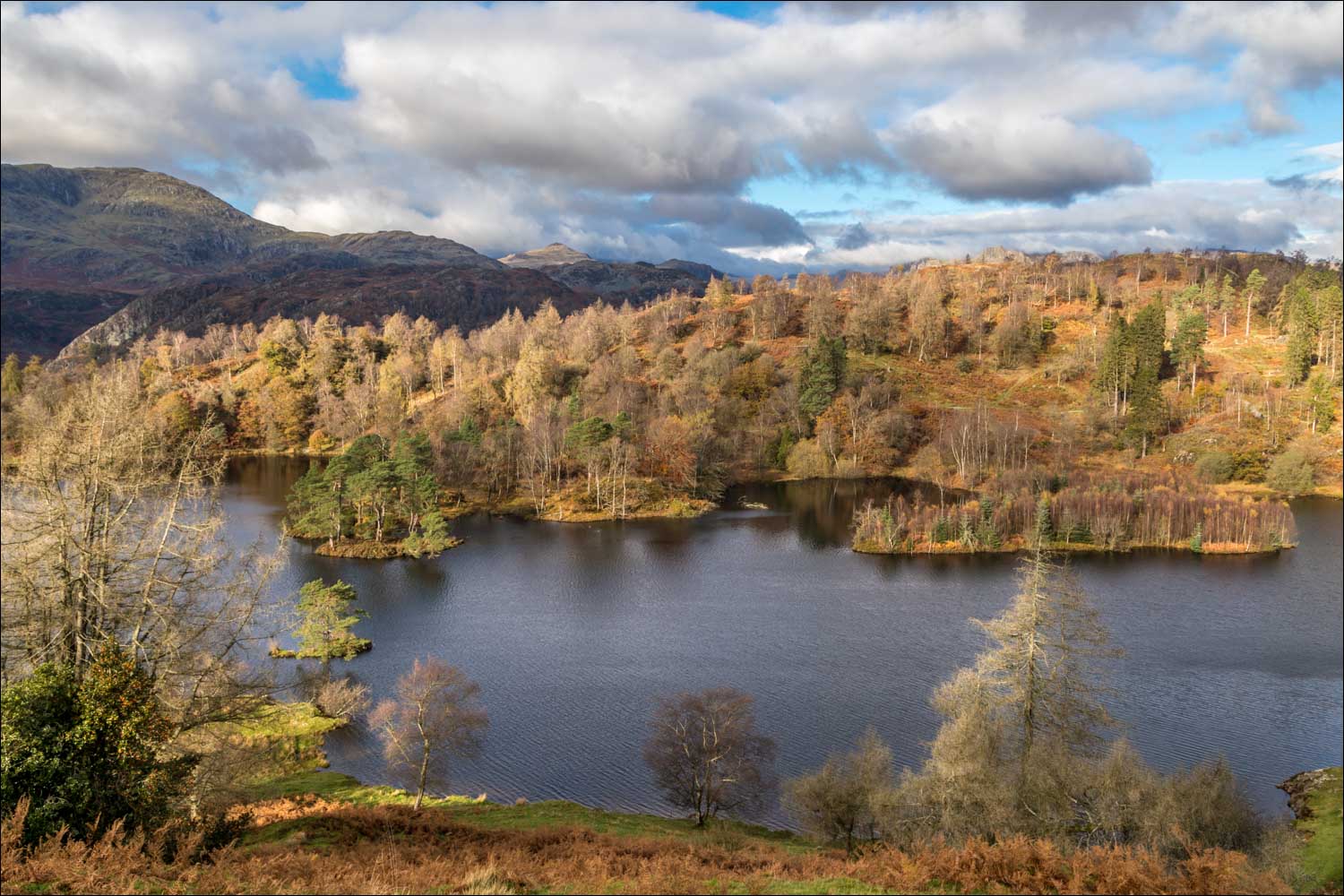
Tarn Hows, and Rose Castle Plantation at its head


Views of the Langdale Pikes as we reach the high point of the diversion...


A wider panorama

Wetherlam and the Coniston Fells

Pike o'Blisco

We retrace our steps to the main path below

We follow the path around the head of the tarns


Reflections in Tarn Hows...


We cross this footbridge to start the walk along the other shore of the tarns


A final glance back along our path as we complete the circuit and retrace our steps to the car park
