
Route: Chalkland Way Stage 5 – Huggate to Pocklington
Area: East Yorkshire
Date of walk: 15th August 2019
Walkers: Andrew
Distance: 10.9 miles
Ascent: 1,100 feet
Weather: Cloudy with a few sunny patches and some light rain
The Chalkland Way is a 40 mile long distance walk which explores the most northerly chalk outcrop in Britain, visiting the hills and valleys of the Yorkshire Wolds. The route was first established in 1994 by Ray Wallis, and is a worthy addition to the other long distance walks in the region – the Wolds Way, the Centenary Way, the Minster Way and the Wilberforce Way. Today’s walk was the last leg and would mark the end of a wonderful journey
Click on the links to the other stages walked so far:
- Stage 1 – Pocklington to Bugthorpe – 10.4 miles
- Stage 2 – Bugthorpe to Thixendale – 8.1 miles
- Stage 3 – Thixendale to Wetwang – 9.8 miles
- Stage 4 – Wetwang to Huggate – 6.7 miles
I started the walk from the same place I’d ended Stage 4 – the Wolds Inn at Huggate (which caters very well for hungry and thirsty walkers). After walking through the village I joined the Yorkshire Wolds Way, which shares its route with the Chalkland Way for much of the walk. After climbing up to Waterman Hole at the top of the wold I descended into Tun Dale and Frendal Dale. I’d been looking forward to this section, but the weather was dull and overcast and didn’t show these lovely dales in their best light. I climbed out of Frendal Dale, following a path shared by yet another long distance Wolds walk, the Minster Way. A steep down and up brought me to one of the scenic highlights of the walk, the lovely path above Millington, from which there are huge views out across the Vale of York. By a stroke of good fortune the weather was on my side along this section and there were patches of sunshine in contrast to the overcast conditions earlier
The path gradually descended from the wold to lead into Pocklington, often described as the ‘Gateway to the Wolds’ – several long distance paths make this town their starting point. On reaching Pocklington I headed to the town centre, where the efficient services of Gilly’s Taxis met me and took me back to my car in Huggate
I enjoy long distance walks such as this – there’s a sense of being on a journey, and a feeling of real satisfaction on reaching the end. Thanks to the founder Ray Wallis for engineering such a great walk
Click on the icon below for the route map (subscribers to OS Maps can view detailed maps of the route, visualise it in aerial 3D, and download the GPX file. Non-subscribers will see a base map)

Scroll down – or click on any photo to enlarge it and you can then view as a slideshow

The start of the final leg of the Chalkland Way as I pass by the Wolds Inn Huggate

At the edge of the village I leave the road and join the Yorkshire Wolds Way

I descend here to follow the track past Glebe Farm...


Horse Dale below...


The path descends into Horse Dale and almost immediately climbs out of it

Back on the top of the wolds as a rain shower comes and goes

I join York Lane and follow it towards the woodland ahead

At Waterman Hole, I come across 2 ancient looking markers. In fact they date from the 1960s, placed here by a local farmer. One bears the quasi Latin inion ‘Vallis Watermanhole Magna’. The one hidden in the hedge says ‘Petrol – 5 furlongs’

From here I descend into the woods...


Out of the woods now, and into Tun Dale

Tun Dale merges into Frendal Dale

Looking back as I climb out of the dale

Frendal Dale

A decent into Millington Dale is followed by an immediate re-ascent up the chalk path to the right

Looking back into Frendal Dale from the chalk path

I'm now following the Chalkland Way, the Yorkshire Wolds Way and the Minster Way


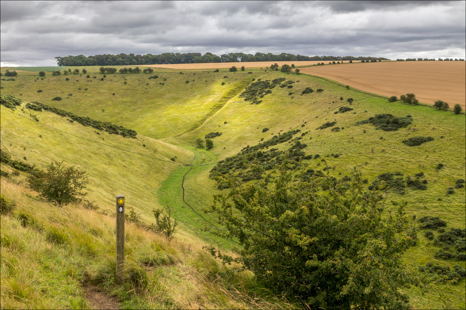
Well named Sylvan Dale below

I descend into the dale along a zig zagging path

Looking across to the Vale of York

Sylvan Dale again

On reaching the floor of the dale I'll climb back onto the wold via the path on the left

Looking back...


Sylvan Dale again

Classic Yorkshire Wolds landscape

I pass by Warren Farm, which has huge views across the Vale of York

Looking back along the path

The Vale of York ahead

Views across Millington Bottom

Millington on the far side of Millington Bottom

One of the lovely carved 'poetry benches' which adorn the Yorkshire Wolds Way...


On reaching Warrendale Plantation below, I follow the waymarked track

I descend from the wolds towards the Vale of York - my destination, Pocklington, is about 1 mile away from here

A last glance up to the wolds as I arrive in the vale

A strange end to the walk, as the path crosses Kilnwick Percy golf course


I arrive back in Pocklington to end a wonderful walk around the chalk outcrop of the Yorkshire Wolds
Follow the link for more walks in East Yorkshire (117)
