
Route: Chalkland Way Stage 1 – Pocklington to Bugthorpe
Area: East Yorkshire
Date of walk: 24th February 2019
Walkers: Andrew and Gilly
Distance: 10.4 miles
Ascent: 900 feet
Weather: sun and blue sky but very hazy
The Chalkland Way is a 40 mile long distance walk which explores the most northerly chalk outcrop in Britain, visiting the hills and valleys of the Yorkshire Wolds. The route was first established in 1994 by Ray Wallis, and is a worthy addition to the other long distance walks in the region – the Wolds Way, the Centenary Way, the Minster Way and the Wilberforce Way
When we completed the Wolds Way nearly three years ago, we’d chosen fine weather days and ticked off the various stages over a period of time. We decided to adopt the same tactic in tackling the Chalkland Way. A bright sunny morning beckoned, and so without ado we set off to the start point
As this is a linear walk, we left one car at our destination in Bugthorpe and drove in the other to the market town of Pocklington. We started the walk from Target Lane and climbed up Chapel Hill, passing by Kilnwick Percy Golf Club, to enter into Pocklington Wood. There would normally be good views back over the Vale of York from the top of the hill but, as would prove to be the case throughout the remainder of the walk, the long distance views were completely obscured by the thick haze
After walking through woodland and fields we arrived in the village of Great Givendale, which for us was the scenic highlight of the walk. The views along Given Dale were beautiful (if a little hazy), and tiny St Ethelburga’s Church was on its Sunday best, surrounded by carpets of snowdrops and aconites. After leaving the village we walked along the top of the wold, but again were disappointed that the normally huge views weren’t visible at all
We descended into the lovely village of Bishop Wilton, where we enjoyed some well earned refreshments at the Fleece Inn, before setting off on the final leg to Bugthorpe. This section of the walk took us mostly along quiet country lanes and through fields. The landscape was completely flat and we made quick progress. When we reached the busy A166 we fell into the trap of walking by the litter strewn roadside for a few unpleasant minutes. The path and the road are adjacent to each other, and the difference can’t be seen on a map. We rectified our oversight by committing a minor trespass along the side of a field (judging by the existence of a narrow path we weren’t the first to have erred in this way). For the benefit of anyone following this route, cross the A166 and join the path on the other side of the road
Peace was restored as we left the road behind us and walked across the fields back into Bugthorpe. Despite the hazy conditions, we’d enjoyed the walk, and look forward to the next stage of our journey along the Chalkland Way
Click here for Stage 2
Click on the icon below for the route map (subscribers to OS Maps can view detailed maps of the route, visualise it in aerial 3D, and download the GPX file. Non-subscribers will see a base map)

Scroll down – or click on any photo to enlarge it and you can then view as a slideshow

A dawn visit to Hessle Foreshore on the day of the walk

A few photos of the Grade 1 listed Humber Bridge...


Later that morning, the start of the Chalkland Way in Pocklington

We climb up Chapel Hill out of the town

Hazy views back to Pocklington as we gain height...


We enter Pocklington Wood


The route takes us along the edge of Kilnwick Percy Golf Course

A flat section across the fields as we aim for the higher ground ahead


Grimthorpe Wood...


Chalkland Way waymarking - the route is well signed but there are moments of doubt, and a map is necessary

We leave Grimthorpe Wood and walk beside its edge for a while

We pass by Grimthorpe Manor

On the edge of the Wolds now, but the views over the Vale of York are obscured by thick haze

The path contours around the side of the wold...


We arrive in Great Givendale

Looking along Given Dale (two words when applied to the valley)

The small Norman church of St Ethelburga’s

Snowdrops and aconites in the graveyard

Walking out of Great Givendale

We follow a path along South Cliff, but again the views are restricted by haze

Bishop Wilton below


We descend into Bishop Wilton

Another hazy view over the Vale of York

Refreshments in the Fleece Inn, Bishop Wilton

Bishop Wilton Beck

We join a lane leading out of the village

Looking back to Bishop Wilton and Bishop Wilton Wold

The remainder of the journey is along flat countryside...

...quiet lanes...

...and paths through fields

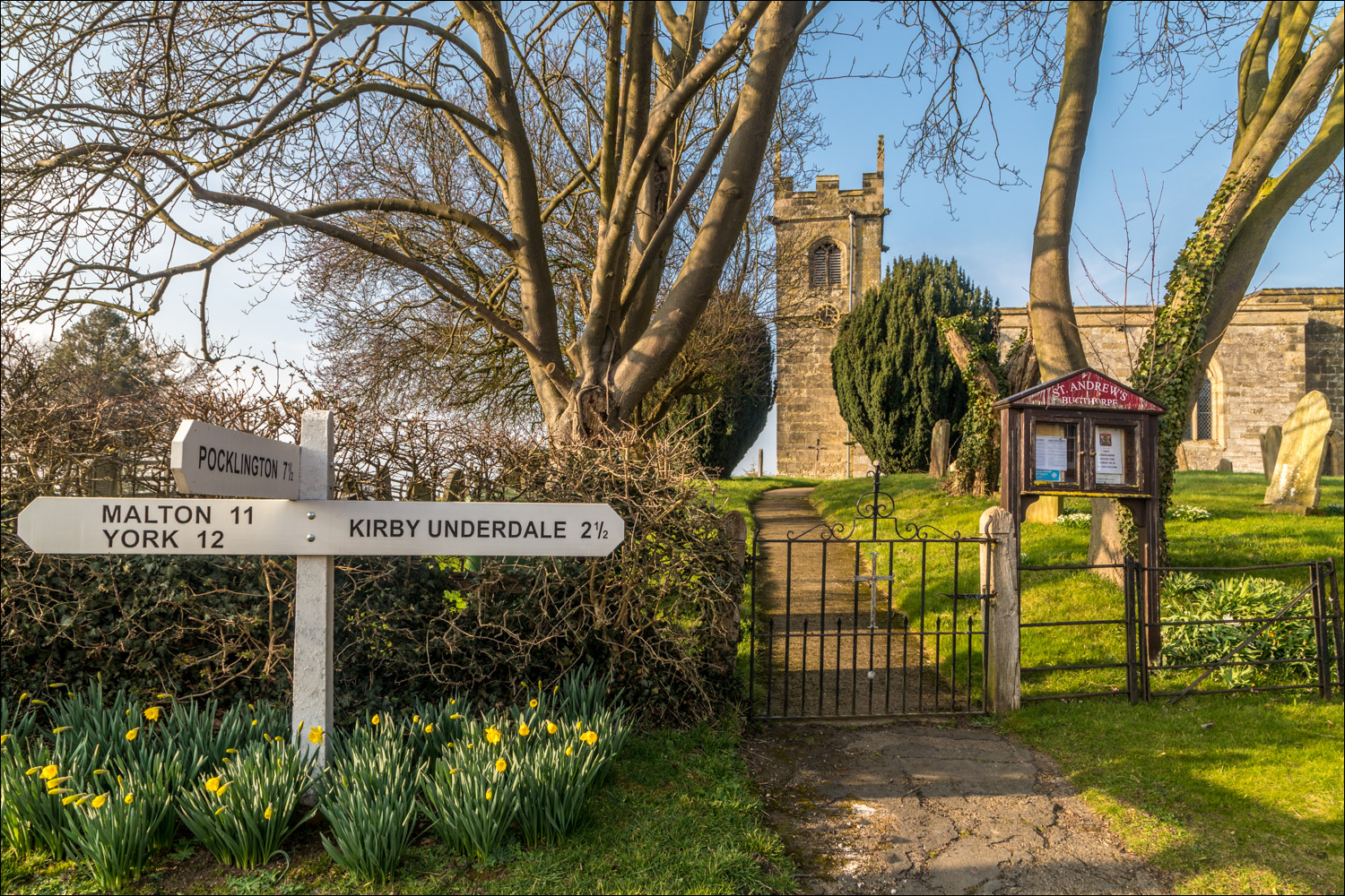
We arrive at our destination, Bugthorpe

St Andrew's Church

The end of our first leg of the Chalkland Way, and we look forward to the next stage, which will take us to Thixendale
Follow the link for more walks in East Yorkshire (117)
