
Route: Tarn Hows
Area: Southern Lake District
Date of walk: 17th October 2019
Walkers: Andrew
Distance: 5.0 miles
Ascent: 900 feet
Weather: Mostly sunny
Tarn Hows is a well known beauty spot, perhaps too well known as it can be a little busy at times. The tarn is partly artificial, having been formed in the 19th century by merging three small tarns. When the Tarns and its setting came up for sale in 1929, they were bought by Beatrix Potter who sold the half containing Tarn Hows to the National Trust, and bequeathed the rest of the estate to the Trust in her will
I was last here 2 years ago to the day, and well recall the glorious autumn colours that were on display on that occasion
I had planned a different route today, and parked in the National Trust car park at Glen Mary bridge, following the steepish path up beside Tom Gill. There are some spectacular waterfalls along the way, and these were on good form after many rainy days. After a few minutes I arrived at the lakeshore path, which is a very easy one and is accessible to wheelchairs and mobility scooters. Following the tarn in an anti-clockwise direction (I always seem to walk round lakes this way for some reason), I took an alternative higher path as the views from it are better
On reaching Rose Castle I made a there and back diversion, climbing higher for improved views. Instead of following the obvious circuit, as I’ve done often before, I decided to climb up to Torver Intake. I left the main path to enjoy the views towards the Langdale Pikes, and continued to take a pathless course across the intake which eventually brought me back down to Tarn Hows. For anyone following this route is may be better to stick to the main path, which joins the Cumbria Way higher up (or alternatively to ignore the diversion altogether and carry on around the tarn). My exploratory pathless course was pleasant enough but didn’t improve on the more obvious routes
Having arrived back at Tarn Hows I completed the circuit, and then descended back to Glen Mary via an alternative route, with lovely views along the way
For other walks here, visit my Find Walks page and enter the name in the ‘Search site’ box
Click on the icon below for the route map (subscribers to OS Maps can view detailed maps of the route, visualise it in aerial 3D, and download the GPX file. Non-subscribers will see a base map)

Scroll down – or click on any photo to enlarge it and you can then view as a slideshow

The start of the walk from Glen Mary car park. I cross the footbridge over Tom Gill, and the gill will accompany me to its outfall at Tarn Hows

I pass by a series of waterfalls in Tom Gill...


I continue beside Tom Gill - it takes about 15 minutes to reach the tarn from the car park

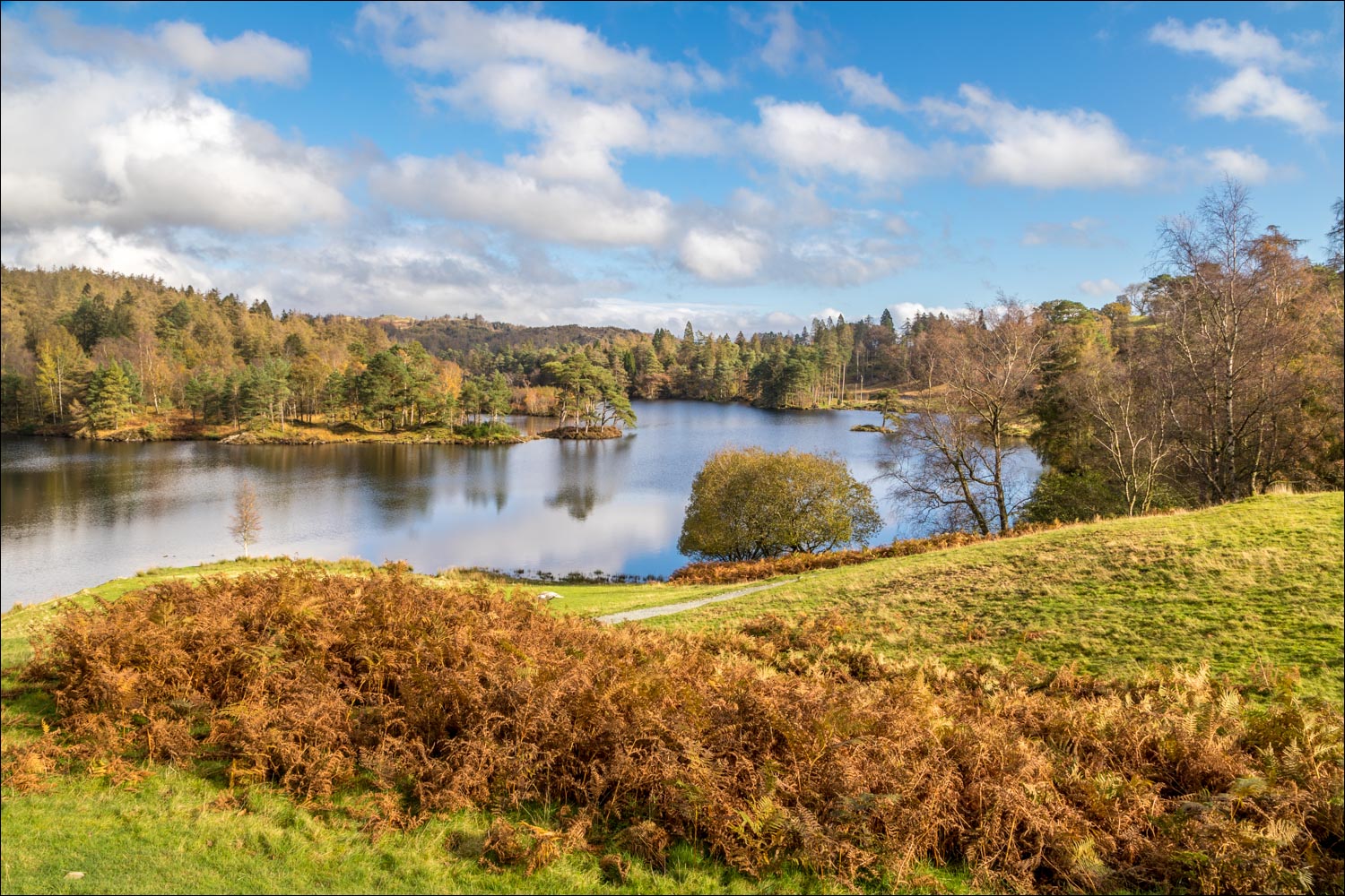
I arrive at Tarn Hows

Autumn colours - just as I'd hoped for

I climb above the lakeshore path for a better view

The unmistakable outline of the Langdale Pikes


Looking towards Wetherlam

Views of Tarn Hows...


I make a there and back detour to a higher viewpoint...


I retrace my steps to the lower path...


Looking back


I left the main path to walk up to Torver Intake, never having been here before. There was a good view towards the Langdale Pikes from here

I followed a mostly pathless course across the knobbly terrain, which was pleasant enough but in retrospect I should have either continued up to the Cumbria Way, or ignored the diversion and carried on around the tarn

Back to Tarn Hows


A final look back along the tarn before I start the descent back to Glen Mary

This is a lovely way down, and far better than simply retracing your steps beside Tom Gill


The Yewdale Fells


The knobbly ridge of Holme Fell

Wetherlam

I pass by a ruined barn

Wetherlam again


The end of a wonderful autumn walk
