
Route: Grange Fell
Area: Central Lake District
Date of walk: 18th October 2019
Walkers: Andrew
Distance: 3.5 miles
Ascent: 1,100 feet
Weather: Mostly sunny
Autumn is well underway, and I wanted to visit an area where there is good woodland colour at this time of the year. Another visit to Borrowdale, home to some ancient deciduous woods, would fit the bill perfectly. I parked in the National Trust Bowderstone car park and from here followed a path which goes through beautiful woodland, gradually curving around the steep crags above – a direct assault on the fell would be impossible for ordinary walkers
After walking through Cummacatta Wood I arrived at the steep (and sometimes slippery) rocky staircase which leads to Long Moss near the summit of the fell. Grange Fell is a complicated place and is an area of many lumps and bumps comprising 3 separate tops. King’s How is the loveliest of these, although it is slightly lower than nearby Brund Fell. My destination today was King’s How. From the summit there is a superb view over Derwent Water looking one way and Borrowdale looking the other.
A direct descent from here is out of the question thanks to the crags on the west side of the fell, so I followed a narrow path which snakes round the other side of the fell and which eventually ends at the Borrowdale road. I followed the road for a short distance – there’s a narrow footpath most of the way – then crossed over at the sign indicating the Bowderstone. I followed this path through the woods, past the massive Bowderstone and back to the car park
What Grange Fell lacks in height it more than makes up for in beauty – this is a wonderful short fell walk at any time of the year. For anyone following this walk, I’d mention that although the route is only 3.5 miles long, it is likely to take as much time as one twice its length. The terrain is rocky and complicated and there are very few sections where it’s possible to get into a proper stride. Walking poles are a very useful piece of kit to bring along
For other walks here, visit my Find Walks page and enter the name in the ‘Search site’ box
Click on the icon below for the route map (subscribers to OS Maps can view detailed maps of the route, visualise it in aerial 3D, and download the GPX file. Non-subscribers will see a base map)

Scroll down – or click on any photo to enlarge it and you can then view as a slideshow

The start of the walk from the National Trust Bowderstone car park - I'll pass by the stone at the end of the walk

I enter into the woods via this gate at the end of the car park

Looking across Borrowdale at its narrowest point, where it's confined by its 'Jaws' - Castle Crag and my target today - King's How on Grange Fell

I pass by this huge stone, which has fallen from the cliffs above...


Silver birch, which add so much to the scenic enjoyment of this walk

In Cummacatta Wood, looking across to Maiden Moor...


Looking back to High Spy


A view back along the path

Another view back, with Castle Crag on the left

Borrowdale birches

Another fallen stone, with the cliffs in the background showing how a frontal assault of Grange Fell is impossible to walkers, who must sneak in through the back door


I turn right before this gate

Looking to my left before I start the steep and rocky climb up to Grange Fell

After a tiring half hour or so, and having climbed up a steep and slippery rock staircase, I arrive at a damp grassy plateau known as Long Moss...


Looking up to King's How

Derwent Water and Skiddaw from King's How on Grange Fell

The complicated expanse of Grange Fell

Borrowdale seen as I set out on the descent

Lone birches on the fell top...


I pass through this gap in the wall, looking towards the head of Borrowdale

The River Derwent below...


Castle Crag through a gap in the trees

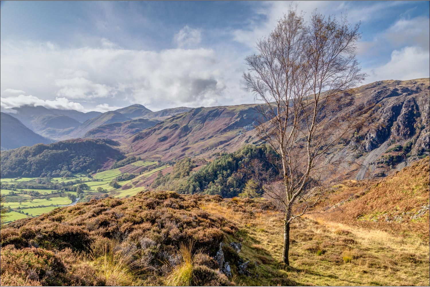
Borrowdale

I join the path which leads down from Watendlath, and a couple of minutes later follow the Borrowdale road heading north

The road section is quite short, and there's a narrow footpath on the left hand side

A short diversion to the bank of the River Derwent...


Having left the road, I join a path which passes by the enormous Bowderstone with its new ladder

The end of the walk is just around the corner
