
Route: Borrowdale from Seatoller
Area: North Western Lake District
Date of walk: 28th January 2024
Walkers: Andrew and Gilly
Distance: 5.1 miles
Ascent: 800 feet
Weather: Overcast and very windy
The district has been battered by gales all week and today was no exception. It wasn’t a day for a fell walk, so we set our sights on a low level walk. We could think of nowhere better than Borrowdale, which many would contend is the most beautiful valley in the Lake District
We parked in the National Trust car park in the small village of Seatoller at the foot of the Honister Pass. After follow the road uphill for a hundred yards or so we turned off to continue climbing. The path merged with a mid level path above Borrowdale – one of the best in the district
The wonderful path leads to Castle Crag, the smallest of the lakeland fells but one of the best. We were fortunate that this section of the walk, perhaps the most scenic, coincided with some good light. For anyone wishing to climb Castle Crag, the summit is within easy reach of this walk – click here for more details
As we passed by the foot of Castle Crag at the high point of the walk, a view of distant Derwent Water appeared. The Skiddaw fells were shrouded in low cloud. We continued in the same direction and made the easy descent down into the valley via a rocky path which brought us to the banks of the River Derwent. This was the far point of the walk and from here we followed the Cumbria Way adjacent to the banks of the river, passing through Low Hows Wood and High Hows Wood. The Cumbria Way turns east into Rosthwaite, but we continued along the western bank of the Derwent. There’s a rocky section near Glaramara YHA where chains are provided, but there are no dangers and progress would be safe without them
Beyond the river, the path continued to circuit around the edge of Johnny Wood, bringing us back to Seatoller to end a blustery but enjoyable walk
For other walks here, visit my Find Walks page and enter the name in the ‘Search site’ box
Click on the icon below for the route map (subscribers to OS Maps can view detailed maps of the route, visualise it in aerial 3D, and download the GPX file. Non-subscribers will see a base map)

Scroll down – or click on any photo to enlarge it and you can then view as a slideshow

The start of the walk as we leave the National Trust car park and walk through Seatoller in the direction of the Honister Pass

After a couple of minutes we leave the road and turn right at a waymarked sign

Looking back to Seatoller

We climb up the nursery slopes of Dale Head

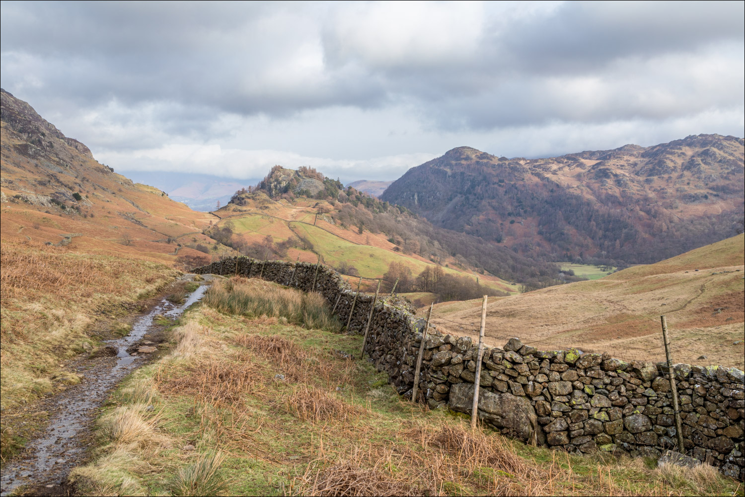
We arrive at the mid level valley path above Borrowdale and turn right here

Looking back along the path

Castle Crag and King's How come into view. We were fortunate that this section of the walk coincided with some pleasing light

Castle Crag, smallest of the lakeland fells

Castle Crag and King's How are collectively known as the Jaws of Borrowdale...


Looking across Borrowdale

Castle Crag again

Further along the path, which contours around the fellside


The walk may be shortened here by descending into Borrowdale, but we continued ahead

Recent storms had caused this tree to fall across the bridge over Tongue Gill

The head of Borrowdale

We pass by another path which could be used to shorten the walk

Derwent Water comes into view as we approach Castle Crag

The path to Castle Crag - from here it's a short but steep ascent

We carried on to start the descent back into Borrowdale

We enter into Low Hows Wood...


The far point of the walk as we arrive at the bank of the River Derwent. The river will be on our left for the remainder of the return leg


Spoil heap by an old quarry

We emerge from the woodland

High Doat ahead

We pass by New Bridge which leads into Rosthwaite

A trip hazard

We pass through Longthwaite

A slightly awkward rocky section where chains are provided

The path follows the edge of Johnny Wood

Pine trees at the edge of Seatoller, and the end of the walk is just ahead

Next day, and a sparrowhawk making a kill in the garden

