
Route: Keswick and Friar’s Crag
Area: North Western Lake District
Date of walk: 26th January 2024
Walkers: Andrew and Gilly
Distance: 3.5 miles
Ascent: 100 feet
Weather: Mostly sunny, very cold and windy
We only had time for a short walk today, and decided to revisit Friars Crag on the east shore of Derwent Water. Friars Crag is a rocky promontory jutting into the lake about half a mile from the boat landing stages. John Ruskin described the view as one of the three most beautiful scenes in Europe
We parked in the large car park next to the Theatre by the Lake on the outskirts of Keswick. After a short diversion into Hope Park we walked past the theatre and Keswick Landing Stages, following the obvious lakeshore path to Friar’s Crag. There are good views across the lake from the path, which is wheelchair friendly and easy to follow. Along the way we passed by Derwent Isle, owned by the National Trust. The house on the island is inhabited, and is open to the public for five days every year, making it the only inhabited island in the Lake District which opens to visitors
We soon arrived at Friar’s Crag, so named because it was believed to be the departure point for monks making a pilgrimage to St Herbert’s Island, located south west of the crag. The view was as wonderful as ever and after admiring it for a while we carried on around the lakeshore path for a short distance until we reached Strangshag Bay. From here the path heads inland through a marshy area known as The Ings. A raised boardwalk helps to keep shoes dry along this section
We arrived at the far point of the walk, Calfclose Bay, where a fine bench gives wonderful views to the head of Derwent Water. We were hoping to revisit the Centenary Stone, a modern sculpture set in the bay, placed there to commemorate the Centenary of the National Trust in the Lake District. Following almost non-stop rain for much of January, the lake level was so high that the stone was completely submerged
From here we retraced our steps to end a short but sweet walk
For other walks here, visit my Find Walks page and enter the name in the ‘Search site’ box
Click on the icon below for the route map (subscribers to OS Maps can view detailed maps of the route, visualise it in aerial 3D, and download the GPX file. Non-subscribers will see a base map)

Scroll down – or click on any photo to enlarge it and you can then view as a slideshow

A quick detour into Hope Park at the start of the walk - we wander through the park towards the landing stages top left


Looking back to Skiddaw which towers above Keswick

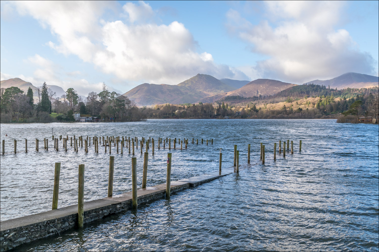
We arrive at the landing stages on the shore of Derwent Water. The level of the lake is extremely high thanks to constant rain all month

The shapely outlines of Catbells and Causey Pike, a feature of today's walk

Derwent Isle, the only inhabited island in the Lake District which opens to visitors...


We arrive at Friar's Crag - the view from here is wonderful although a blinding low sun made it impossible to photograph much of it

Catbells

The Ruskin Memorial - the inion reads '“The first thing which I remember as an event in life was being taken by my nurse to the brow of Friar’s Crag on Derwentwater”

Rampsholme Island, the smallest of the four islands on Derwent Water

Looking back to Friar's Crag as we continue along the lakeshore path

Catbells from Strandshag Bay


Zooming in on Causey Pike

Lord's Island - once home to the Earls of Derwent Water, and connected to the mainland via a drawbridge. Only the foundations of the house remain


The Centenary Stone is hereabouts but is nowhere to be seen thanks to the high water level

The Centenary Stone seen on a previous visit. The stone is carved out of a boulder of volcanic rock from the Borrowdale Valley and the design represents ten segments across ten rings, a century

Causey Pike and the foot of Catbells beyond the flooded lakeshore. This is the far point of our walk today, and from here we retrace our steps...


A final glance back along Derwent Water as we arrive back in Keswick
