
Route: Lindisfarne
Area: Northumberland
Date of walk: 17th March 2020
Walkers: Andrew and Gilly
Distance: 5.2 miles
Ascent: 200 feet
Weather: Sunny at first, gradually clouding over with light rain near the end
After this morning’s short walk around Berwick-upon-Tweed there remained enough time for a visit to Lindisfarne, or Holy Island – the northern cradle of Christianity. We’d walked here 5 years ago – click here for a shorter version of today’s walk – but it’s a place that merits multiple visits
Before setting out to Holy Island it’s essential to check the tide timetable, as the road leading to the island is inaccessible during high tide. We’d timed our arrival to coincide with low tide, and drove across the Lindisfarne Causeway – a fascinating journey in its own right – and parked in the public car park on the outskirts of Holy Island village
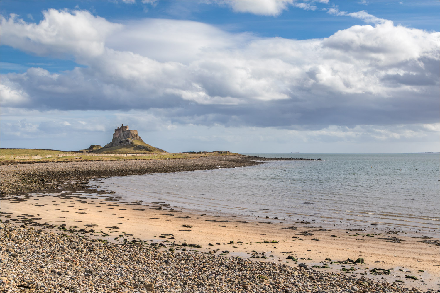
We walked through the village in order to visit Lindisfarne Priory, built by the ancient monks about 1,400 years ago and now preserved by English Heritage. From here we climbed up to The Heugh, which has good views of Lindisfarne Castle. We then walked around the harbour to join the popular path to the castle, and passed by it to visit the small Gertrude Jekyll Garden managed by the National Trust
From here we headed north along the coast as far as Emmanuel Point, where there is a tall white pyramid. This appears to be a modernist installation but in fact it is a daymark for maritime navigation, built in 1810, and is said to be Britain’s earliest purpose-built daymark
From here we descended to the beach and, after a pleasant stroll along it, followed an undulating path over the dunes to start the return journey south back to the start. By now the weather had closed in, with grey skies and light rain, and we felt fortunate that the best of the scenery had coincided with the best of the weather at the start of the walk. A stroll along Straight Lonnen brought us back into the village and the end of a wonderful and unique walk
Click on the icon below for the route map (subscribers to OS Maps can view detailed maps of the route, visualise it in aerial 3D, and download the GPX file. Non-subscribers will see a base map)

Scroll down – or click on any photo to enlarge it and you can then view as a slideshow

We walk through Holy Island village to Lindisfarne Priory

The Celtic priory, founded in AD635 by St Aidan, lies at the southern edge of the village

The priory was converted to the Benedictine faith by Durham monks in the 11th century. Lindisfarne Castle can be seen in the background

We continue towards the castle

Looking back to Holy Island village and Lindisfarne Priory

Lindisfarne Castle seen from a grassy ridge known as The Heugh

Looking back to the priory and 12th century St Mary's Church

The ruined building was originally part of Osborne's Fort, built in the 1670s to protect Holy Island from Dutch raids

We walk along the harbour side, with views of the castle on our right

Local fishermen on Holy Island apparently considered it a sin to send boats to the junkyard, so instead they converted their old herring boats into storage sheds for nets and other equipment


Lindisfarne Castle from The Ouse

There's a path on the right leading up to the castle...

...but we follow a path to its left

We visit the nearby Gertrude Jekyll Garden, maintained by the National Trust. Jekyll was a friend and frequent collaborator of Edwin Lutyens, who'd transformed the Castle into a holiday home


We're too early in the season, but in summer this will be a riot of colour

We now head east towards the sea

Looking back to Lindisfarne Castle as we follow the coastal path

We arrive at the north east extremity of the island - Emmanuel Head and its white beacon

Its purpose is to warn shipping of the hidden reefs around here, which have claimed several victims in the past

We continue along the coastal path, which leads to Sandham Bay

Sandham Bay

Bar tailed godwit on the sands

Sandpiper...


Oystercatcher

Views back to the beacon on Emmanuel Head...


The final section back to the start is along a wide track, lacking in interest in comparison with all that had gone before

Straight Lonnen, and the end of a wonderful walk is just around the corner
Follow the link for more walks in Northumberland (29)
