
Route: Beadnell to Craster
Area: Northumberland
Date of walk: 18th March 2020
Walkers: Andrew and Gilly
Distance: 9.5 miles
Ascent: 500 feet
Weather: Mostly cloudy
Today’s walk from Beadnell to Craster was a linear one, and to make that possible we parked the car in Craster and caught the 9.34am bus to Beadnell, further north along the Northumberland coast. For anyone who prefers a shorter walk, the bus also stops at Embleton and High Newton-by-the-Sea
After alighting from the bus in Beadnell we walked through the village to the harbour and the old lime kilns. From here we descended to the beach. The OS map shows a public footpath further inland, but we preferred to walk along the golden sands, which stretched ahead of us for miles
We turned inland briefly when we reached Long Nanny, a burn which flows inland from the moors, but after crossing the footbridge we were able to continue our journey across the sands. After passing by Snook Point and Football Hole we arrived in the little village of Low Newton-by-the-Sea, where we had refreshments at the excellent Ship Inn. From here we walked across the beach of Embleton Bay, with ever improving views of the stark outline of Dunstanburgh Castle ahead of us. The castle was built by Earl Thomas of Lancaster between 1313 and 1322, taking advantage of the site’s natural defences and the existing earthworks of an Iron Age fort. There is no road access, and it can only be reached on foot
After passing around the castle (which was closed today) we followed an easy grassy path for about 1 mile to our destination – Craster, home to the famous Craster Kippers
Click on the icon below for the route map (subscribers to OS Maps can view detailed maps of the route, visualise it in aerial 3D, and download the GPX file. Non-subscribers will see a base map)

Scroll down – or click on any photo to enlarge it and you can then view as a slideshow

After alighting from the bus in Beadnell, we pass by St Ebba's Church

We arrive at the coast, and turn right here to follow the road through the village

Beadnell Harbour at the edge of the village

We pass by Beadnell Limekilns, the earliest of which was built in 1789. Limestone was burnt here to make quicklime, which was used as a fertilizer and in building mortar

Today they are used by local fishermen to store lobster pots, and are Grade II listed buildings

We continue past Beadnell Harbour

We arrive on a golden strand of beach...


We arrive at Long Nanny, and are forced inland

The burn is easily forded at low tide, and we could have done so here, but decided to keep our boots on and use Long Nanny footbridge

We follow a path beside the dunes

Looking out to sea

We cross the footbridge over Long Nanny

Looking back over the burn

More miles of deserted beaches ahead of us

Patterns in the sand

Looking back - we thought that the rain clouds would overtake us but luckily they moved out to sea

The beach ends at Snook Point, and we climb up onto the dunes

Looking back

We descend to a small beach at Football Hole

We climb up to Newton Point and have our first good view of Dunstanburgh Castle, which we'll pass by later on

We pass through the small and attractive village of Low-Newton-by-the-Sea

Back on the beach again

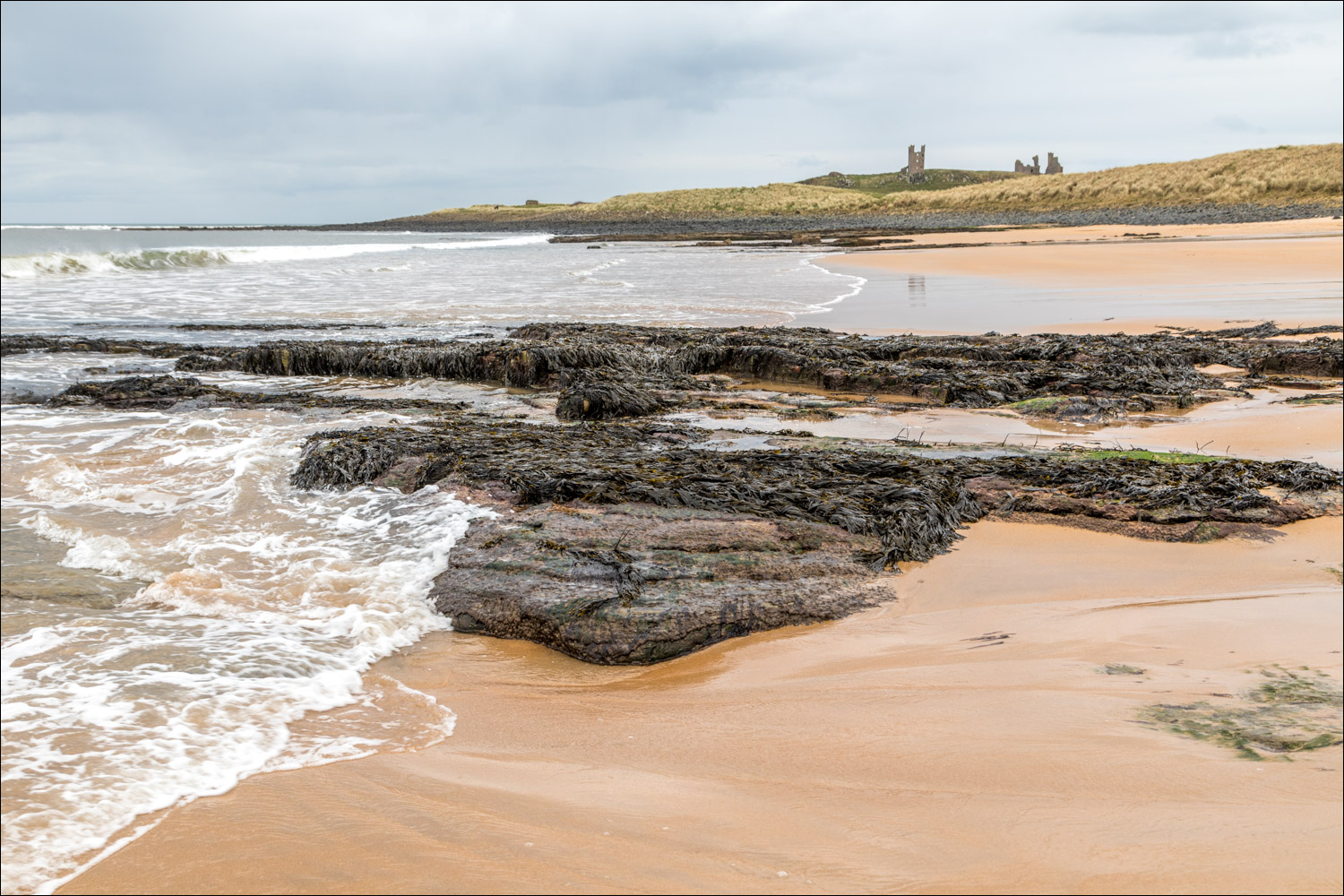
The start of a heavenly section, with views of Dunstanburgh Castle ahead of us all the way...


The beach ends at Greymare Rock and the path takes us above the rocks...

We head towards Dunstanburgh Castle...


We follow the path to the right of the castle


Our destination, Craster, can be seen in the distance

A view back to Dunstanburgh Castle

The end of the walk - the fishing village of Craster...

...famous for its kippers

Later that day, and back at our temporary base near Howick, sunset over the Northumberland coast...


A final look along the coast to the scenic highlight of today's walk - Dunstanburgh Castle
Follow the link for more walks in Northumberland (29)
