
Route: Holme Wood
Area: Western Lake District
Date of walk: 2nd November 2018
Walkers: Andrew
Distance: 5.7 miles
Ascent: 1,000 feet
Weather: Sunny spells at first but clouded over midway
Holme Wood is owned and managed by the National Trust, and runs along the south west side of Loweswater. It’s a classic English mixed woodland of oak, chestnut, ash, beech, sycamore, alder and lime. I’ve walked through the wood many times, and it’s a favourite location, especially at this time of the year when the yellow and golds of autumn are showing
I parked in the small car park at Maggie’s Bridge where there is room for about 8 cars. Instead of heading directly towards Loweswater and the woods I followed the track through High Nook Farm. Beyond the farm I joined the old Corpse Road which leads from Buttermere to Lamplugh church, and then to St Bees Priory. This lovely old track gives superb views as it contours around the fellside above Holme Wood, at a height of around 900 feet
After reaching the end of the wood I continued towards Fangs Brow, my plan being to walk back via Jenkinson Place and Hudson Place. However as I went along the clouds started to roll in, and I decided to retrace my steps to the woods in order to catch what was left of the light. I went through a gate in the woodland wall near Holme Beck and followed the path downhill. On reaching a crossroads I turned left to pass by Holme Force waterfall, known locally as ‘Grey Mare’s Tail’
From here I made my way down to Loweswater and followed the path along the lakeshore – an alternative track runs through the middle of the wood. I passed by the bothy and then walked across the head of Loweswater along a track which took me back to the start at Maggie’s Bridge. By now the weather had closed in and was as dull as ditchwater, so I was glad to have shortened the route – for the longer version (which I highly recommend) click here
For other walks here, visit my Find Walks page and enter the name in the ‘Search site’ box
Click on the icon below for the route map (subscribers to OS Maps can view detailed maps of the route, visualise it in aerial 3D, and download the GPX file. Non-subscribers will see a base map)

Scroll down – or click on any photo to enlarge it and you can then view as a slideshow

The start of today's walk as I head towards High Nook Farm from Maggie's Bridge

The edge of Holme Wood on the flanks of Carling Knott - the path will take me along the top of the wood

Looking back to Low Fell...

...and a view of Grasmoor across the fields

Carling Knott again as I follow the farm track

Beyond High Nook Farm now, and looking back to Lorton Vale, with Low Fell left and Whiteside right of the photo

At the head of the valley I'll ford Highnook Beck and turn right to follow the flanks of the fellside

Looking across to Grasmoor and the foot of Mellbreak as I climb up the old coffin road

Crummock Water comes into view

Starling Dodd and Hen Comb

Grasmoor again as I reach the edge of Holme Wood...

....a wider view

Looking back along the coffin road which skirts around the top of the wood


The path contours around Burnbank Fell - the hills of Scotland are just visible in the distance

The trees on the edge of the wood are battered by the wind and have assumed some interesting shapes

A path leads down into the wood here, but I continue along the coffin road for a short distance before retracing my steps to this point

Looking back...


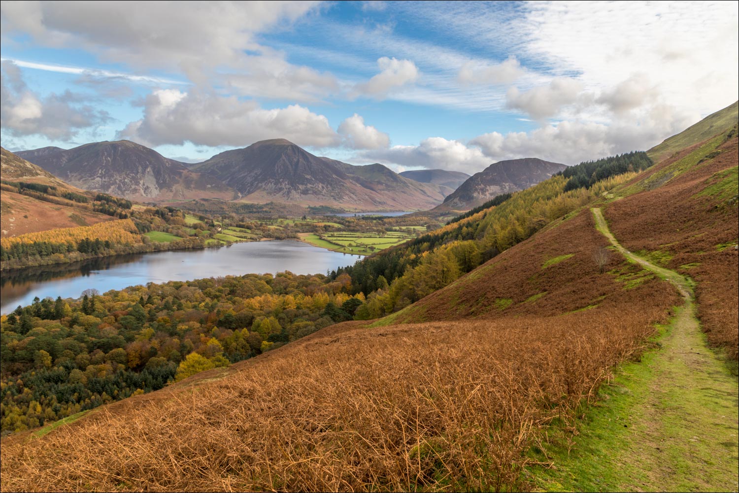
Autumn colours in Holme Wood, with Loweswater and Crummock Water beyond...


Bench with a view

Low Fell, Whiteside and Grasmoor

Having enjoyed the views over the lake, I retrace my steps along the coffin road for a short distance

I enter Holme Wood here

Windswept trees at the edge of the wood...


I follow the path through the trees, turning left at a crossroad further down

Holme Force waterfalls

Autumn colours in Holme Wood...


A shelter in the woods

The foot of Loweswater - by now the clouds have closed in and the weather is dull and grey

I follow the path along the shore of Loweswater

The bothy, available to rent from the National Trust

Gravel beach by the bothy

Path through Holme Wood

I emerge from Holme Wood and walk by the head of Loweswater, here looking towards Low Fell

The end of the walk is around the corner
