
Route: Loweswater
Area: Western Lake District
Date of walk: 18th August 2017
Walkers: Andrew
Distance: 5.9 miles
Ascent: 900 feet
Weather: Mixed cloud and sun
This is one of my favourite walks, and one which I repeat several times a year. I could never grow weary of it. The scenery is incredibly varied, and the route passes along and through meadows, a deserted valley, fellside, open moorland, fields, ancient woodland and lakeshore. Along the way there are views of some of lakeland’s finest fells looking one way and the Irish Sea, the Solway Firth and Scotland looking the other
I parked as usual in the small National Trust car park at Maggie’s Bridge and followed the path through High Nook Farm. At the head of the valley I joined the path known as the old coffin road which rises up and then snakes around the flanks of Carling Knott, giving superb views over Lorton Vale and Crummock Water. Whiteside and Grasmoor are also well seen from here
The path continues above Holme Wood and after a while there is an option to shorten the walk by descending into the wood. There was no sign of the forecast rain, and the conditions were good, so I opted for the longer route and carried on towards Fangs Brow. At the half way point of the walk I walked through the fields to Iredale Place to commence the return leg to Loweswater. This took me through Holme Wood which is well managed by the National Trust and then back through fields to the start
The walk was as enjoyable as ever and I hope to be treading these paths again soon
For other walks here, visit my Find Walks page and enter the name in the ‘Search site’ box
Click on the icon below for the route map (subscribers to OS Maps can view detailed maps of the route, visualise it in aerial 3D, and download the GPX file. Non-subscribers will see a base map)

Scroll down – or click on any photo to enlarge it and you can then view as a slideshow

Red squirrel this morning, burying hazelnuts in the lawn

At Maggie's Bridge car park I follow the sign for High Nook Farm and will return later via Water Gate Farm

Maggie's Bridge

Dub Beck from the bridge

Carling Knott - my path will take me above the woods on the flanks of the fell

Gavel Fell

I head up the valley beyond High Nook Farm

Looking back over sweet Lorton Vale

High Nook Tarn is at the head of the valley but out of sight

The foot of Mellbreak

Looking back down the path to High Nook Tarn

Heavenly views along the uphill section of the path - here is Lorton Vale

Grasmoor and Mellbreak

Crummock Water comes into view

Zooming in on Crummock Water

Hen Comb

Looking back along the path, which continues to rise above Holme Wood...


At the high point of the walk, the Solway Firth and Scotland can be seen in the distance

This is where the walk may be shortened but for obvious reasons I didn't want to do that

The path now continues at mid level around the flanks of Burnbank Fell

Crummock Water again, and heather on the lower slopes of Grasmoor

My favourite bench

Looking back along the path

A view across Loweswater to Miresyke

On the fringes of the Lake District now, as I head across open moorland towards Fangs Brow

I leave the moorland path here to head down towards Iredale Place - this is the start of the return leg


Loweswater walk

Hudson Place

I arrive at the foot of Loweswater

Loweswater walk

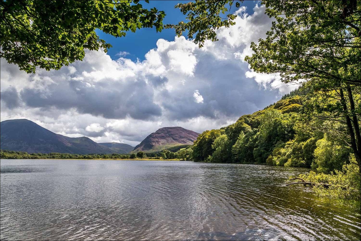
Looking along Loweswater...


Entering Holme Wood

There's a choice of paths here, one through the middle of the wood, and the other along the shore of the lake. I choose the latter today

Askill Knott

Grasmoor

I pass by the bothy, which is available to rent from the National Trust

Mellbreak

I emerge from Holme Wood near the head of Loweswater

The track back to Maggie's Bridge, here looking towards Grasmoor

Looking across to Carling Knott - my route had taken me above the woodland to the right of the photo

Heather clad Mellbreak

Beyond these log piles lies the car park and the end of a wonderful walk
