
Route: Brund Fell
Area: Central Lake District
Date of walk: 27th October 2018
Walkers: Andrew
Distance: 7.5 miles
Ascent: 1,600 feet
Weather: Sunny, cold wind on the tops
Brund Fell is the highest of the three tops of Grange Fell, one of the lower lakeland fells but one of the very best. I’ve been up here many times, and usually start from the Bowderstone car park and climb up to King’s How, one of the other tops. I’d planned another way up today, a longer route which I’ve not tried before, and I wondered how this would compare
The start wasn’t a particularly good one, as I had to walk for about 15 minutes along the valley road from the roadside parking space near the Leathes Head Hotel to the Swiss Lodore Hotel. There’s no way of avoiding this (unless making a lengthy detour via Grange and the head of Derwent Water). To make things worse, as I arrived at the Swiss Lodore a group of around 20 guided walkers set out along the footpath just in front of me. I’m afraid that I find the presence of such large groups to be intrusive. After a loud ‘excuse me’ I hastily overtook them one by one. I walked past the Lodore Falls without stopping and began the ascent as fast as I could. Fortunately the group were heading elsewhere, peace was restored, and I could start to enjoy the walk
I followed a rather vague path, with Watendlath Beck about 50 yards away on the right – the beck would be a constant companion until I reached its source at Watendlath Tarn. After crossing it via a footbridge I followed a lovely section of the walk along a narrow valley, and arrived at the hamlet of Watendlath, owned by the National Trust. I walked along the broad track signposted for Rosthwaite but turned right after only a few yards to follow a vague grassy path leading uphill to Brund Fell. The summit of the fell is a fascinating place, with a number of steep sided rock towers scattered around, and with wonderful views of the surrounding fells
I then made my way across to King’s How following a clear path (which didn’t head directly for King’s How in its early stages). A short clamber to the rocky summit brought with it more lovely views, perhaps more extensive than those from Brund Fell. I descended from the top and entered woodland, climbing down a steep path consisting of rock steps. The gradient eventually eased and I walked past Troutdale Cottages back to the start
For other walks here, visit my Find Walks page and enter the name in the ‘Search site’ box
Click on the icon below for the route map (subscribers to OS Maps can view detailed maps of the route, visualise it in aerial 3D, and download the GPX file. Non-subscribers will see a base map)

Scroll down – or click on any photo to enlarge it and you can then view as a slideshow

The roadside section at the start of the walk as I head towards Shepherds Crag

Skiddaw and Derwent Water. The Swiss Lodore Hotel is around the corner, and just beyond it I turn off the road and follow a path to the Lodore Falls

My photo of the falls isn't worth showing - it was taken in haste as I tried to get away from the large group of walkers. Beyond the falls I followed a narrow path uphill

Autumn colours in Lodore Wood...


Watendlath Beck

The gradient eases as I reach the edge of the woods

I cross the footbridge ahead, and will have Watendlath Beck on my left until I reach its source at Watendlath Tarn

Looking across the beck

A view back along the path

Watendlath Tarn ahead

Looking across the tarn to Brund Fell - I'll be aiming for the rocks to the right of the photo

I cross over the old packhorse bridge

The path forks and I turn right towards Rosthwaite, but leave the path after a few yards to walk up the grassy slopes to the right

Looking back to Watendlath and its tarn

I follow a faint path beside this dry stone wall

Brund Fell ahead

Looking back along the path as I reach the summit of Brund Fell - the Helvellyn range is in the distance

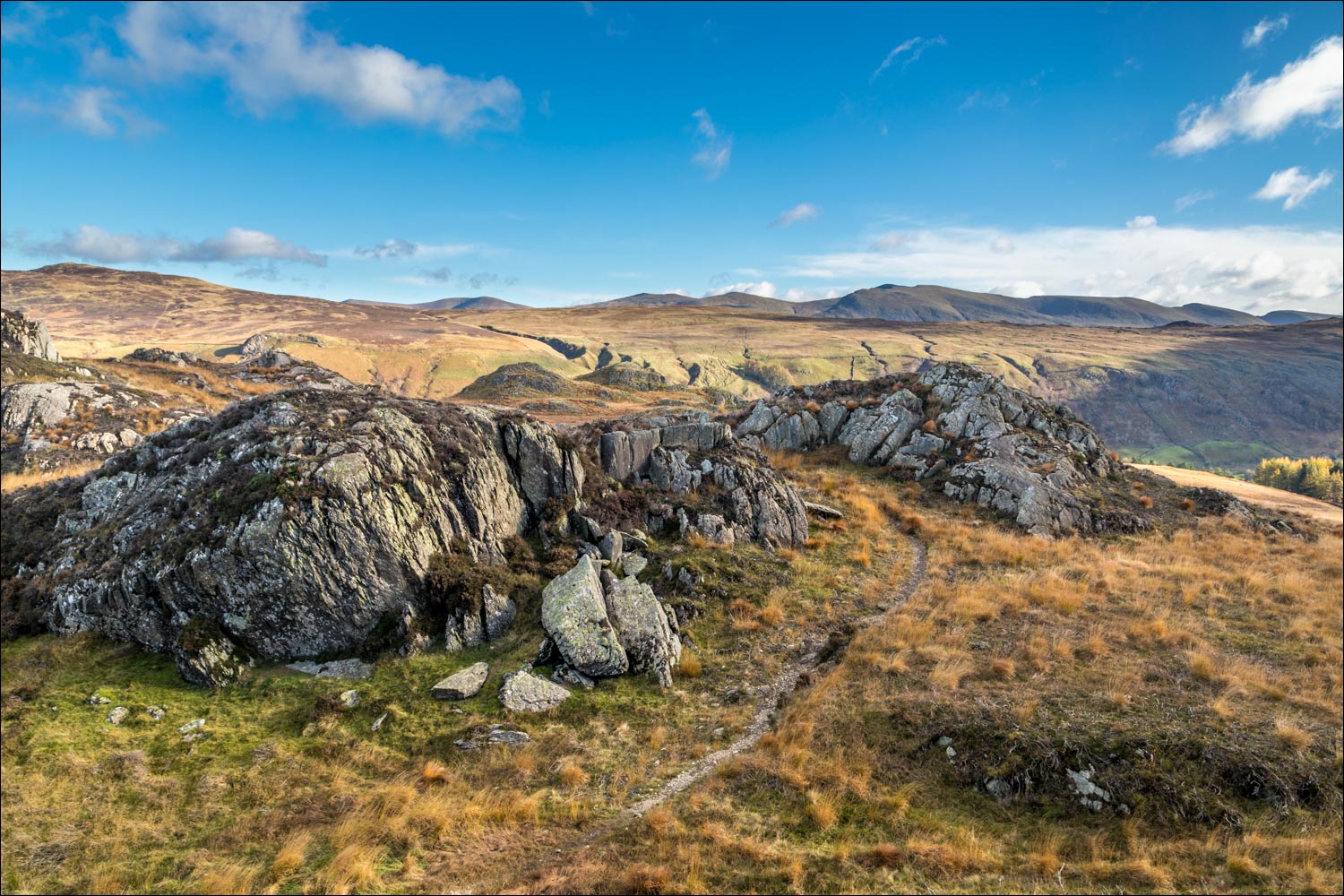
The rocky surroundings on Brund Fell

Great Gable top left

Looking towards my next destination, King's How, with a glimpse of Derwent Water on the right

High Spy, and Dale Head to its left

The rock outcrop of Jopplety How below

I set off for King's How

Borrowdale

I turn away from Borrowdale and head towards King's How

Looking back to Brund Fell and Jopplety How

Ether Knott, the third summit of Grange Fell

Borrowdale from the summit of King's How

Derwent Water, Skiddaw and Blencathra

Grange below Maiden Moor

I descend from King's How, passing by some lovely birch trees on the way down...


More autumn colours in the woodland...


The gradient eases as I arrive in Troutdale

I pass by Troutdale Cottages ahead, and the end of the walk is just around the corner

A final look back to the crags below Grange Fell
