
Route: Farndale
Area: North Yorkshire
Date of walk: 10th April 2019
Walkers: Andrew
Distance: 4.3 miles
Ascent: 400 feet
Weather: Cloudy at first, becoming brighter
Farndale is a valley located in the heart of the North Yorkshire Moors National Park. The valley is beautiful at all times of the year, but it has a particular claim to fame – each spring, countless daffodils put on a spectacular show – a dazzling display of colour that carpets the meadows and banks of the River Dove.
The medieval monks from nearby Rievaulx Abbey are thought to have planted the first daffodil bulbs here, but the wild daffodil (Narcissus pseudonarcissus) is one of our native plants, and it may be the case that they arrived naturally. The area is part of the Farndale Local Nature Reserve, established in 1955 to safeguard the valley’s famous flowers.
I arrived in Low Mill as early as I could in order to avoid the crowds, and was glad to see that there were only a couple of other cars in the car park. By the time I ended the walk, it would be almost full. The path along the bank of the River Dove starts immediately and I followed its meandering course as far as High Mill (where refreshments are available at the ‘Daffy Caffy’). The daffodils were on good form, and I’d timed my visit well. However I’d arrived quite late in the season and I guess that by this time next week they will start to go into decline
Beyond High Mill, I left the river bank to join a lane leading to Church Houses, which is the furthest point of today’s walk. I followed the lane out of Church Houses for a short distance and then left it to walk through the beautiful grounds of St Mary’s Church, which were carpeted by thousands of daffodils. Another short road section took me further up the valley before I turned off near Mackeridge House. From here I followed a succession of paths though fields and farmhouses, with good views across the valley, gradually descending back to the start at Low Mill. The daffodils had been the undoubted highlight of the walk, but this is a walk which could be enjoyed at any time of the year
For other walks here, visit my Find Walks page and enter the name in the ‘Search site’ box
Click on the icon below for the route map (subscribers to OS Maps can view detailed maps of the route, visualise it in aerial 3D, and download the GPX file. Non-subscribers will see a base map)

Scroll down – or click on any photo to enlarge it and you can then view as a slideshow

Taking these photos reminded me that I'd missed our usual visit to Farndale last year - time to rectify that...


The start of the walk as I enter into the Farndale Nature Reserve next to the car park at Low Mill

I cross the bridge over the River Dove, and will follow the path along its bank as far as High Mill...


Wild daffodils, thriving in the woodland with mixed shade and damp soil...


Wild garlic, which will provide a wonderful sight and scent in a few weeks' time

Further along the easy path


Blackthorn blossom


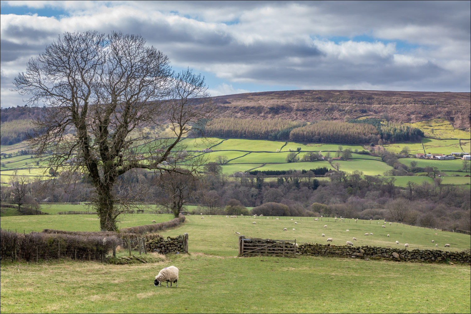
Looking across to Horn Ridge on the west of Farndale

More wild garlic

Approaching High Mill


High Mill, where I take a short diversion along the path to Hazel House in order to admire more daffodils...


From here I return into High Mill and follow the lane to Church Houses

Looking back to High Mill

I pass through Church Houses

Just beyond the village, I leave the road to follow a path through St Mary's Church...


Looking back to High Blakey Moor, shortly before I leave the lane

View across Farndale as I cross the ladder stile to follow the elevated path along the east side of the valley

Looking back...


Farndale West

The path takes me through a couple of farmyards

I gradually descend back to the valley floor...


Looking across to the head of Farndale


Arriving back in Low Mill

The circuit is complete as I look along the path I'd followed at the start of the walk

Mill Farm in Low Mill, and the end of a wonderful walk

As an introduction to the theme of today's walk, spring flowers in the garden this week...


Daffodils, which we planted in the lawn 25 years ago and which have provided so much pleasure for so little effort...
Follow the link for more walks in North Yorkshire (152)
