
Route: Circuit of Rydal Water
Area: Central Lake District
Date of walk: 23rd October 2019
Walkers: Andrew and Gilly
Distance: 5.3 miles
Ascent: 700 feet
Weather: Cloudy at first, gradually clearing
We haven’t visited Rydal Water for some time, and were keen to see the autumn colours around the lake. We were unable to park in the usual place at Pelter Bridge and Rydal Mount as they were full, and the sheer number of people around almost caused us to abandon the area and find somewhere quieter – I’d forgotten that it was half term. We decided to carry on though, having found some spaces in one of the car parks at White Moss Common. From here we climbed up to the old Coffin Road, so called as it was the route used to take the dead of Rydal to the church in Grasmere for burial. This is a delightful mid level woodland path, with occasional views of Rydal Water along the way
We descended to Rydal and made a short diversion to the grounds of Rydal Hall – the lovely gardens in front of the hall make this a very worthwhile detour. Rydal Mount, William Wordsworth’s family home, is next door but we passed by this today. After crossing the Ambleside road we then crossed the footbridge over the River Rothay and arrived at the shore of Rydal Water. About half way along the lake the path rises to give good views back over it. At this point we’d intended to descend back to White Moss Common but by a stroke of good fortune the grey skies parted, the light improved, and we decided to extend the walk by following the elevated path along Loughrigg Terrace. This is one of the loveliest half miles in lakeland, with wonderful views over Grasmere
From here we descended Red Bank and joined the lakeshore path beside Grasmere briefly before crossing back to White Moss Common and the car park at the end of the walk
For other walks here, visit my Find Walks page and enter the name in the ‘Search site’ box
Click on the icon below for the route map (subscribers to OS Maps can view detailed maps of the route, visualise it in aerial 3D, and download the GPX file. Non-subscribers will see a base map)

Scroll down – or click on any photo to enlarge it and you can then view as a slideshow

The start of the walk from White Moss Common (there are various possible walks from here, all of them easy)

We pass by this waterfall near the junction with the old Coffin Road

We join the Coffin Road, heading east

Looking towards Silver How

Rydal Water and Loughrigg Fell as we descend to Rydal

Cottage at Rydal Mount

We detour to the gardens of Rydal Hall - entry is free


The Grot, which is Grade II listed and was built in 1668 to provide a window to frame the view of the lower Rydal Beck waterfall


St Mary's Church, built in 1824. William Wordsworth helped to choose the site, which was originally an orchard

We cross the footbridge over the River Rothay

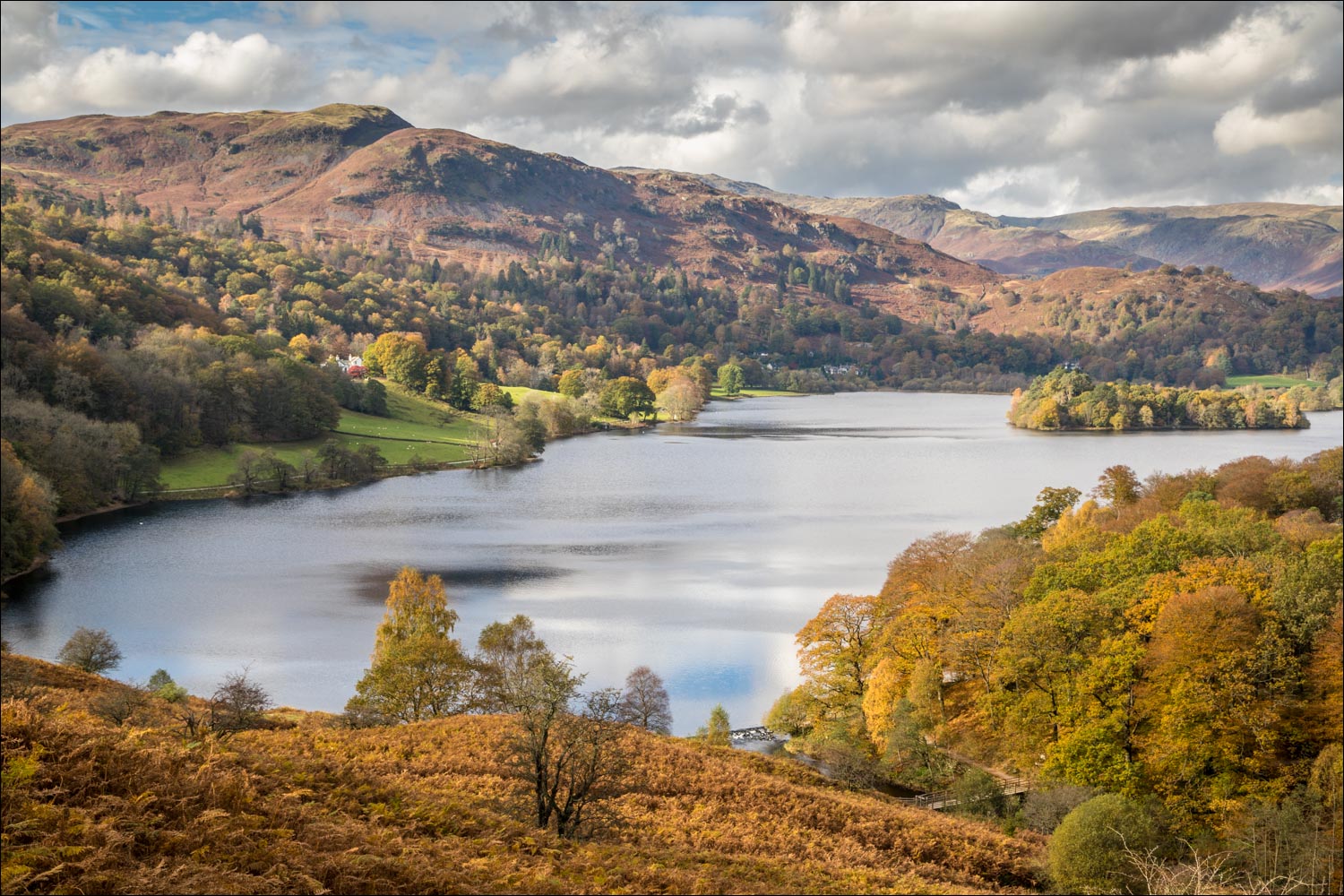
Looking across Rydal Water to the boathouse on the far shore

Heron Island, well named as we often see herons here, but not today

A view back to the boathouse

Heron Island again

The head of Rydal Water - the path rises gently up to Loughrigg Terrace from here...


Autumn colours along the path

Looking back...


We pass above an old barn


This path provides a shorter way back but in view of the improving weather we decide to keep to the higher path along Loughrigg Terrace - which proved to be a good decision

Grasmere comes into view, with the lower path below

Helm Crag in the centre of the picture

A heavenly section of the walk along Loughrigg Terrace, with views over Grasmere

Looking back


We reach the edge of Deerbolts Wood...


Having descended through the wood, we arrive at the foot of Grasmere, here looking towards Helm Crag


We pass by the weir and cross the River Rothay as it flows from Grasmere into Rydal Water

We walk through Penny Rock Wood, with the river on our right


White Moss Common ahead

A final look back along the Rothay as we arrive back at the start
