
Route: Derwent Water
Area: North Western Lake District
Date of walk: 24th October 2019
Walkers: Andrew and Gilly
Distance: 5.2 miles
Ascent: 600 feet
Weather: Cloudy with sunny spells
Chasing autumn colours, we decided to revisit Borrowdale and its Atlantic Oakwoods for the second time this month (click here for the previous visit). The valley is home to the largest area of native broadleaf woodland of any of the Lake District valleys. These woodlands are the last surviving fragments of an enormous ancient forest that once stretched all the way down the west coast of Britain and Ireland. They receive an incredible 11 feet of rainfall per year and qualify as temperate rainforest
We parked in the village of Grange in a small free car park by the double arched bridge over the River Derwent. Heading north, we followed the lane out of the village and past the Borrowdale Gates Hotel. A little further along we left the lane to join the Cumbria Way, which leads to Great Bay at the head of Derwent Water. We then walked through Manesty Park, admiring the wonderful colours in the woodland as we went along. We hadn’t decided in advance as to when we’d start the return journey – there are various options, and this walk could easily be extended or shortened depending on circumstances
When we arrived at Brandelhow Bay we decided to head back, and climbed up the foothills of Catbells to join a mid-level path above Derwent Water. I’ve walked this path many times before and it’s one of my favourites, with lovely views over the lake and the surrounding fells. Near Manesty we could have simply returned to Grange along the lane, but preferred to keep to the higher path, which offered some wonderful views towards Castle Crag, one of the ‘Jaws of Borrowdale’
As we arrived above Grange we left the mid-level path to descend back into the village to end another wonderful walk in this heavenly valley
For other walks here, visit my Find Walks page and enter the name in the ‘Search site’ box
Click on the icon below for the route map (subscribers to OS Maps can view detailed maps of the route, visualise it in aerial 3D, and download the GPX file. Non-subscribers will see a base map)

Scroll down – or click on any photo to enlarge it and you can then view as a slideshow

Dramatic light on Honister Crag as we drove over to Borrowdale

We arrive in Grange to start our walk today - the River Derwent flows past the village

We walk out of Grange

We follow the lane past the Borrowdale Gates Hotel, with Catbells in the background

Looking across Borrowdale to Grange Fell, where I'd walked last week

Borrowdale birches

The lower flanks of Maiden Moor

Having left the lane we join the Cumbria Way, heading towards Derwent Water

Looking back along the path


Castle Crag

We arrive in Manesty Park near the head of Derwent Water, where the birch trees enhance the scenic beauty of the walk...


We arrive at Great Bay at the head of Derwent Water

More Borrowdale birches in Manesty Park...


Autumn colours in Manesty...


Boathouse in Abbot's Bay

Abbot's Bay

The Teddy in the Window at Brandelhow Bay, with some of his fan mail from around the world...


The halfway point of the walk as we leave the lakeshore path at Brandelhow and climb up to a higher level path heading back to Grange

We arrive at the road below Catbells but immediately leave it to join the path on the right

A well located house...

...and another


Looking across Derwent Water to Walla Crag and Bleaberry Fell

Views back along the elevated path...


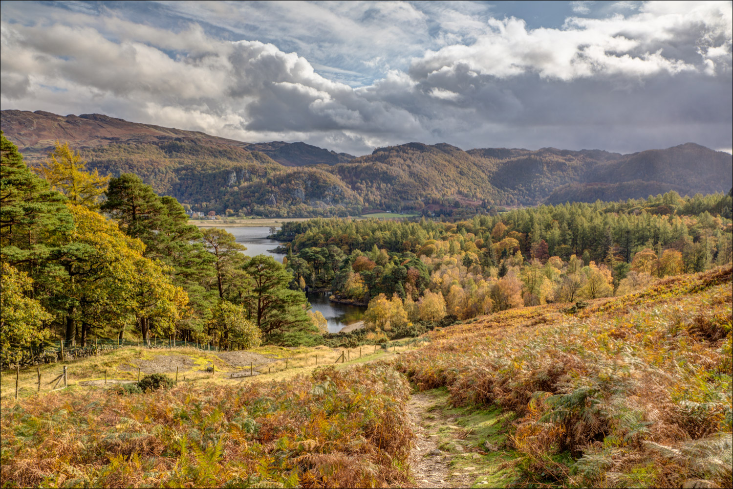
As we round Manesty Band a new vista is revealed - Borrowdale

A view of Castle Crag, illustrating why the Borrowdale woodland is classified as temperate rainforest

We follow a path to the right of the dry stone wall

Looking back along the path

We cross a footbridge over a small beck running down from Maiden Moor

Grange comes into view, and we follow the path which descends gently towards it...


The end of a wonderful autumn walk as we pass by Holy Trinity Church in Grange
