
Route: Glaramara and Allen Crags
Area: Southern Lake District
Date of walk: 30th October 2019
Walkers: Andrew
Distance: 7.4 miles
Ascent: 2,800 feet
Weather: A few patches of sunshine, mostly cloudy. Very windy and bitterly cold on the tops
It’s been a couple of years since I last visited Glaramara – such a beautiful name for a fell and, as Wainwright observes, these names were given by the earliest settlers, rough men, invaders and robbers, but even they ‘had poetry in their hearts’. On that occasion I’d started from Seatoller, using a different route via Thornythwaite Fell
I set off early today and after parking in Seathwaite followed the path through the farm, turning off after a short distance to start the long climb up to Glaramara via Hind Gill. The path is faint in parts and disappears altogether on several occasions but as long as the gill is kept to the left there are no difficulties. It’s a steep path in places, better tackled going up than coming down. The views are slightly restricted, but there are some wonderful retrospective views towards Great Gable and Fleetwith Pike, and these were shown well today in good light at times
Eventually Glaramara comes into sight, though there’s a sting in the tail before the summit is gained in the shape of a steep rock step where hands are needed. This can be avoided by detouring around to the right, and I took this easier option today. I didn’t linger at the summit as there was a very strong and bitterly cold wind, and without ado set off for the next target, Allen Crags
I made my way along the knobbly ridge, with numerous twists and turns. The path is faint in places, but nearer the summit a clear path emerges and passes by several attractive tarns along the way. From the summit of Allen Crags it was an easy descent to the crossroads of paths below Esk Hause where I turned right to walk towards the imposing face of Great End. The last leg of the journey was the long, but easy descent alongside Ruddy Gill and Grains Gill back to the start
For other walks here, visit my Find Walks page and enter the name in the ‘Search site’ box
Click on the icon below for the route map (subscribers to OS Maps can view detailed maps of the route, visualise it in aerial 3D, and download the GPX file. Non-subscribers will see a base map)

Scroll down – or click on any photo to enlarge it and you can then view as a slideshow

The night before the walk, a skyful of stars over Lorton Vale...


The next morning, reflections in Crummock Water as I drove over to Seathwaite for the start of the walk...

...and again in Buttermere a few minutes later

The start of the walk as I pass through Seathwaite Farm

Looking along the valley which will be my return route - I turn left here to start the steep and sometimes pathless climb beside Hind Gill

During the early stages of the climb, looking back across the valley to Taylorgill Force waterfall...

Taylorgill Force again

Seathwaite below the intake wall

Looking across the valley to the pointed outline of Honister Crag

Great Gable comes into view on the left...


Honister Crag again

Great Gable, with the Irish Sea on the left...


Looking back down the path, with Honister Crag featuring again

Looking north now towards Derwent Water, though the light was poor in that direction

Summit of Glaramara ahead - you may either carry straight on and scramble up a 20 foot rock step, or sneak in via the back door on the right

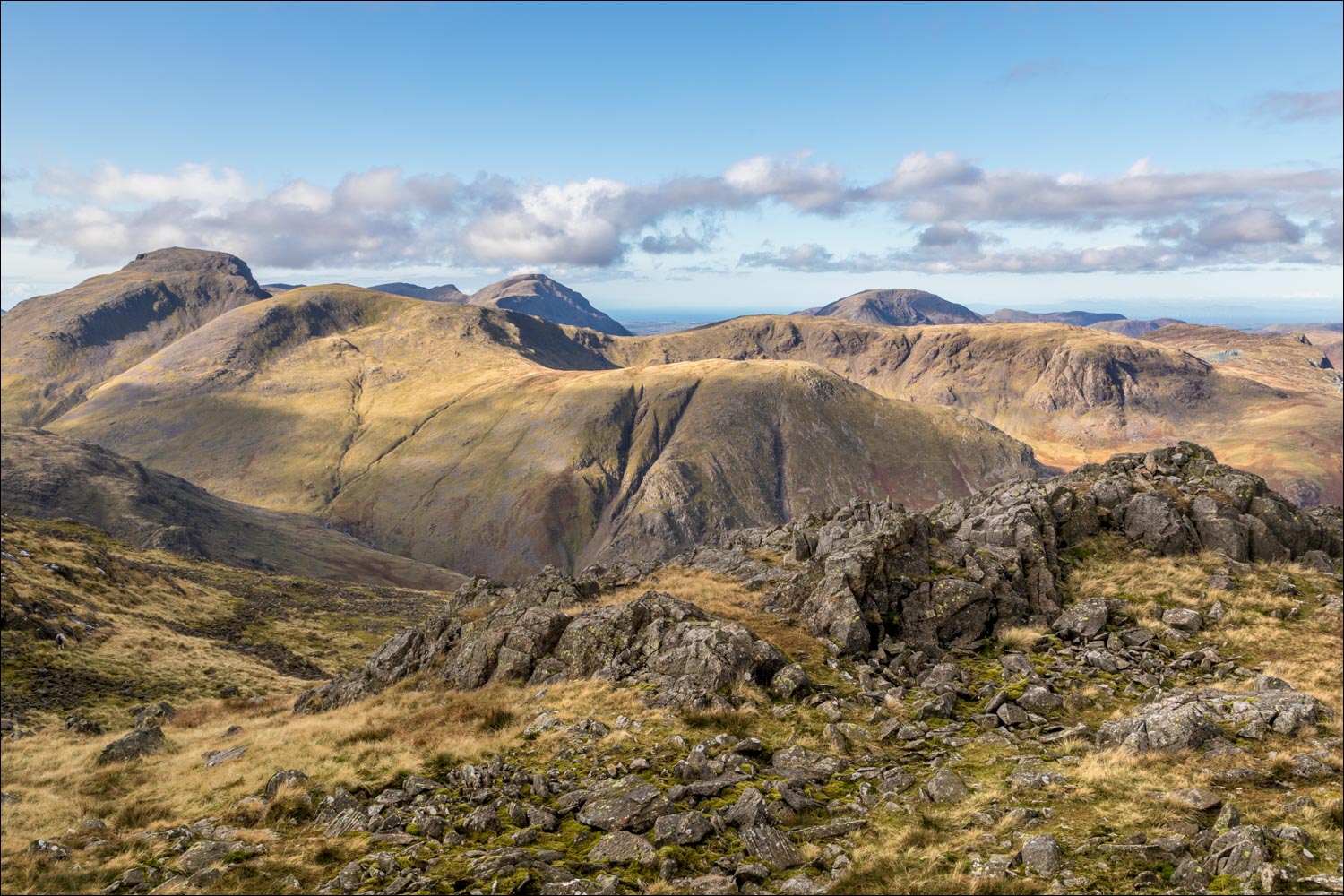
Great Gable and Green Gable from Glaramara summit

Derwent Water, with Skiddaw and Blencathra under the clouds

Looking back down to Seathwaite

The start of the complicated ridge route from Glaramara to Allen Crags

There are innumerable ups and downs along the way, and navigation could be tricky in mist

I pass by several tarns along the way

Great Gable and Green Gable

I arrive at the summit of Allen Crags, here looking towards Sprinkling Tarn at the foot of Great End

Looking back to Glaramara

The Langdale Pikes on my left as I descend towards Esk Hause

Just before Esk Hause I turn right at this cairn, with Great End on my left...


Heading back north in the direction of Seathwaite, with Ruddy Gill below on my left

Further down the path, I can just see Seathwaite in the distance

Looking back along the path

I cross Stockley Bridge

A final look up the valley from Stockley Bridge, and from here it's a short stroll back into Seathwaite
