
Route: Circuit of Buttermere
Area: Western Lake District
Date of walk: 17th January 2024
Walkers: Andrew
Distance: 5.1 miles
Ascent: 400 feet
Weather: Sunny and cloudless, very cold
It was a glorious morning as I made the short journey to Buttermere, though care was needed on the icy roads as the temperature was -7C
The classic walk around Buttermere appears over 30 times on this site and is one of the finest low level walks in the Lake District. The beauty and accessibility of the walk is both a virtue and a problem in that the path can be too busy at peak times and, if you prefer to walk in relative solitude, then it’s best to choose a quiet day and time. I made an early start and as a result only passed by a handful of other walkers along the way
I parked as usual in the National Trust car park at Long How, where the ticket machine was frozen solid. I walked through Buttermere village, passing by the Buttermere Court Hotel (formerly The Fish). I followed the path to the foot of the lake. As with the roads, there were numerous icy patches and I had to watch my step – which isn’t easy when the surroundings are so beautiful. I always walk around Buttermere in an anti-clockwise direction in order to keep the best views ahead. After crossing the footbridge over Buttermere Dubs I set off along the lakeshore path which leads to the head of Buttermere. The section near the head of the lake is perhaps the best of all, with views towards Fleetwith Pike and Haystacks
After crossing Peggy’s Bridge and passing by Gatesgarth Farm I started the return leg along the other shore, passing through the rock tunnel near Hassness along the way. I continued along the shoreline path and, where it forks off to the foot of the lake, carried on ahead. This brought me back into Buttermere village, to end another wonderful circuit of the lake
For other walks here, visit my Find Walks page and enter the name in the ‘Search site’ box
Click on the icon below for the route map (subscribers to OS Maps can view detailed maps of the route, visualise it in aerial 3D, and download the GPX file. Non-subscribers will see a base map)

Scroll down – or click on any photo to enlarge it and you can then view as a slideshow

The day before the walk, early morning snow and a red squirrel in the garden...


The day of the walk, and brief stop at Crummock Water as I drove over to Buttermere

After parking at Long How, I pass by Grade II listed Cragg House Farm at the edge of Buttermere village

I walk past the Croft House Farm Cafe, a good place to visit at the end of the walk

Path to the foot of Buttermere

The first of many photos of Fleetwith Pike at the head of Buttermere, looking at its best in these lovely conditions...


I cross the footbridge over Buttermere Dubs and follow the path along the western shore

Looking back over Buttermere village to Whiteless Pike and Grasmoor

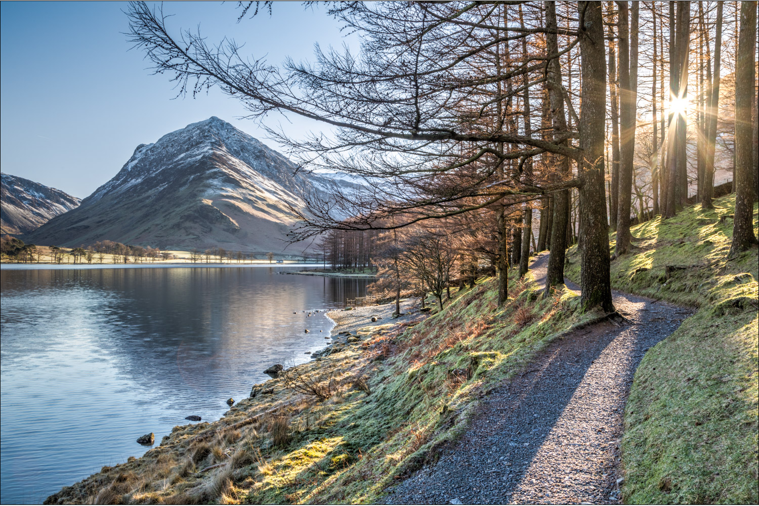
Burtness Wood

The main path continues ahead, but I take a narrower path to keep to the shoreline

Fleetwith Pike again, and the low winter sun through the trees

The circuit of Buttermere is beautiful throughout, but the approach to its head is my favourite section


I pass by a small coppice known as Horse Close


The star of the show, Fleetwith Pike...

The little white bothy at the head of the lake is called Char Cottage and was intended only for fishermen, with no overnight stays. It was named after char, the rare arctic fish left in the lake after the glacier retreated


Beyond the bothy lies Gatesgarth Farm, which I'll pass through shortly


I cross Warnscale Beck via Peggy's Bridge

Fleetwith Pike and Haystacks as I follow the path across the head of Buttermere

looking back to snow clad High Crag

I walk through Gatesgarth Farm, on the left of Fleetwith Pike

The High Stile Range which flanks the west shore of Buttermere - left to right, High Crag, High Stile and Red Pike. This makes for a wonderful high level walk in the area

A short road section beyond Gatesgarth Farm

More views of the High Stile Range...


I follow the shoreline path around the promontory at Hassness

Fleetwith Pike from Hassness

Buttermere pine and Red Pike

Into the rock tunnel...

...and out again - the tunnel was made by a former owner of Hassness Estate so that he didn’t need to stray too far from the shore

I make a short there and back detour at the foot of Buttermere to admire the view back to its head...


The path heads away from the lake to return to Buttermere village

From there it's a short stroll back to the end of a fabulous walk
