
Route: The Biniaraix Gorge
Area: North West Mallorca
Date of walk: 8th September 2015
Walkers: Andrew and Gilly
Distance: 10.2 miles
Weather: Bright at start but then grey skies, some light rain later
Today’s walk started with a bus ride. A summer service runs between Sóller and Pollença and after an interesting ride up mountain passes we alighted at the Cúber Reservoir, a well known birdwatching site. The reservoir is at an altitude of almost 2,500 feet, and this meant that most of our walk would be downhill back into the Sóller valley
We walked round the side of the reservoir, looking (unsuccessfully) for osprey and black vultures which are known to inhabit the area. After reaching the end of the reservoir we passed through mountainous terrain to the highest point of the walk – the Coll de l’Ofre at 2,870 feet. A very long descent began and after a while we reached the Biniaraix Gorge
This section of the walk was spectacular every step of the way. The well made path somehow made its way down steep cliffs thanks to innumerable hairpin bends. There was some exposure to vertical drops on the odd occasion, but the path is reasonably wide and completely safe so this wasn’t an issue. The rock scenery and the huge views over the Sóller valley were awesome
Eventually we reached the pretty village of Biniaraix, where it started raining lightly. The village merges with the town of Sóller and we walked through its streets, past St Bartholomew Church, and back to our rented villa to conclude a fantastic walk
Click on the icon below for the route map
![]()
Scroll down – or click on any photo to enlarge it and you can then view as a slideshow

Start of the walk from the Cuber Reservoir, and we follow the sign for Biniaraix

Walking towards the reservoir

Puig Major, the highest peak on the island, though the top is out of bounds as it’s used for military purposes

There are no lakes in Mallorca, and this is the larger of 2 reservoirs which augments the water supplies of the island

Looking back to the reservoir as we head uphill

Time to change into my matador outfit


Looking up towards Puig Franquera

We pass through an area of woodland, mostly pine trees


Looking back to the reservoir from the high point of the walk - the Coll de l’Ofre at 2,870 feet

and looking the other way towards the sea

Walking towards the gorge ‘Es Barranc’

Looking down on a farm set in a natural amphitheatre

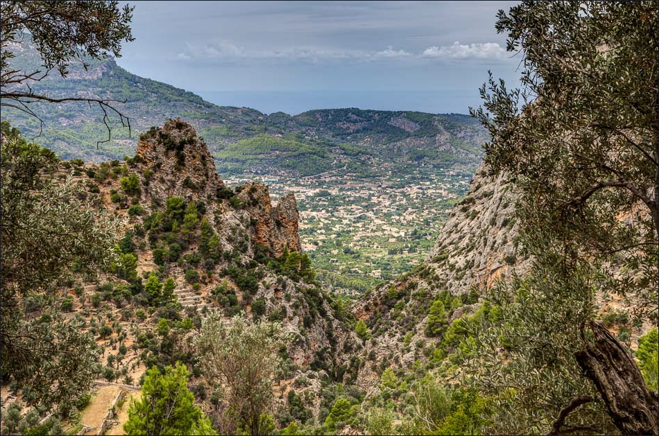
Our pulses quicken as we round a corner and have our first glimpse of the gorge and our path below. Port de Soller and the sea are in the distance

Here we go, watch your step Gilly


A wild goat seen through the telephoto lens

Spectacular rock scenery in every direction

Peering over the edge


It hardly seems possible that there is a safe way down the gorge but original builders of this amazing path somehow managed to find a way

Looking down towards Sóller


Terraces of olive trees far below

Biniaraix below and Sóller beyond


Sóller again, and the sea behind it

Lower down, farming is possible despite the harshness of the terrain


More terracing up the steep rock ahead


We enter the very narrow exit from the gorge

More spectacular rock scenery…


A farm up there - on the edge of a cliff!

Ancient olive trees

We arrive at Biniaraix


Walking through the attractive little village

We soon arrive back in Sóller

We walk towards the main square

The main square - Plaza de la Constitucion - and the end of a fantastic walk
Follow the link for more walks in Mallorca (13)
