
Route: Angletarn Pikes
Area: Far Eastern Lake District
Date of walk: 24th October 2018
Walkers: Andrew
Distance: 7.0 miles
Ascent: 1,900 feet
Weather: Sunny and quite warm, clouding over a little later on
The weather in the western part of the district was miserable and gloomy this morning, but the excellent Mountain Weather Information Service forecast sunshine in the east, so I made an early start and headed in that direction. As I turned off for Ullswater sure enough the clag and murk disappeared and was replaced by sun and blue skies
I parked in the small car park at the far end of the lovely unspoilt hamlet of Hartsop and headed uphill along a track past some sheep pens. I was following a route which Gilly and I had walked in March 2016, but on that occasion we’d been beset by snow, hail and gale force winds, and so we didn’t see much of the landscape. Today’s clear weather provided a chance to rectify that
After a steady uphill climb I reached a footbridge over Hayeswater Gill, which I crossed, and then continued to a point near the foot of Hayeswater where I heard the loud bellowing of a red deer stag. A little further up I spotted a herd of deer and from this point until the eventual descent the fells echoed to the sound of roaring stags. The Nab, which is nearby, is home to the oldest red deer herd in England – click here (and scroll down) for some close up photos taken on a previous walk up Beda Fell
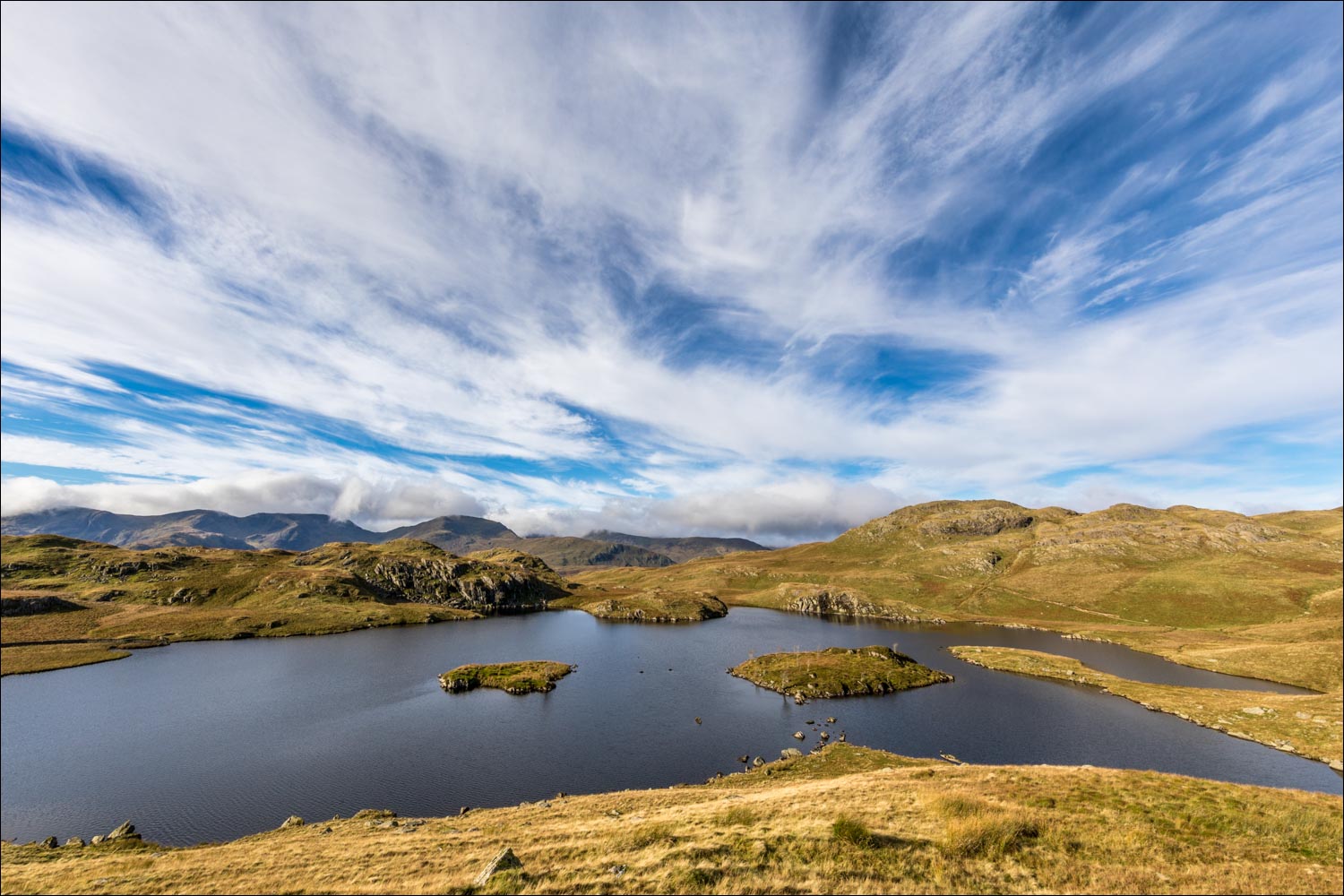
Beyond Hayeswater I climbed up to reach Satura Crag, a rocky prominence from which there are some superb views. Angle Tarn then came into view, with my objective Angletarn Pikes beyond it. I followed the rocky undulating path past the tarn and its two small islands and then scrambled up to the summit of Angletarn Pikes – the views from here were glorious
I descended to Boredale Hause, enjoying views of Ullswater as I did so, and at the hause turned south to follow the path back to Hartsop to the end of a wonderful walk
For other walks here, visit my Find Walks page and enter the name in the ‘Search site’ box
Click on the icon below for the route map (subscribers to OS Maps can view detailed maps of the route, visualise it in aerial 3D, and download the GPX file. Non-subscribers will see a base map)

Scroll down – or click on any photo to enlarge it and you can then view as a slideshow

A benign weather forecast proved to be accurate as I set off from Hartsop, passing by these sheep pens

Looking along Pasture Beck

I pass by this old barn, which looks as though it's been planted, not built

Looking back down the track

I cross the footbridge over Hayeswater Gill

A short detour to Hayeswater

Looking back down the path, with St Sunday Crag in the clouds

Zooming in on a herd of red deer below Rest Dodd

On the ridge line now, I follow the improved path to Satura Crag

The weather today...

Satura Crag ahead, with Fairfield and St Sunday Crag beyond

Top of Satura Crag

A small tarn below Satura Crag...


I follow the path beside a ruined dry stone wall...


Bannerdale and Howe Grain to my right


Brock Crags to my left, temptingly close, but I carry on along the ridge

The path passes above Angle Tarn

Dramatic skies above the tarn


Just beyond the tarn I make the short ascent of Angletarn Pikes - this is Brothers Water from the summit

Angle Tarn from Angletarn Pikes

Another summit to the north is a few feet higher than this one, but as the views are the same I don't visit it

A small tarn below the south summit

Start of the descent as I follow the path in the direction of Place Fell

Hart Crag, Fairfield and St Sunday Crag above Deepdale

St Sunday Crag again

Brothers Water


I arrive at Boredale Hause - the path ahead leads to Patterdale, and I fork off left here to head south

Deepdale...


Looking back to Ullswater

More photos of Deepdale from the lovely path to Hartsop...


A wonderfully positioned house on the hill above Hartsop

Deepdale again...


One of several old green iron benches in the Ullswater area

I pass by a couple of old barns

The house on the hill again

A small waterfall at the base of Brock Crags

Looking back along the path

My destination, Hartsop

I follow this track above the village

Rush hour in Hartsop at the end of a wonderful walk
