
Route: Angletarn Pikes
Area: Far Eastern Lake District
Date of walk: 29th March 2016
Walkers: Andrew and Gilly
Distance: 7.0 miles
Ascent: 1,900 feet
Weather: the lot – hail, sleet, snow, mist, high winds and bright sunny spells
As we set off from the pretty and unspolit village of Hartsop, following a path beside Hayeswater Gill, the weather looked to be set fair and we hoped for some good views. That changed rapidly when we reached the hause just above Hayeswater – a storm came in from nowhere, bringing with it gale force winds, a shower of hail and then heavy snow, and at times almost white out conditions. Fortunately we’d packed winter gear and were equipped, though we hadn’t anticipated snow in summer
The conditions made the walk along Satura Crag arduous at times and sadly the views were obscured most of the time
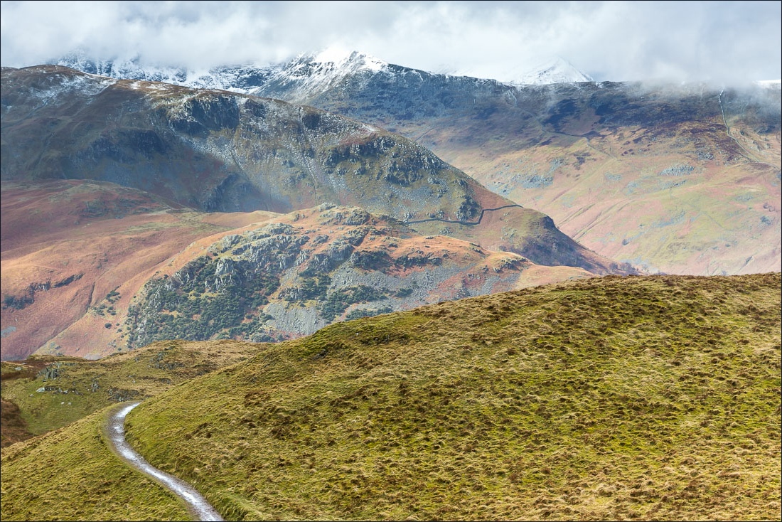
After visiting Angletarn Pikes, for the sole reason that it was there and it would have been disrespectful to pass by without visiting, we walked down to Boredale Hause to start the return leg along Patterdale Valley. This signalled an improvement in the weather, with some lovely sunny intervals and beautiful views of the surrounding mountains and valleys
Despite the improvement in the weather it continued to drizzle much of the time, and keeping the camera dry and the lens clear was a constant challenge throughout the walk, as will be seen from the photos that follow…
For other walks here, visit my Find Walks page and enter the name in the ‘Search site’ box
Click on the icon below for the route map (subscribers to OS Maps can view detailed maps of the route, visualise it in aerial 3D, and download the GPX file. Non-subscribers will see a base map)

Scroll down – or click on any photo to enlarge it and you can then view as a slideshow

Walking out of Hartsop

We pass by Pasture Bottom

An old barn, which looks as though it’s grown here

Looking back to Hartsop and the eastern fells

Hartsop above How, and St Sunday Crag beyond

One of several smaller gills running into Hayeswater Gill

As we climb above Hayeswater the clouds start to roll in…

Visibility is reduced to a few yards


Onwards and upwards

A break in the clouds gives us a good view along lonely Bannerdale


Angle Tarn

Angletarn Pikes - we didn’t linger here

We follow the path to Boredale Hause

Brothers Water - I’d like to claim that the soft focus effect is deliberate…

…but it’s due to condensation on the lens after the damp and cold camera had been stored in a drybag

The air was blue when I noticed this a few shots later, but in hindsight I quite like the effect

Patterdale, Glenridding and the head of Ullswater

Deepdale

Condensation noticed and lens duly wiped, this is looking back along Patterdale

Deepdale again

Goldrill Beck below - we take the higher of the two paths leading back to Hartsop

Approaching Hartsop, set at the foot of Hartsop Dodd

Looking across to the eastern fells

Brothers Water and High Hartsop Dodd


We cross the footbridge over Angletarn Beck

Hartsop and its Dodd

Red Screes and High Hartsop Dodd

We follow the track back into Hartsop

Hartsop below


Back to Hartsop, and the end of a memorable walk

Weather
