
Route: Alcock Tarn
Area: Central Lake District
Date of walk: 26th October 2018
Walkers: Andrew and Gilly
Distance: 4.0 miles
Ascent: 1,100 feet
Weather: Overcast with rain early on, clearing to sunshine – and a rainbow. Icy winds
I enjoy visiting the tarns of the Lake District almost as much as the fells, and one that has escaped my attention so far is Alcock Tarn, which lies to the east of Grasmere. With only a morning to spare it would make an ideal candidate for today’s walk
We parked in the Stock Lane car park at the edge of Grasmere village, having made an early start in order to avoid the hordes of tourists who descend on Grasmere. After crossing the main A591 road we turned off along a minor road and walked past Dove Cottage and the Wordsworth Museum. Further uphill we passed by some attractive old farm buildings and followed a sign indicating Alcock Tarn. We continued to ascend along a footpath through woodland which eventually emerged onto open fellside with some good views of Grasmere village and its lake
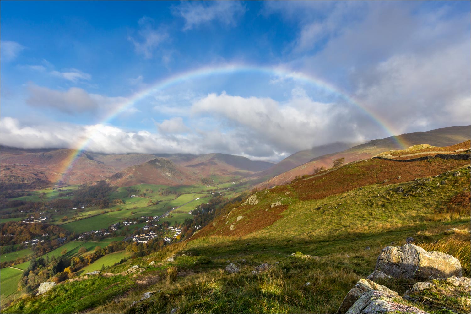
The weather had been rather dull and uninspiring up to this point, and it took a turn for the worse when a heavy rain shower blew in, borne on icy cold winds, and this caused me to stow the camera away. It appeared to be the clearing shower however and the camera was soon back in action when blue skies appeared as we reached Grey Crag, and a glorious rainbow arched over the valley to the north of Grasmere
We carried on along the undulating ridge, enjoying some lovely views as we did so, before reaching Alcock Tarn. We followed a path beside the shore of the tarn and passed by Butter Crag. Just beyond here the ridge ends and the descent starts. The direction of travel is obvious and we followed a fairly steep rocky path down to the valley, reaching the main road beside the Swan Hotel. We followed the road for a short distance and at the second of two public footpath signs we walked through the fields to Grasmere and the end of a great little walk
Click on the icon below for the route map (subscribers to OS Maps can view detailed maps of the route, visualise it in aerial 3D, and download the GPX file. Non-subscribers will see a base map)

Scroll down – or click on any photo to enlarge it and you can then view as a slideshow

The day before the walk, a red squirrel in the garden

The start of the walk as we pass by Dove Cottage

Beyond this old farm we follow a sign for Alcock Tarn...


The initial section is through woodland...


Views across the valley open up as we gain height - a glimpse of Harrison Stickle in Langdale

Helm Crag

Grasmere

A view back along the path


Grasmere village below

Grey Crag - the path will take us past its foot


The Langdale Pikes beyond Grasmere

It starts raining at this point

Time to put the camera away as the rain becomes heavier

After a few minutes the skies clear and a rainbow appears...


Looking towards Helm Crag,,,

...and again

Views of Grasmere...


We continue along the ridge with an ice cold wind in our faces - Great Rigg is in the distance


Seat Sandal behind Great Rigg

Alcock Tarn

We walk along the side of the tarn

The view on our left


Great Rigg again

The start of our descent

Grasmere below

Helm Crag above Forestside Plantation

A glimpse of Grasmere through the trees, with Wetherlam in the distance

Greenhead Gill below - further down, the bridge over the beck was destroyed by Storm Desmond in 2015 and is being replaced, but there's no problem in fording the beck in the meantime

The rainbow reappears in front of Helm Crag...


Autumn leaves

We arrive back to the valley floor

The A591 passes by the Swan Hotel, and we turn left here to walk along the pavement for a few yards

Having crossed the road, we follow a public footpath sign (the second of two) back to Grasmere

A last look up to Grey Crag and the ridge we'd followed
