
Route: Kingscross Point from Whiting Bay
Area: Scotland, Isle of Arran
Date of walk: 19th October 2021
Walkers: Andrew, Gilly and James
Distance: 2.0 miles
Ascent: 140 feet
Weather: Poor – low cloud, drizzle then heavy rain later on
For the third day in succession it was forecast to rain all day, but a drier spell mid-morning persuaded us to try a short coastal walk. We parked near the church at the north end of Whiting Bay. There are plenty of free spaces opposite the playing fields. After walking past the church we followed the lane past some houses and then onto the stony beach. We kept a sharp lookout for otters as we went along – this is a good place to spot them, though we were out of luck today
We left the beach at a signpost for Kingscross Point and climbed up through scrubby woodland, eventually reaching a grassy area with views of Lamlash Bay. We continued as far as the ruins of a Viking Fort where there was a good view of Holy Island. Excavations show that Kingscross Point was once the site of a fortified homestead for around two thousand years before being used by the Vikings as a settlement and burial site
We retraced our steps for a short distance and descended down a rough path on our left, which brought us onto the beach. The weather had been indifferent up to this point, mostly low cloud and drizzle, but as we arrived on the beach it took a turn for the worse, and heavy rain set in, causing the camera to be stowed away. We trudged back to the start, wishing we could have enjoyed the surroundings in better conditions
Later that day, back at our rented cottage in Lamlash, the grey skies cleared and we were treated to an epic sunset over Holy Island. I’ve included a few photos of the dramatic cloud formations to compensate for those taken on the walk
Click on the icon below for the route map (subscribers to OS Maps can view detailed maps of the route, visualise it in aerial 3D, and download the GPX file. Non-subscribers will see a base map)

Scroll down – or click on any photo to enlarge it and you can then view as a slideshow

The start of today's short walk as we pass by the church at the northern end of Whiting Bay

Whiting Bay

After following the lane for a few yards we descend to the shingle beach...


Looking back to Whiting Bay and its village

We head inland at this sign for our destination, Kingscross Point

We follow a path uphill through scrubby woodland...


Holy Island comes into view

Mullach Mor ahead, the highest point on Holy Island

We follow a grassy path towards Kingscross Point

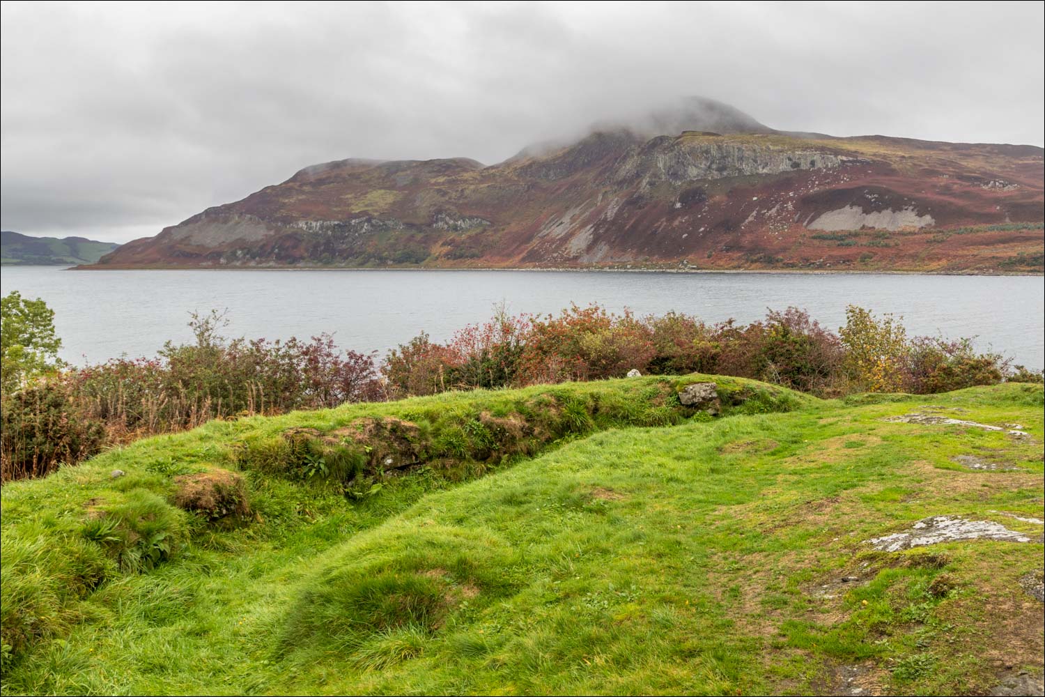
Lamlash Bay

Kingscross Point, the site of a fortified homestead for around 2,000 years, and then used by the Vikings as a settlement and burial site

Lamlash Bay from Kingscross Point

From here we retrace our steps for a short distance, then take a path back down to the beach

Looking back to Holy Island

Views of Whiting Bay as we walk back to the start in driving rain....


The end of a pleasant short walk, though we could have wished for better weather

Later that day, at around 5.50pm, we witnessed some epic skies from our rented cottage in Lamlash. It started with a rainbow over Holy Island


For the next 30 minutes we were treated to a wonderful display as the cloud formations underwent rapid changes...

The start of a 'banner cloud' - very rare in the UK - and best seen in the timelapse video at the end of the photos


Sunset over Holy Island, and a spectacular end to the day
Follow the link for more walks in Scotland (44)
Look out for the banner cloud phenomenon in the timelapse below as the clouds stream over the highest point on Holy Island (credit to son James). The video shows a ‘banner cloud’ – not common in the UK but a classic on the Matterhorn. The air blowing right to left is deflected up over the island and air pressure becomes lower on the leeward side. This in turn allows air to rise on the leeward side, and if conditions are right, cools and forms the cloud. This cloud (like a flag – hence known as a banner cloud) streams out until the process decays down wind. The time lapse shows the process particularly around the 9 second mark. Sometimes you see a similar effect when fast jets take off and ‘cloud’ forms temporarily on the rear edge of the wings. (Thanks to a Twitter follower for this explanation)
