
Route: Coire-Fhionn Lochan
Area: Scotland, Isle of Arran
Date of walk: 20th October 2021
Walkers: Andrew, Gilly and James
Distance: 3.7 miles
Ascent: 1,100 feet
Weather: Mixed sun and cloud
Earlier in the morning we’d set off to climb Goatfell, the highest mountain on Arran, but rain set in during the early part of the ascent and we opted to turn back before becoming overly committed to the walk. We decided instead to head away from the mountains in search of better weather, and found some on the west coast. We parked by the sea on one of the roadside spaces at the tiny settlement of Thundergay, where a signpost indicates the way to Coire-Fhionn Lochan. A couple of seals popped up their heads out of the sea and gazed at us inquisitively as we set off
After passing the last of the houses we started the climb up the bracken clad slopes and crossed a ladder stile beside a tall gate in a deer fence. A burn known as Uisge Soluis Mhoir was our constant companion as we continued uphill, featuring a series of waterfalls all of which were in good form following plentiful recent rain. On a couple of occasions we crossed the burn via stepping stones
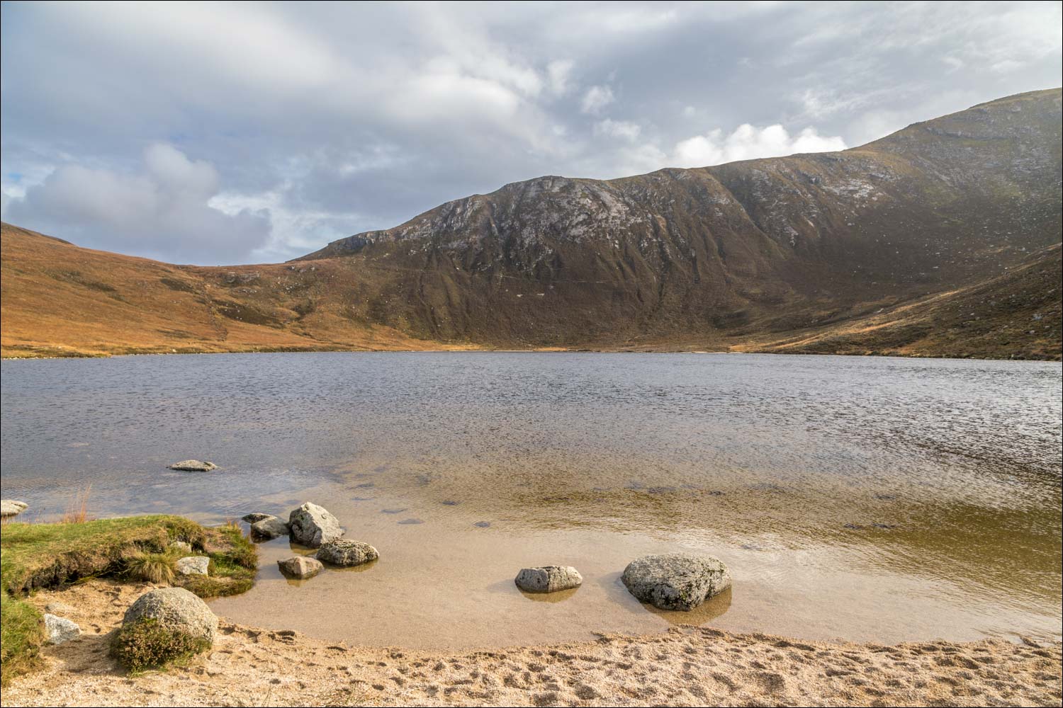
Eventually we arrived at our destination, Coire-Fhionn Lochan, which has a white gravel beach and is surrounded by impressive mountains. It was a perfect spot to enjoy our picnic, after which we retraced our steps back to the start, enjoying some wonderful sea views along the way
For anyone looking for a longer and more adventurous walk, this route could easily be extended to include the peak of Meall Biorach at 1,898 feet
Click on the icon below for the route map (subscribers to OS Maps can view detailed maps of the route, visualise it in aerial 3D, and download the GPX file. Non-subscribers will see a base map)

Scroll down – or click on any photo to enlarge it and you can then view as a slideshow

On the way to the start of the walk we stopped the car at Corrie, where there is a wooden statue of a seal on a rock - with a live companion today

View from one of the roadside parking spaces by the settlement of Thundergay

The way to Coire-Fhionn Lochan is marked by a sign, and we follow a lane uphill

We pass by this cottage

Looking back to the cottage

Views of Kintyre as we look back...


We cross this ladder stile in a deer fence

A rainbow over Kilbrannan Sound

The dome of Meall nan Damh ahead

We cross the stepping stones over Uisge Soluis Mhoir - the stream is our constant companion until we reach our destination of Coire-Fhionn Lochan

Looking back

Meall Bhig ahead as the path swings around to the right

Views back along Uisge Soluis Mhoir...


We pass by a small glade at another ford

The gradient steepens

We follow a steep rock staircase beside the waterfall...


The rainbow reappears over Kildonnan Sound

The final approach to Coire-Fhionn Lochan....


Coire-Fhionn Lochan

A heavenly spot

After enjoying our picnic here we retrace our steps

Improving weather as we descend, with views over Kildonnan Sound to Kintyre along the way....


Thundergay lies below, and with it the end of a wonderful short walk

On the way back to base we stopped at Brodick. This rainbow at the foot of Goatfell gave us hope that the weather will finally allow us to climb it tomorrow, our last day on Arran
Follow the link for more walks in Scotland (44)
