
Route: Fairy Dell, Lochranza
Area: Scotland, Isle of Arran
Date of walk: 18th October 2021
Walkers: Andrew, Gilly and James
Distance: 5.2 miles
Ascent: 400 feet
Weather: Mostly cloudy, improving later on with a few patches of sun
Lochranza (the village) and Loch Ranza (the loch) are situated near the northernmost tip of Arran. The area is abundant with wildlife, and this is a good place to spot red deer, golden eagle and seals. After being confined indoors for most of the day by heavy rain and thick mist, we decided to drive north in the afternoon in search of wildlife and, if conditions improved, we’d still have time for a walk
We parked near the ruins of Lochranza Castle, which stands in a wonderful position by the loch, looking out to sea. The weather showed signs of improvement so we set off on our walk. We followed the village lane around the foot of the loch, passing by the local golf course. After passing by some houses the road petered out, to be replaced by a well made footpath, part of the long distance Arran Coastal Way
We rounded Newton Point and just beyond it arrived at an important rock formation known as ‘Hutton’s Unconformity‘. This place is significant as it was here that geologist James Hutton noticed an unusual formation, with some rocks inclined vertically and others almost horizontal. This supported his contention that the earth was millions of years old, rather than thousands as was believed
We carried on along the shoreline until reaching Fairy Dell, a wooded area where there is a white cottage and an old shed. Just before these we turned right and after a short climb reached a higher level track. We followed the track as it contoured around the hillside above Newton Point. We passed by a few cottages and then descended to the village lane. From here we retraced our steps, pausing for a while to watch a large herd of red deer grazing on the golf course
It had been a wonderful walk, full of interest and beauty throughout
Click on the icon below for the route map (subscribers to OS Maps can view detailed maps of the route, visualise it in aerial 3D, and download the GPX file. Non-subscribers will see a base map)

Scroll down – or click on any photo to enlarge it and you can then view as a slideshow

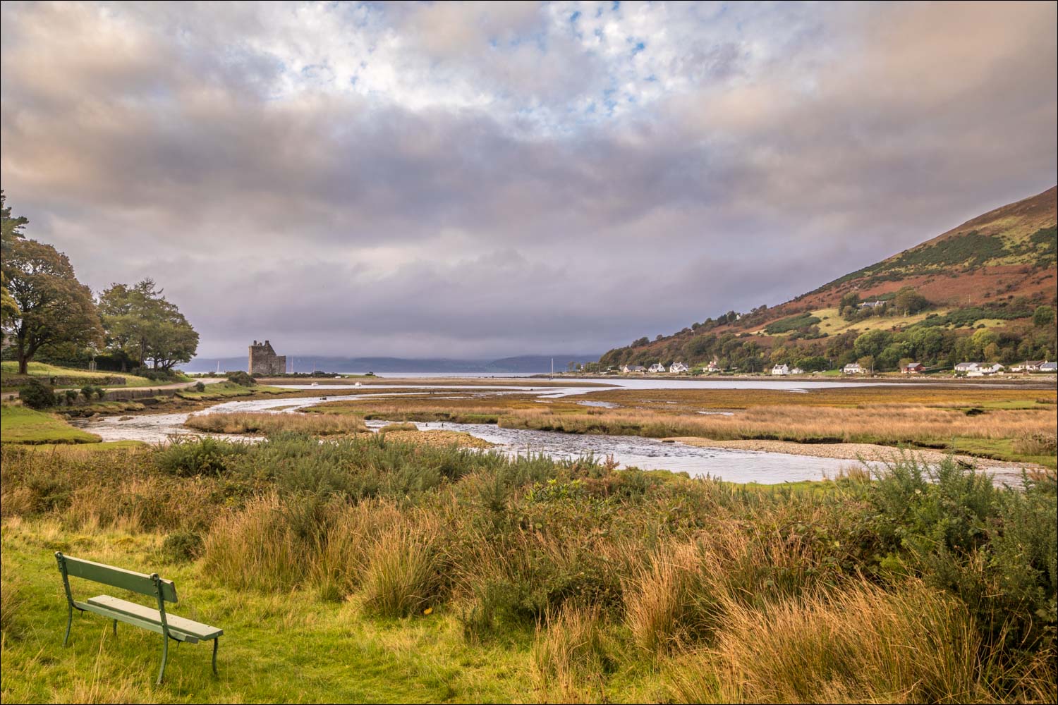
The start of the walk from one of the roadside spaces near Lochranza Castle

We walk away from the castle in order to reach the coastal path on the other side of the river

Looking back to Lochranza Castle. We're heading for South Newton, right of picture

We cross the bridge over the outflow into Loch Ranza

South Newton

We follow the lane past the few houses in the village

Looking across Loch Ranza to the castle

Kintyre in the distance

Lochranza

The last of the cottages in South Newton as we approach Newton Point

We follow the path, part of the Arran Coastal Path, around Newton Point

The Isle of Bute in the distance

The ferry from Kintyre sails in to Lochranza

Rock formations near Newton Point

A stone plaque marks the place where geologist James Hutton noticed the unusual rock formations now known as Hutton's Unconformity

The observations made here helped to change our knowledge about the age of the earth


We carry on along the coastal path

The Isle of Bute in the distance

The small black hut on the right marks the end of the coastal section

There is a white cottage here, unseen in this photo. We turn right at the old dry stone wall

We follow a narrow path uphill through Fairy Dell

Birch trees in Fairy Dell

Looking back down to the coastal path

After a short climb we join this track and head back towards Lochranza

Kintyre across Kilbrannan Sound

Looking back

Coillemore Point at the edge of Lochranza comes into view, left of picture

Lochranza and its castle as some late afternoon light illuminates the scene

We pass by a white cottage knows as The Whins

Looking back

We look up to see a buzzard fly by...


We'd hoped to see a golden eagle but our luck was out today

The track descends gently toward Lochranza...


We arrive at the South Newton lane and from here we retrace our steps back to the start

We pass by a large herd of red deer on the local golf course, of all places


Views of Lochranza Castle as we reach the end of a wonderful walk...


Follow the link for more walks in Scotland (44)
