
Route: Eoligarry
Area: Isle of Barra, Outer Hebrides
Date of walk: 6th September 2022
Walkers: Andrew and Gilly
Distance: 5.9 miles
Ascent: 400 feet
Weather: Mixed sunshine and clouds
The Eoligarry peninsula is the most northerly part of Barra. It is almost entirely surrounded by beaches, one of which provides the runway for Barra airport. Today’s walk could convenienly be started from the airport, especially for anyone arriving here by bus. We chose to start from Eoligarry jetty on the east of the peninsula
The initial section of the walk was along the road, not an issue as the roads hereabouts are very quiet. We passed by Cille Bharra or St Barr’s Church where Compton MacKenzie, author of Whisky Galore, is buried. We left the road at a sign indicating the Eoligarry Trail and made the short climb up to Dun Sgurabhal, the crumbling remains of an iron age fort. There were wonderful views from here, both across to South Uist and Eriskay and over the beaches of the Eoligarry peninsula
We descended from the fort and crossed some rough pathless terrain before climbing up to Beinn Eolaigearry, the highest summit on the peninsula though only 350 feet. Occasional marker posts assisted navigation here, though they are widely spaced and hard to spot at times. Our arrival at the top of the hill coincided with a good view of a plane landing on the beach of Tràigh Mhor – this the only airport in the world on which scheduled flights take off and land on a beach
We made a pathless descent to the white sands of Tràigh Eais and walked along the beach, leaving it just before the end to climb up through the dunes to reach the airport terminal. There is a cafe here in season, but sadly we were out of season. We followed the road from the terminal for a short distance and then turned off to walk along the vast beach, keeping to its inner edge. The melodious calls of curlews accompanied us along the way. On reaching Orasaigh the beach turns a corner and merges into Tràigh Cille-Bharra. On reaching Sanderling we climbed up to the road and from here it was a short stroll back to the start
Click on the icon below for the route map (subscribers to OS Maps can view detailed maps of the route, visualise it in aerial 3D, and download the GPX file. Non-subscribers will see a base map)

Scroll down – or click on any photo to enlarge it and you can then view as a slideshow

Sunrise from our rented cottage in Northbay

It's a short drive from the cottage to the Eoligarry peninsula, where we stop the car to look along the huge expanse of Tràigh Mhor, the runway for Barra airport


We drive further around the peninsula and park at the start of the walk - the jetty at Eoligarry

The first section of the walk across the peninsula is along quiet roads...


Cille Bharra, the final resting place of Compton Mackenzie, author of Whisky Galore


We leave the road at this sign indicating the Eoligarry Trail

After a short climb we reach Dun Sgurabhal, the crumbling remains of an iron age fort, from where there are wonderful views...

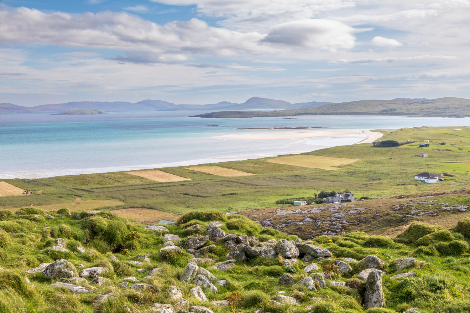
Looking over the Eoligarry peninsula from Dun Sgurabhal to South Uist in the distance...


Tràigh Eais, which we'll be walking along later...


Cattle on the beach

We walk over some rough and pathless ground towards Beinn Eolaigearry, the highest summit on the peninsula though only around 350 feet


Summit cairn on Beinn Eolaigearry

Perfect timing as we have a good view of a plane descending to the landing strip on Tràigh Mhor, which lies just beyond Tràigh Eais below

Zooming in on Barra Airport as the plane makes a safe landing on the beach

We descend gently to Tràigh Eais


We arrive on Tràigh Eais and turn left to walk along the beach


Looking back to Dun Sgurabhal, where we'd been earlier

We leave Tràigh Eais near its southern end and climb up through the dunes

Barra Airport, where there is a cafe - which was closed today

State of the art baggage reclaim area

Beyond the airport we descend to the beach, keeping to the inner edge

We continue along Tràigh Mohr

We round a corner where the beach merges into Tràigh Cille-Bharra


We walk along the beach as far as possible but at Sanderling, just beyond this point, it's necessary to climb up to the road

A final look back as we reach the road, and from here it's a short stroll back to the start

Later that day, the view from our rented cottaqge in nearby Northbay...

Follow the link for more walks in Scotland (44)
