
Route: The Ullswater Way Stage 3
Area: North Eastern Lake District
Date of walk: 8th June 2016
Walkers: Andrew
Distance: 7.3 miles
Ascent: 1,000 feet
Weather: Cloudy with bright spells, two heavy showers, very warm and hazy
The Ullswater Way is a new 20 mile long walking route which circumnavigates Ullswater using existing rights of way and quiet public roads. Walkers are encouraged to start from any point, travel in any direction, and break the route down into sections. What an excellent idea, and congratulations to the partnership which promoted this, including the Lake District National Park Authority, See More Cumbria and the Lake District, The National Trust, Eden District Council, Ullswater Steamers and the Ullswater Association
Click here for Stage 1 and here for Stage 2 of our journey. I made today’s walk the final stage of the Ullswater Way in order to save the best until last – it’s a classic lakeland low level walk which we’ve done many times before and and is full of beauty every step of the way
I took advantage of the Ullswater Steamers again, catching the 9.45am boat from Glenridding and after an enjoyable boat ride I disembarked at Howtown Pier and set off on the lakeside path, the first section of which rounds the foot of Hallin Fell
I strongly recommend that anyone following this route walks in the direction I did today (and as I did on Stage 1 and 2) – towards the head of Ullswater. In this way, the best scenery is ahead of you as you walk
Navigation is easy, but it’s hard to make quick progress as the path is rocky much of the way and there is about 1,000 feet of ascent involved as the route crosses over several promontories. Who wants to rush a walk like this though’ It’s worth taking all day over it, and it had been a wonderful way to complete the Ullswater Way
For a more challenging two day approach to the walk, and for tips about accommodation and gear, visit Hiker Hero where you will find lots of useful information
Click on the icon below for the route map (subscribers to OS Maps can view detailed maps of the route, visualise it in aerial 3D, and download the GPX file. Non-subscribers will see a base map)

Scroll down – or click on any photo to enlarge it and you can then view as a slideshow

A quick visit to Buttermere at dawn before I set off on today’s walk

The bothy at the head of Buttermere

Woodhouse Islands on Crummock Water

The view from Crummock Water Cottages

Back home, a red squirrel in the garden

An hour or so later, I arrive Glenridding and buy a ticket for one man and his dog to Howtown


The landing stages at Glenridding

On board the M.Y Raven

Approaching Howtown

Howtown Pier with Steel Knotts rising above it

The start of the walk as I disembark and head towards Waternook at the foot of Hallin Fell

Looking across to Howtown


Looking back to Howtown Pier as I approach Geordie’s Crag

The path round Geordie’s Crag

Kailpot Crag

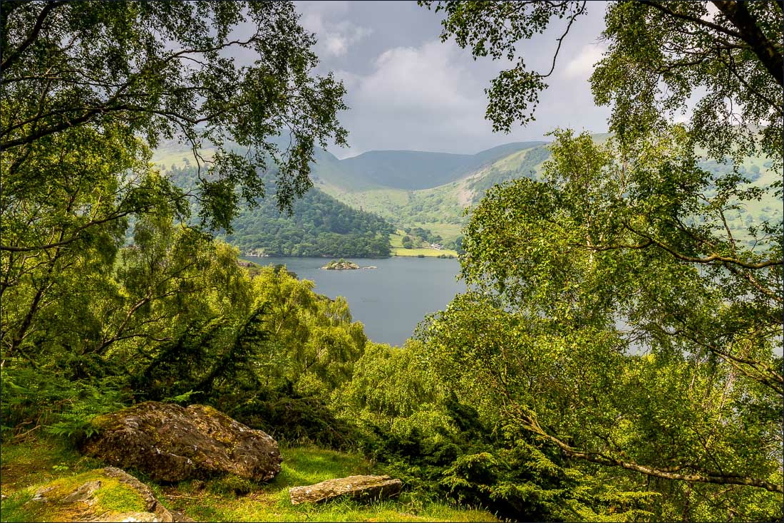
I follow the lakeshore path through Hallinhag Wood

Beyond the wood now and heading for Sandwick


I cross the bridge over Sandwick Beck

Walking towards Place Fell


Rounding the corner of Roscombe Rigg

After a heavy downpour the weather improves as I walk through a delightful woodland section at the foot of Birk Fell


A glimpse of Glencoyne on the far side of Ullswater


Silver Bay

Devil’s Chimney

My destination, Glenridding, comes into view across the lake


I draw level with Glenridding and walk past it towards the head of the lake


The landing stages at Glenridding, the start of today’s journey

I pass by an old barn

Hartsop Dodd


The head of Ullswater

Side Farm - I leave the valley path here

Passing through Side Farm

I follow the track across the head of the lake which leads into Patterdale

Crossing Goldrill Beck

Patterdale - another heavy shower meant that the camera had to be stowed away during the 15 minute stroll from here back to Glenridding

St Patrick’s Church Glenridding - the pier is just down the road and this will mark the end of the Ullswater Way for me - what a wonderful journey it had been
