
Route: Seathwaite Fell
Area: Southern Lake District
Date of walk: 30th September 2014
Walkers: Andrew
Distance: 6.2 miles
Weather: Mainly cloudy with a couple of showers and bright intervals
I parked just before the small settlement of Seathwaite, which has an unenviable reputation for having the heaviest rainfall in the country. True to form, there were a few spits and spots of rain as I set off but luckily these didn’t turn into heavy rain, though there were plenty of dark clouds about during the walk
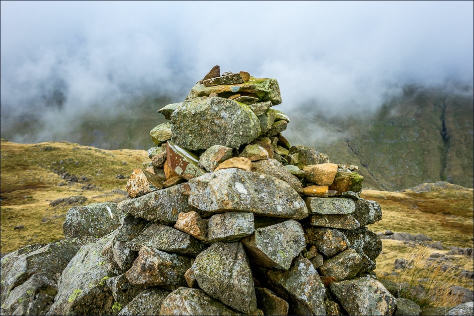
Having walked through Seathwaite, I crossed over Stockley Bridge and followed the well used path for a short distance before heading up the slopes of Seathwaite Fell along a very faint path beside a small stream. The path became steeper as I gained height but there were no difficulties and I was soon at the summit cairn (which isn’t at the highest point of the fell)
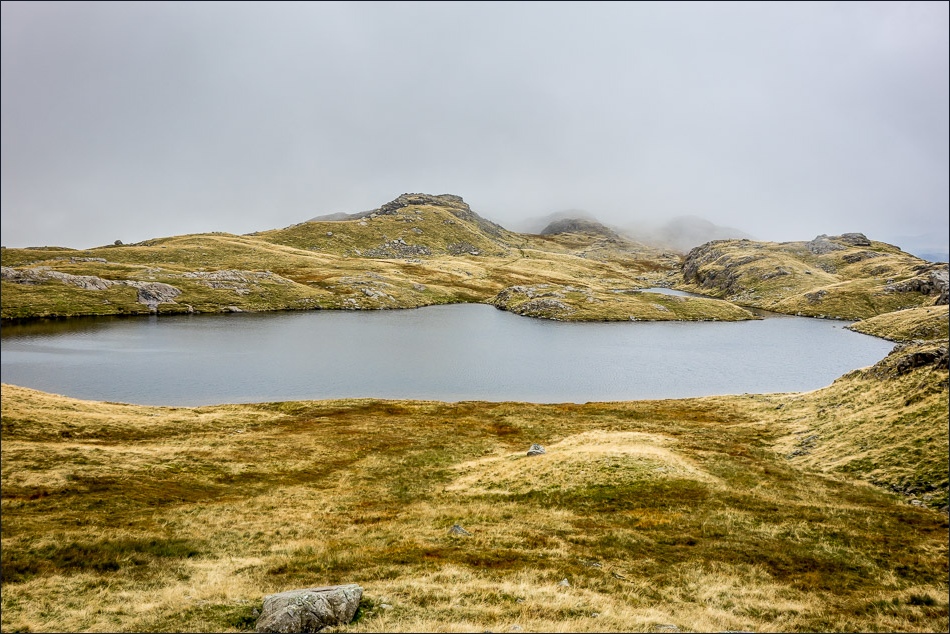
I made my way across the top of the fell to Sprinkling Tarn, accredited as the source of the River Derwent, and set in dramatic surroundings, then picked up the Grains Gill path to descend back down to the valley. The views ahead were wonderful all the way back to the start of the walk
For other walks here, visit my Find Walks page and enter the name in the ‘Search site’ box
Click on the icon below for the route map (subscribers to OS Maps can view detailed maps of the route, visualise it in aerial 3D, and download the GPX file. Non-subscribers will see a base map)

Scroll down – or click on any photo to enlarge it and you can then view as a slideshow

Passing through Seathwaite Farm at the start of the walk - Seathwaite Fell is straight ahead

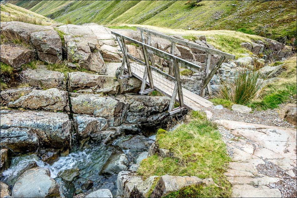
Even though this is the wettest valley in England, the stream has dried up and the bridge is redundant today

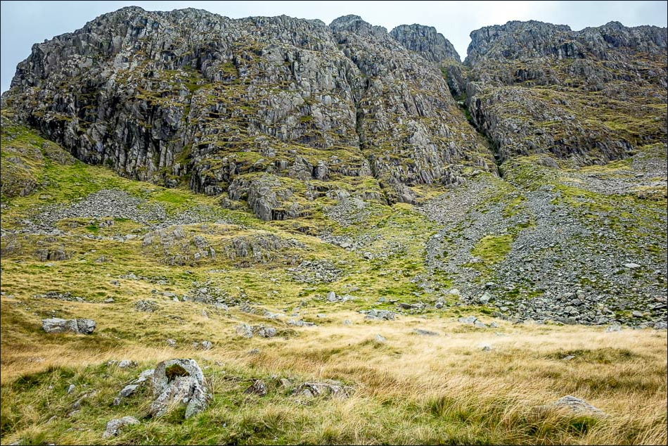
Seathwaite Fell

I cross over Stockley Bridge

Looking along Grains Gill from the bridge

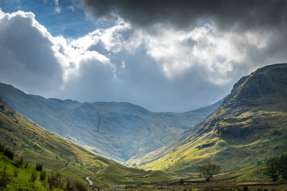
Ever changing skies as I walk along the lower slope of the fell
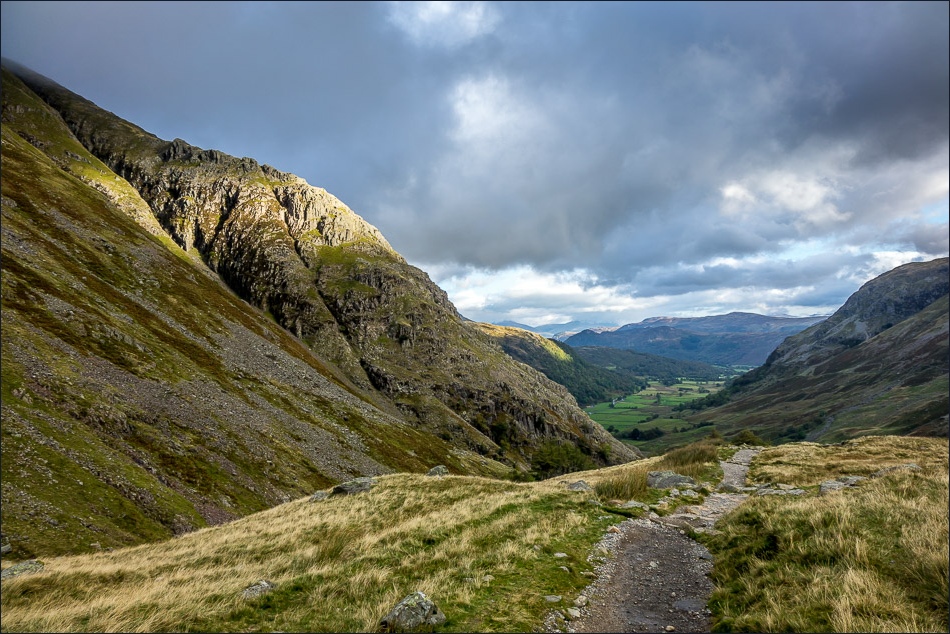
Looking back along the valley
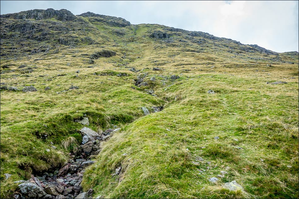
I branch off the main path to take this very faint path up the fellside
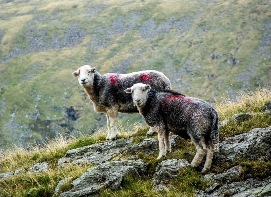
A couple of herdies

Zooming back to Derwent Water and the Jaws of Borrowdale

Looking back to Seathwaite

Approaching the summit of Seathwaite Fell

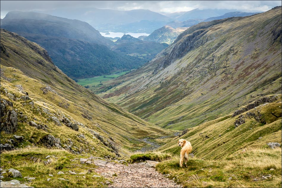
As usual, Bonnie beats me to it and waits patiently for me to catch up

Seathwaite from the summit of its fell

Unnamed tarn below the summit cairn as I head across the fell

Bonnie - the skies were very dramatic along this section with both sun and dark clouds, but luckily we escaped with just a light shower

Further along Seathwaite Fell

Walking towards Great End which came in and out of view as the clouds scuttled across

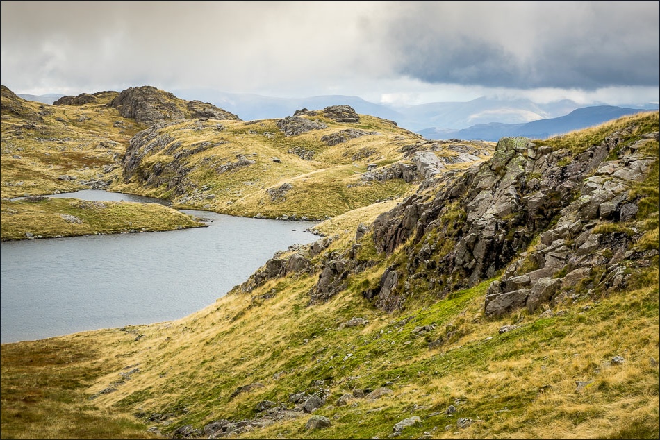
Small unnamed tarn, with Sprinkling Tarn beyond

Sprinkling Tarn
Walking below Great End at the furthest point of the walk - the descent route is to the left

The path runs along the right of Ruddy Gill below
Looking back to Great End as I start the descent

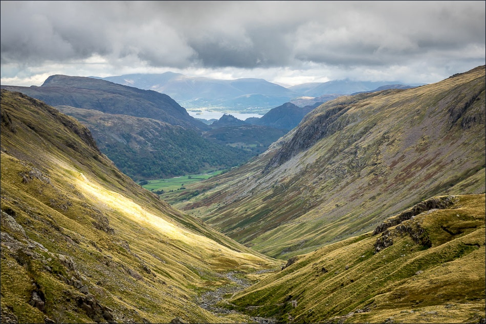
Zooming in on Castle Crag and Derwent Water

The path above Ruddy Gill
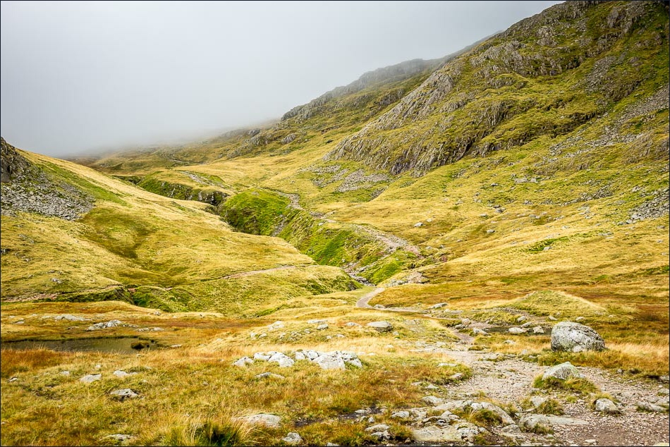
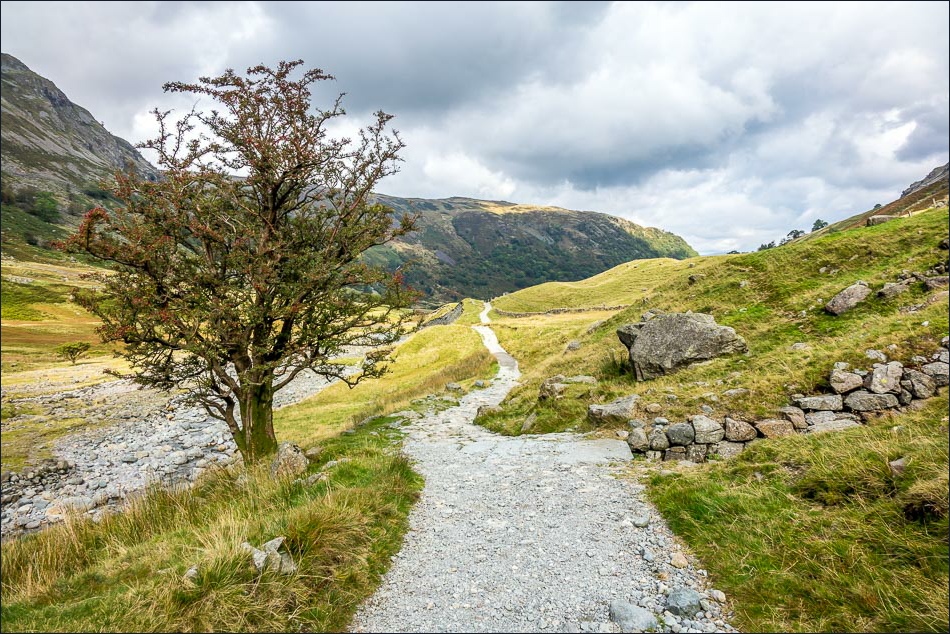
The wonderful view on the way down
Almost back down to valley level

Looking back along the descent route, Seathwaite Fell is on the right

Seathwaite Farm ahead

A last lingering look back to Seathwaite Fell as I walk through the farmyard back to the start
