
Route: Sale Fell
Area: North Western Lake District
Date of walk: 11th September 2018
Walkers: Andrew
Distance: 3.0 miles
Ascent: 800 feet
Weather: Cloudy with sunny spells, windy
Sale Fell is situated in the far north west of Lakeland, and marks the end of the district. Its isolated position means that there are seldom many folk around
I drove along the charming Wythop Valley and parked in one of the roadside spaces near St Margaret’s Church. The gentle climb starts immediately and before long there were some good views of Bassenthwaite Lake. The path continued beside Wythop Woods, part of which has been felled along this section. I was keen to revisit Lothwaite and the ridge along it, as we’d had some fabulous views from here on our last visit in February. Reversing the direction of travel we’d taken on that occasion, I followed the grassy path to Lothwaite and walked along the ridge towards the subsidiary hill of Rivings. The views across Bassenthwaite Lake and into the Lake District were superb, with constantly changing light on the surrounding hills
I then continued uphill, past Rivings, to the summit of Sale Fell. There are good views from here towards the Skiddaw fells but they are inferior to those from Lothwaite, and it would be a shame for anyone to omit Lothwaite from the route
It was very windy on the top, and so without ado I started the gentle descent in the direction of Bassenthwaite, soon joining up with my original ascent path. From here I retraced my steps back to the start
This is a short and simple walk which may lack the drama of the better known lakeland fells, but it’s thoroughly enjoyable and the perfect way to spend an hour or two in this peaceful and far flung corner of the district
Postscript: on a return visit in May 2019, the view from Lothwaite into lakeland had been spoilt by extensive tree felling operations, which have left a denuded hill in the foreground
For other walks here, visit my Find Walks page and enter the name in the ‘Search site’ box
Click on the icon below for the route map (subscribers to OS Maps can view detailed maps of the route, visualise it in aerial 3D, and download the GPX file. Non-subscribers will see a base map)

Scroll down – or click on any photo to enlarge it and you can then view as a slideshow

Looking back down the path at the start of today's walk

Bench overlooking Bassenthwaite Lake and the Wythop Valley

I follow the easy path up the grassy slope

Dubwath, near the foot of Bassenthwaite

The path rises through a gap in an old dry stone wall

Looking back through the gap to Embleton on the other side of the Wythop Valley...


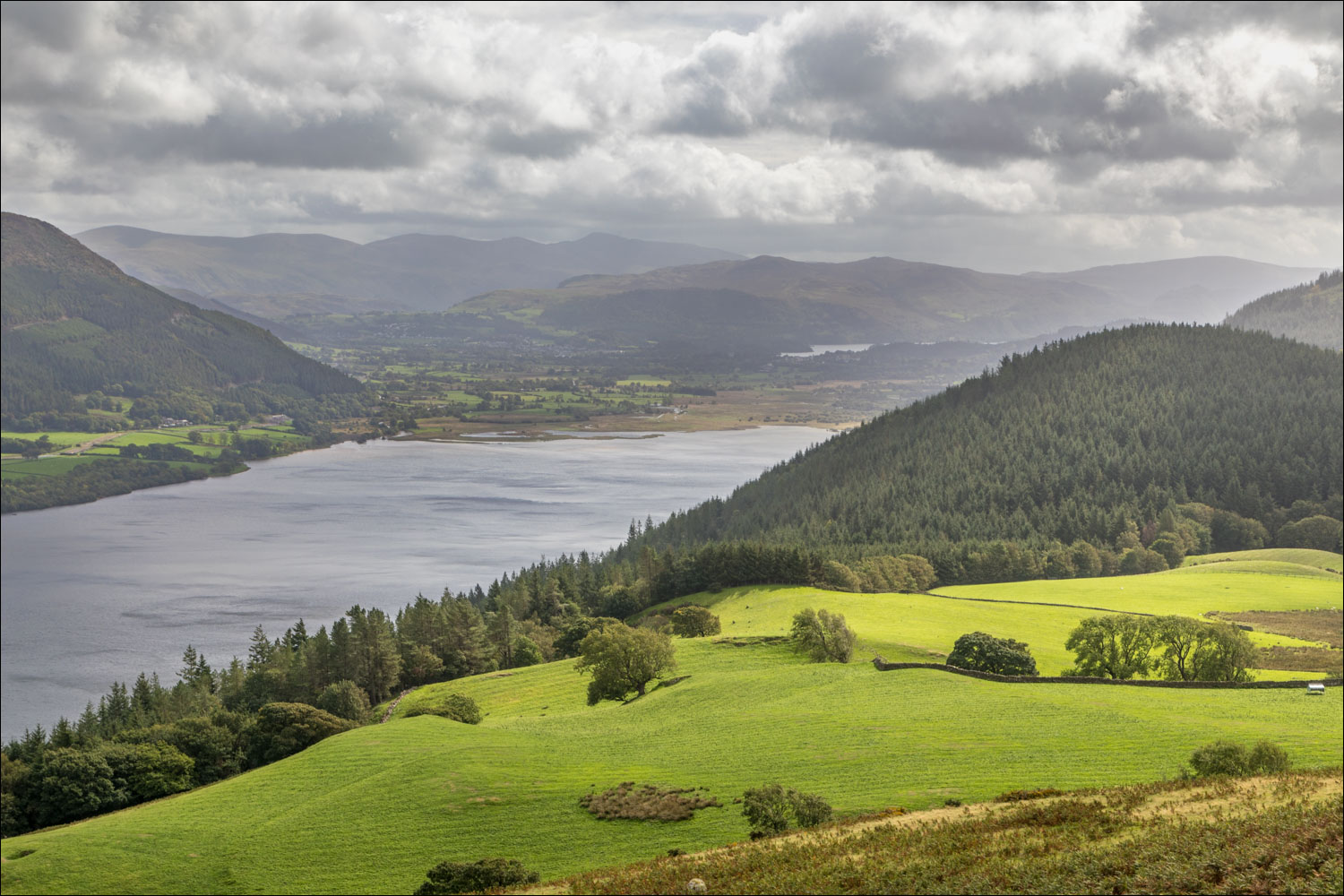
Bassenthwaite Lake seen as I gain height

The edge of Wythop Woods, which have been felled on this higher section

I pass through this gate - Sale Fell is up to the right and could be gained in 5 or 10 minutes by anyone in a hurry

I continue straight ahead and aim for Lothwaite in the mid distance

It's an easy climb up the grassy slopes

Looking back - Sale Fell is beyond the trees and I'll loop round to it after walking along the Lothwaite ridge

The Edge, leading up to Ullock Pike, and Skiddaw in the background

I follow the grassy ridge, with a glimpse of Derwent Water beyond the head of Bassenthwaite

Skiddaw from Lothwaite

Looking into lakeland, with Derwent Water above Wythop Woods

Zooming in

East shore of Bassenthwaite Lake as I continue along the ridge

Ling Fell, Sale Fell's next door neighbour

That lovely view into lakeland again as I reach the furthest point of the Lothwaite ridge

Looking back along the easy path

Sale Fell seen from a small subsidiary top

Looking back to Lothwaite, with Skiddaw towering above it. My route is well seen from here - I'd ascended the path on the left, followed the ridge, and ascended via the path on the right

Summit of Sale Fell...


A rather hazy view of the coastal plain

Bassenthwaite

I head down towards the dry stone wall

Having reached the wall I follow it downhill

Lovely views of the Wythop Valley as I retrace my steps back to the start...


St Margaret's Church at the end of a short but sweet walk
