
Route: Robinson and Hindscarth
Area: North Western Lake District
Date of walk: 12th September 2018
Walkers: Andrew
Distance: 7.4 miles
Weather: Cloudy with patches of sun. Windy and cold on the tops
I last walked this route almost exactly 3 years ago and have happy memories of it. Full of anticipation, I parked in the small car park at Chapel Bridge, near Little Town. As I walked along the lane past Newlands Church I could see both Robinson and Hindscarth in the distance, and the overall route was immediately apparent. I passed by a sign indicating ‘Robinson 2 miles’, which must be as the crow flies. If you’re not a crow it’s more like 3. ‘Robinson’ lacks the romance of the names of many other lakeland fells (Glaramara springs to mind), and it derives from a Richard Robinson who purchased land in the area centuries ago. The fell came to be known as ‘Robinson’s Fell’ and the name stuck
I walked past High Snab and, instead of following the path up the valley beside Scope Beck, I climbed up the steep grassy banks of High Snab Bank in order to gain the summit ridge. It was easy going until I reached the rock steps on Blea Crags. The first of the three is the hardest and involves a mini rock climb, where hands are needed. There are no dangers but it may be out of the comfort zone of some walkers. This is the reason I’d chosen to walk the circuit in an anti-clockwise direction – it would be a tricky business descending these crags
Once I was over Blea Crags is was a simple walk up to the top of Robinson. Having savoured the views, I descended and walked along Littledale Edge, then climbed up again to reach the top of Hindscarth. The views along Newlands Valley and over to Keswick, Skiddaw and Blencathra are superb and these continue most of the way back down to valley level
I descended via Scope End, which is steep and rocky in places (walking poles are useful here) and at Newlands Church I rejoined the original path and retraced my steps back to the car to complete a wonderful circuit
For other walks here, visit my Find Walks page and enter the name in the ‘Search site’ box
Click on the icon below for the route map (subscribers to OS Maps can view detailed maps of the route, visualise it in aerial 3D, and download the GPX file. Non-subscribers will see a base map)

Scroll down – or click on any photo to enlarge it and you can then view as a slideshow

The start of the walk as I follow the lane over Chapel Bridge

Robinson on the right, and Hindscarth beyond Scope End on the left - I'm aiming for Robinson first


Newlands Church

I follow the lane to High Snab (which is a dead end and there's no parking along here)

I pass by High Snab

Looking back along Newlands Valley

Robinson in the distance

I follow the valley path

I leave the path beyond the dry stone wall and climb up a grassy path on the right to join the ridge, here known as High Snab Bank

Robinson, and the exciting ridge leading up to it

Looking back down the path to Scope Beck, which runs along the valley floor

A glimpse of Derwent Water and Blencathra in the distance

Hindscarth up on the left and the ridge to Robinson right

Catbells seen as I gain the ridge

Fellow walkers ahead of me on Blea Crags

Robinson Crags

There are lovely retrospective views along Newlands Valley throughout the ascent

Herdy, with Littledale Edge in the background - I'll be over there later

The precipice of Robinson Crags is on the right, so this is not a place to stray from the path

Littledale Edge

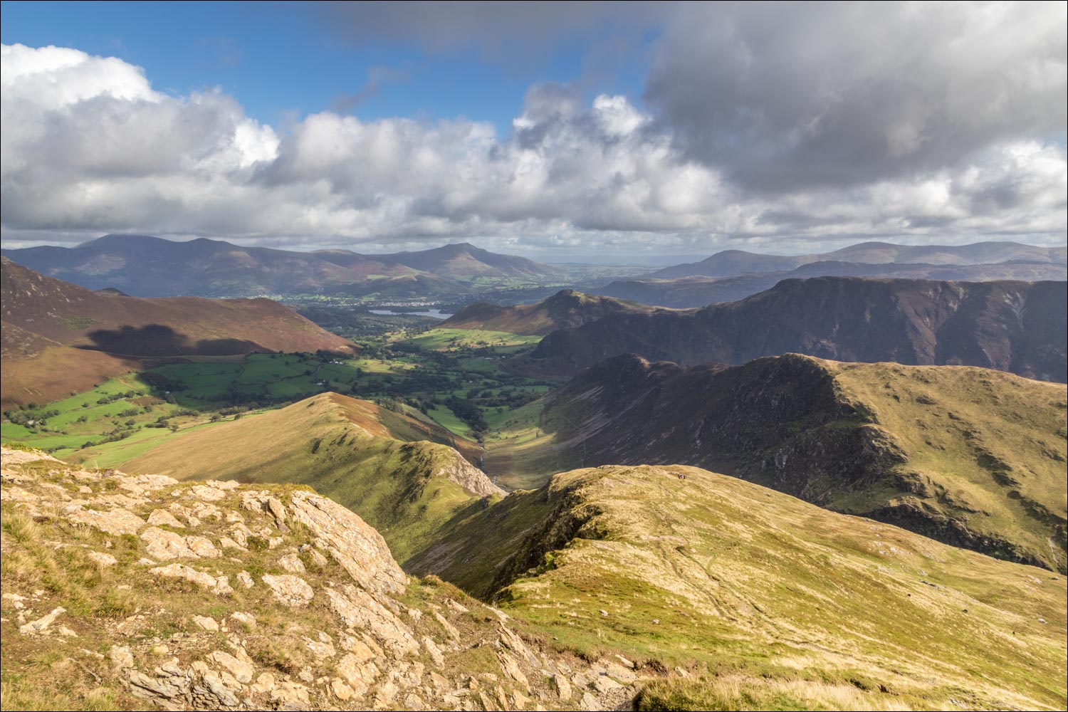
That wonderful view back along Newlands Valley again, with Keswick at the foot of Derwent Water and Skiddaw and Blencathra in the background

The cairn ahead appears to be the summit, but is the first of several such cairns along the easy path to the top

Summit shelter on Robinson - the broad and flat summit area hides the views

I leave the summit to seek out this view of Crummock Water and Loweswater

Buttermere

I descend to the fence along Littledale Edge, here looking towards Pillar

I follow the line of the fence, initially in the direction of Honister Slate Mine

Looking across to Haystacks and Pillar

Honister Pass and the Slate Mine at its head

The ridge continues to Dale Head, but I'll branch off shortly to follow the fainter path curving round to the left

Looking back along Littledale Edge to the High Stile Range

Summit of Hindscarth - the views are not well seen from here


Newlands Valley - my path will take me down the ridge bottom left of the photo

Looking back up Littledale to Robinson

The path leaves the top of the ridge for a while and contours along the edge

It's an easy descent until Scope End is reached - beyond that point it becomes steep and rocky

Looking back to Hindscarth and Robinson...

...and now to Dale Head and Hindscarth

The end is in sight as Newlands Church comes into view

Back to the valley floor, and having followed a permissive path through Low Snab, I follow the farm track - Causey Pike is on the left

Looking back along the track to the flanks of Maiden Moor

Newlands Church ahead, and the end of a wonderful walk is just around the corner

A final glance back to Robinson
