
Route: Rannerdale Knotts
Area: Western Lake District
Date of walk: 31st July 2020
Walkers: Andrew
Distance: 3.0 miles
Ascent: 1,100 feet
Weather: Mostly sunny, very warm
Rannerdale Knotts is one of the smallest lakeland fells, standing at the modest height of 1,160 feet. What Rannerdale Knotts lacks in height it more than makes up for in its rugged mountainous character and the beauty of its surroundings
I made an early start as today was forecast to be the hottest day of the year, with temperatures over 30c. I parked in the small National Trust car park at Hause Point and from here the ascent starts almost immediately. Within a few minutes there were lovely views over Crummock Water and Buttermere. After a steep section up a rocky staircase I was soon on the north top enjoying more good views
I carried on along the knobbly summit ridge known as Low Bank. At the end of the ridge there’s a choice of return routes: either back along Rannerdale, or along the Crummock Water side. I opted for the latter today, as the valley route has restricted views. Such a choice would be unthinkable in May, when the famous Rannerdale bluebells are in flower. The sight – and scent – of huge swathes of these flowers growing on open fellside is unmissable
I descended towards Buttermere down the easy grassy slopes and then joined a narrow path which runs at mid-level above Great Wood, giving good views over Crummock Water along the way. The path is quite faint and little used, and it can be hard to locate when the bracken is high, as it was today. The key to navigation is to keep Grassgarth Coppice, Great Wood and the post and wire fence close by on your left. Beyond the wood I continued to traverse the fellside, and near Hause Point I met up with my original ascent path. From here I retraced my steps back to the start
For other walks here, visit my Find Walks page and enter the name in the ‘Search site’ box
Click on the icon below for the route map (subscribers to OS Maps can view detailed maps of the route, visualise it in aerial 3D, and download the GPX file. Non-subscribers will see a base map)

Scroll down – or click on any photo to enlarge it and you can then view as a slideshow

Mellbreak on the far side of Crummock Water as I leave the car park at Hause Point...


The climb starts immediately - an early view back towards the foot of Crummock Water

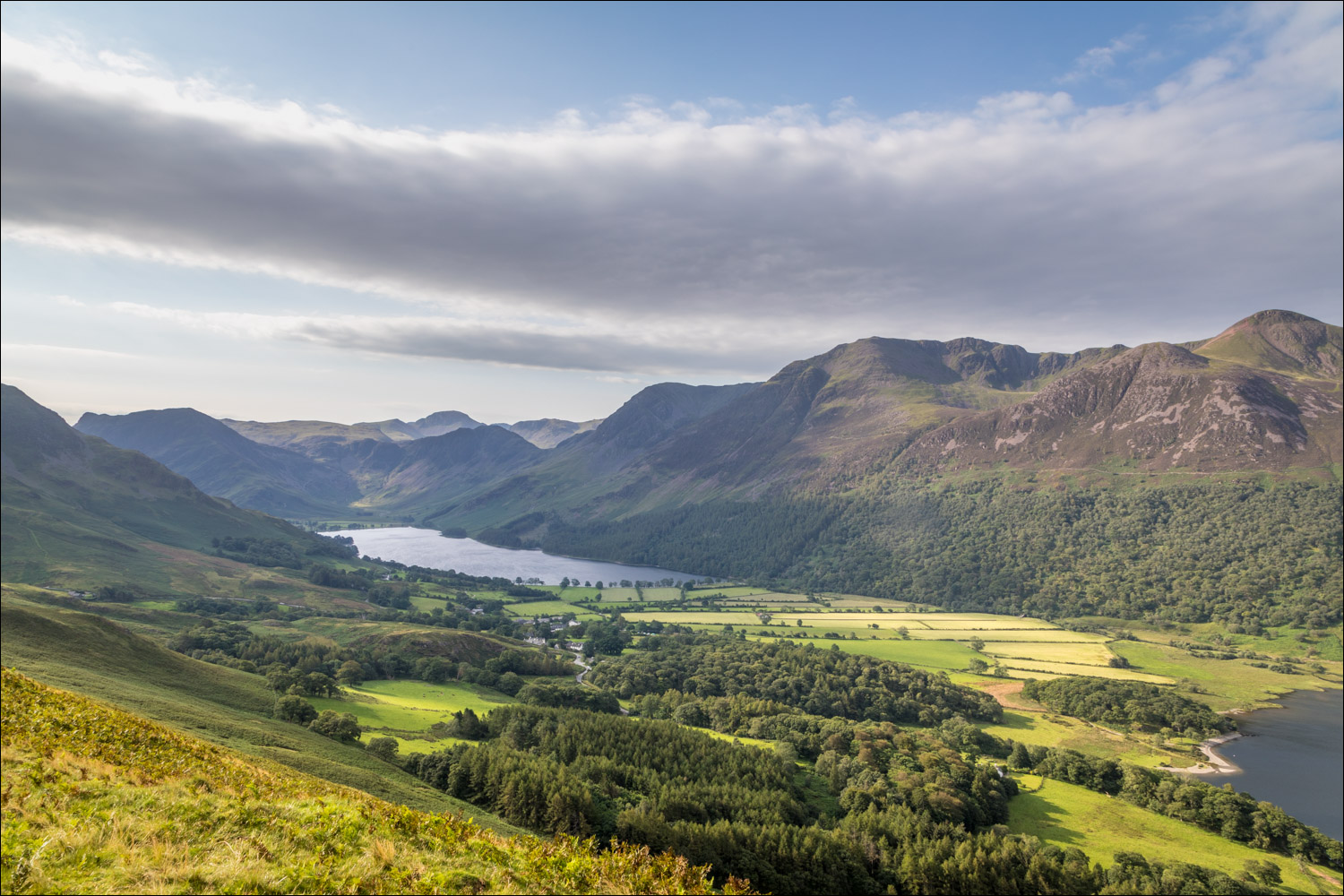
From the top of a hause, a view in the other direction to the head of the lake, and Buttermere beyond it...


Rannerdale Farm below

Red Pike on the far side of Crummock Water

Mellbreak

Looking back down the path

A glimpse of Buttermere as I reach the north summit of Rannerdale Knotts

Crummock Water and Buttermere

Summit cairn on the north top

Looking down to the head of Crummock Water

I set off along the knobbly ridge

Glorious views of Buttermere as I make my way along the ridge...


The High Stile Range - L to R: High Crag, High Stile and Red Pike

Whiteless Pike and Grasmoor on my left

The path on the left leads back to the start via Rannerdale, but I take the path on the right

The path descends gently, initially in the direction of Buttermere...


Red Pike again

Buttermere village below

Grassgarth Coppice on the right. The path back to the start runs along the top of the coppice

Haystacks and High Stile

The path is hidden by bracken in places, but follows the line of the fence and woodland so it would be hard to go astray

A view through a gap in the trees to the High Stile Range...

...and to Buttermere

At the end of the wood, I continue to traverse around the lower flanks of Rannerdale Knotts

Wood House, set in a wonderful location at the head of Crummock Water

Looking back to the head of Crummock Water

I arrive back at Hause Point, and the end of the walk is just around the corner
