
Route: Newport Bay
Area: Pembrokeshire
Date of walk: 26th September 2020
Walkers: Andrew and Gilly
Distance: 5.0 miles
Ascent: 800 feet
Weather: Sunshine and clouds, very strong winds
Today’s walk was a linear one, made possible by the local bus service. We left our rented holiday cottage at Ffynnonofi Farm (which we can highly recommend) and walked along the lane into the nearby village of Dinas Cross. Anyone following this walk would need to park in the village. The ‘Poppit Rocket’ bus offers a more convenient alternative, starting from Pwllgwaelod, but only operates at certain times. Either way, it’s best to check availability and timetables before setting off (especially in these Covid affected times). With linear walks, it’s always preferable to take the bus at the start if possible, as this avoids a potential long wait at the end or, even worse, missing the last bus home
The 9.29am bus arrived bang on time and 10 minutes later we disembarked in Newport at the start of the walk. We headed down the road to Newport Parrog (the Poppit Rocket service stops there when in service). The tide was out, and we were able to walk along the beach before climbing up to join a footpath, part of the Wales Coast Path) leading out of the village. There were various species of wading birds on the sands, and it was a pleasant surprise to see a kingfisher working its way along the rock pools. I’ve always associated these birds with freshwater locations
The path climbed up to the cliff top, giving good views back over Newport Sands. We continued along the cliffs (care is needed in places as there are sheer drops close by), and on two occasions were able to descend to deserted shingle beaches at Aber Rhugian and Aber Fforest
Eventually we arrived at the small coastal hamlet of Cwm-yr-Eglwys, which we’d walked through two days ago on our circuit of Dinas Island. It was tempting to walk around the island again (it is in fact a promontory), but we decided instead to walk across its neck. A short stroll along the easy path brought us to the end of the walk at Pwllgwaelod, where the Old Sailors’ Pub provides refreshments. From here we walked back to our holiday cottage. Anyone catching the bus from Dinas Cross would need to follow the road back into the village
Click on the icon below for the route map (subscribers to OS Maps can view detailed maps of the route, visualise it in aerial 3D, and download the GPX file. Non-subscribers will see a base map)

Scroll down – or click on any photo to enlarge it and you can then view as a slideshow

The start of the walk from Newport Parrog

Newport Sands on our right - the tide is out and we're able to walk along the beach for a short distance

Looking back to Newport Parrog

We leave the beach to join this path, part of the Wales Coast Path, leading out of the town

Views over Newport Sands as the path gradually rises


We pass by the old lifeboat station, now a private house. The station was built in 1884 but in the wrong place, and was abandoned after 11 years

From Carreg Germain, a view across Newport Bay

Cat Rock below the cliffs and Dinas Island in the distance

On top of the cliffs now and we follow a path which weaves in and out of coves

Above Aber Step

Dinas Island, our objective, jutting out to sea

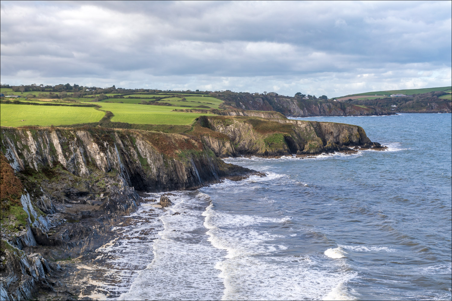
Looking along the rugged coastline


Dinas Island again

The path is close to steep drops at times and care needs to be taken


Penrhyn y Fforest

We descend to a stony beach

Patterns in the rock

We cross a bridge over Aber Rhigian and climb back up to the cliffs

Dinas Island

We pass above an inaccessible beach


Rough seas in strong wind

The path descends to Aber Fforest beach

The descent is inevitably followed by an ascent back onto the cliffs

Looking back along Newport Bay

Another glance back as we start the descent into Cwm-yr-Eglyws

St Brynach's Church, Cwm-yr-Eglwys, which we'd visited on our walk round Dinas Island two days ago

Depending on what bus service is running, Cwm-yr-Eglyws may be the end of the walk. It was necessary for us to walk across the neck of Dinas Island into Pwllgwaelod, about 15 minutes from here

It's an easy stroll on a well made path

The end of the walk (in our case we had a further short walk back to our holiday cottage)

Later that day, we drove north along the coast to check out a possible location for tomorrow's walk. These are the spectacular contorted rock formations at Pen yr Afr

We parked at Ceibwr Bay to admire the views along the cliffs, and decided instantly that we'd return here tomorrow to walk the paths above these cliffs


We're full of anticipation for tomorrow's walk...
Follow the link for more walks in Wales (17)
