
Route: Ceibwr Bay
Area: Pembrokeshire
Date of walk: 27th September 2020
Walkers: Andrew and Gilly
Distance: 5.1 miles
Ascent: 1,000 feet
Weather: Sunshine and clouds
At the end of yesterday’s walk we’d driven to Ceibwr Bay to marvel at the spectacular folding in the cliff face at Pen yr Afr, the result of ancient upheaval and aeons of erosion. This wonderful sight persuaded us to plan a cliff top walk keeping those views ahead of us
We parked in one of the roadside spaces at Ceibwr Bay and joined the Wales Coast Path, which we’ve followed on all our walks this week. After rounding the bay we made a steep ascent up to the headland. The views back along the coast were superb from here, extending to Dinas Island and Strumble Head, both of which are the subject of earlier posts
As we continued along the undulating cliff top path, the views ahead began to command attention, just as we’d hoped when planning the walk. A succession of majestic cliffs stretched out ahead of us, culminating in the amazing rock face at Pen yr Afr
As we approached Pwllygranant at the end of the coastal section, there was a steep ascent followed by a descent to a bridge across a stream. We left the coast path here to start the inland return route, which was through fields and along quiet lanes and bridleways with occasional views out to sea. At a farm named Granant-isaf there has been a re-routing of the path, and it doesn’t follow the dotted green lines on the OS map. The path is waymarked, but the sign is easy to miss as it’s hidden behind a tall hedge. It’s not necessary to enter the farmyard as the OS map indicates
Beyond the farm it was a pleasant stroll back to the start, with ever improving views along the coast. It had been another superb walk, and in the course of 5 miles (and on a weekend) we hadn’t seen another walker
Click on the icon below for the route map (subscribers to OS Maps can view detailed maps of the route, visualise it in aerial 3D, and download the GPX file. Non-subscribers will see a base map)

Scroll down – or click on any photo to enlarge it and you can then view as a slideshow

We visited Ceibwr Bay late afternoon the day before the walk by way of a reconnoitre...

It took us no time at all to decide to return here for tomorrow's walk

Next day, the start of the walk from Ceibwr Bay - there are several roadside parking spaces nearby

We cross a bridge over the outflow of Nant Ceibwr

Looking back over the bay as we climb to the top of the cliffs

More views back along the coast...


...and now looking ahead along a series of spectacular cliffs, originally formed by glacial erosion

The best of these formations is the contorted face of Pen yr Afr...


Looking back

There are sharp drops in some places, but no dangers as long as care is taken


We continue along the undulating path

Looking back

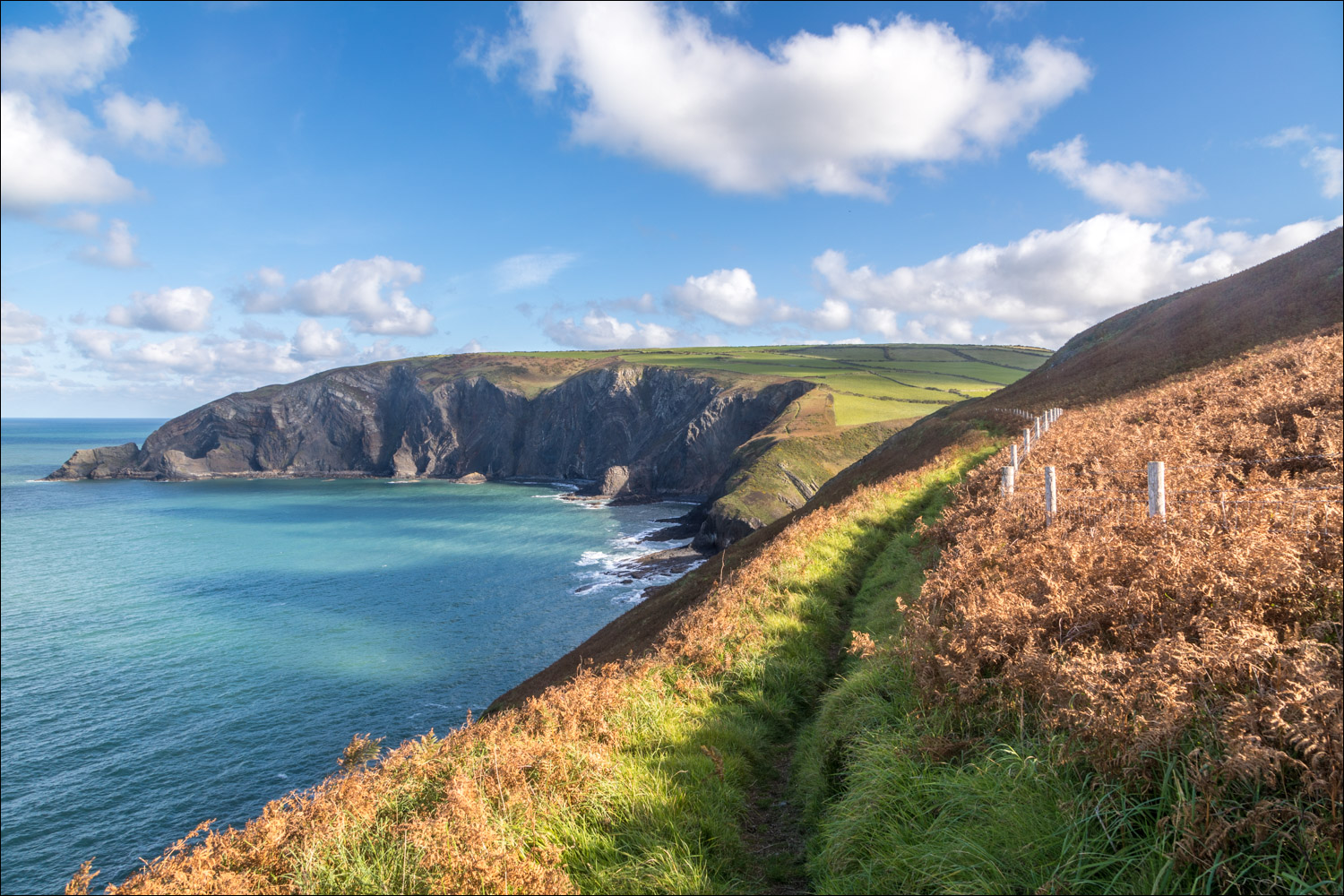
The path continues by the line of the fence

Foel Hendre on the right


Pen yr Afr ahead

Our path will turn inland at Pwllygranant, below the green fields ahead

Folding rock formations in the cliff face at Pen yr Afr


We leave the Wales Coast Path just beyond this point...


Cwm yr Esgyr, where we turn inland to start the return journey

Beyond Granant-isaf we walk through the fields

We join a lane at Tre-Rhys

Ceibwr Bay below

We retrace our steps along the path back to the start

Ceibwr Bay, and the end of a wonderful walk which will live long in the memory

Later that day, sunset over Fishguard Bay
Follow the link for more walks in Wales (17)
