
Route: Scalpay and Eilean Glas Lighthouse
Area: Outer Hebrides, Isle of Scalpay
Date of walk: 9th March 2024
Walkers: Andrew and Gilly
Distance: 6.7 miles
Ascent: 500 feet
Weather: Sunny, exceptionally windy
The Isle of Scalpay is a small island with a population of around 300. Access to the island was formerly by ferry, but it is now connected to Harris via a bridge built in 1997
Click on the icon below for the route map (subscribers to OS Maps can view detailed maps of the route, visualise it in aerial 3D, and download the GPX file. Non-subscribers will see a base map)

Scroll down – or click on any photo to enlarge it and you can then view as a slideshow

We park on the roadside near the main settlement on the island and set out along the Heritage Path to Eilean Glas

Looking across to Ceann a Bhaigh, which we'll walk past at the end of the walk

We reach Loch an Duin and turn left

We cross a small bridge over the outflow of Loch an Duin, aiming for the marker post ahead

Leac Easgadail, which is on Harris

Looking back to the start - the marker posts proved to be an invaluable guide through some rough and remote terrain


The coast of North Harris

Looking back along Loch an Duin

We cross a narrow neck of land between Loch an Duin and the adjacent Loch Cuilceach

Looking out to the Shiant Islands

We start the easy ascent of Beinn Scorabhaig

North Harris

We reach the top of Beinn Scorabhaig, from where we can see our next target, the Eilean Glas Lighthouse

North Harris and the Shiants from Beinn Scorabhaig, the highest point on Scalpay

The Shiants again

After crossing some rough ground, it's a relief to be on the easy path to Eilean Glas

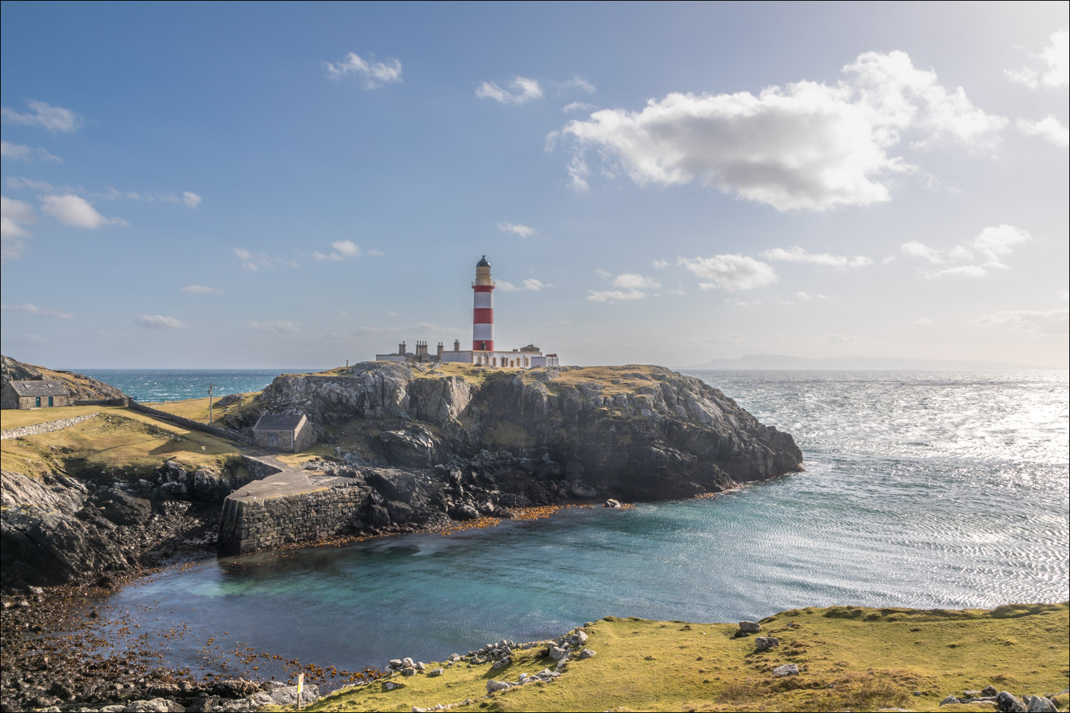
We arrive at the Eilean Glas Lighthouse. Refreshments are available here during the summer months


We turn right at the lighthouse and follow the undulating coastal path

Looking back to the Eilean Glas Lighthouse

The path weaves its way up and down gullies, with good views out to sea...


The end of the coast path as we reach Ceann a Bhaigh (confusingly, there are two Ceann a Bhaighs on the small island)

We descend to the road, which we'll follow for about three miles back to the start

We pass by a sea loch


")
We walk above An Acairseid a Deas (South Harbour)
")

We approach the main settlement on Scalpay (which for some reason doesn't appear to have a name)
")
We pass by the West Harbour (An Acairseid a Tuath)

We arrive back at the other Ceann a' Bhaigh and from here it's a short stroll back to the start
Follow the link for more walks in Scotland (44)
