
Route: Loweswater and Holme Wood
Area : Western Lake District
Date of walk: 4th March 2022
Walkers: Andrew and Gilly
Distance: 5.7 miles
Ascent: 1,000 feet
Weather: Mixed cloud and sun
This is one of our favourite local walks which, in the space of 6 miles, manages to cram in a huge variety of scenery including farmland, ancient woodland, a lake, a tarn, open moorland and a lonely valley. Along the way there are wonderful views over the Solway Plain looking north (including Scotland in clear weather) and to the high lakeland fells looking south
With the felltops hidden under clouds, this was a good choice for today’s walk. We made an early start and parked as usual at Maggie’s Bridge where there is space for 8-10 cars. Instead of heading directly to Loweswater we followed the track to High Nook Farm, where Alfred Wainwright used to stay when he was researching his Guide to the Western Fells. After passing through the farmyard we carried on to the head of the valley before joining the wonderful terraced path above Holme Wood, known as the old coffin road from Loweswater to St Bees (the description may be fanciful but the name has stuck). The views from here are superb
The path contours around the sides of Carling Knott and Burnbank Fell and reaches a height of over 1,000 feet – higher than one or two lakeland fells. However the climbing is so gentle that it’s hardly noticed. We carried on towards Fangs Brow, on the very edge of the Lake District, before turning back at Iredale Place and following the path past Jenkinson Place and Hudson Place. Just before Hudson Place, a herd of Belted Galloway cattle had turned the field into a quagmire and we emerged onto the lane with our boots caked in mud
We then descended into Holme Wood, and along the shore of Loweswater, passing by the bothy as we did so
The last section was an easy stroll along the track between Watergate Farm and Maggie’s Bridge. We’ve followed this route on numerous occasions at every time of the year and never tire of it
For other walks here, visit my Find Walks page and enter the name in the ‘Search site’ box
Click on the icon below for the route map (subscribers to OS Maps can view detailed maps of the route, visualise it in aerial 3D, and download the GPX file. Non-subscribers will see a base map)

Scroll down – or click on any photo to enlarge it and you can then view as a slideshow

The start of the walk as we follow the track in the direction of Carling Knott. Our route will take us above Holme Wood right of picture

The track passes through High Nook Farm, which is just around the corner

Beyond the farm we head to the end of the valley

A view back to Low Fell, and a glimpse of Loweswater

We reach the head of the valley and curve round to the right

We cross the footbridge over Highnook Beck and turn sharp right to climb up above Holme Wood

Low cloud obscuring the fell tops as we look back across our route

We arrive at the edge of Holme Wood, looking across to the foot of Mellbreak

Looking back along the path above Holme Wood

We follow the so-called old coffin road but it's believed that the name is fanciful, as it's an impractical path for such a purpose and a much easier alternative is below

Clearing skies reveal Criffel in Scotland in the far distance

Loweswater and Holme Wood below as we follow the elevated path

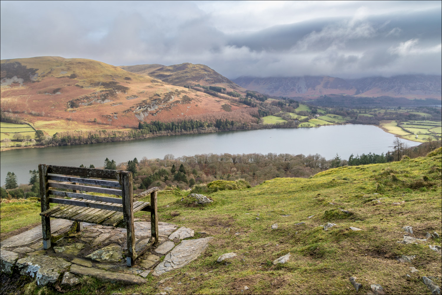
A well positioned bench overlooking Loweswater

Looking back along the 'old coffin road'

On the fringes of the Lake District now as we head towards Fangs Brow...


Just before Fangs Brow we turn right and pass through this gate to start the return leg

We follow the path, initially in the direction of Mosser Fell

We pass above Iredale Place, one of the lovely traditional farmhouses in the Loweswater area...

...and another one - Jenkinson Place

Loweswater comes into view

We arrive at the lane to Hudson Place and turn right here

Beyond Hudson Place we follow the path to the lakeshore

Loweswater is unusual in that it drains into lakeland, so we're walking towards the foot of the lake rather than its head, as would be expected

We walk along the shore of Loweswater

Holme Wood. There's a choice of paths here, one through the wood and the other by the shore. They both end up in the same place, so take your pick

Holme Wood is a mixed woodland of oak, chestnut, ash, sycamore, alder and lime. Sadly the larch trees here have been infected by the Phytophthora ramorum virus which is highly contagious, and felling work is in progress


We cross the footbridge over Holme Beck


We leave Holme Wood at the foot of the lake...

Looking back along Loweswater...

...and a final glance back to Carling Knott and Holme Wood as we follow the track back to Maggie's Bridge
