
Route: Loweswater and Holme Wood
Area : Western Lake District
Date of walk: 6th July 2020
Walkers: Andrew
Distance: 5.7 miles
Ascent: 1,000 feet
Weather: Mostly cloudy, but some sunny patches
Following the relaxation of the 3 month lockdown caused by Covid-19, my wish is to revisit some of my favourite places. The 3 month absence feels like 3 years
The walk which I chose today is is one of my favourite local walks which, in the space of 6 miles, manages to cram in a huge variety of scenery including farmland, ancient woodland, a lake, a tarn, open moorland and a lonely valley. Along the way there are wonderful views over the Solway Plain looking north (including Scotland in clear weather) and to the high lakeland fells looking south
I parked as usual at Maggie’s Bridge where there is space for 8-10 cars. Instead of heading directly to Loweswater I followed the track to High Nook Farm, where Alfred Wainwright used to stay when he was researching his Guide to the Western Fells. After passing through the farmyard I carried on to the head of the valley before joining the wonderful terrace path above Holme Wood, which is often described as the ancient coffin road from Loweswater to St Bees. However the description is probably a misnomer, and it’s thought that the name was applied by the National Trust about 40 years ago in order to promote the route. Whatever the truth, the views from here are superb and it was fortunate that there were some breaks in the cloud, giving good light at times. Scotland and the Solway Firth could clearly be seen in the distance
The path contours around the sides of Carling Knott and Burnbank Fell and reaches a height of over 1,000 feet – higher than one or two lakeland fells. However the climbing is so gentle that it’s hardly noticed. I carried on towards Fangs Brow, on the very edge of the Lake District, before turning back at Iredale Place and following the path past Jenkinson Place and Hudson Place. I then walked back through Holme Wood, and along the shore of Loweswater, passing by the bothy as I did so
The last section was an easy stroll along the track between Watergate Farm and Maggie’s Bridge. I’ve followed this route on numerous occasions at every time of the year and never tire of it – it was good to be back
For other walks here, visit my Find Walks page and enter the name in the ‘Search site’ box
Click on the icon below for the route map (subscribers to OS Maps can view detailed maps of the route, visualise it in aerial 3D, and download the GPX file. Non-subscribers will see a base map)

Scroll down – or click on any photo to enlarge it and you can then view as a slideshow

The start of the walk as I cross Maggie's Bridge over Dub Beck

Gavel Fell as I follow the track to High Nook Tarn

Looking back along Lorton Vale, with Low Fell on the left

Zooming in on the vale

Looking across to Whiteside, Grasmoor and Mellbreak as I reach the edge of Holme Wood

The old coffin road takes me above Holme Wood, and at the edge of the wood there's a clear view of the Solway Firth and Criffel in Scotland

The walk can be shortened here by descending into Holme Wood via the gate below, but I follow the path as it contours around the lower flanks of Burnbank Fell

Early flowering heather on the fellside

Looking over Holme Wood to Loweswater and Crummock Water beyond it

Perhaps my favourite bench in the district...


The head of Loweswater - the lake is unusual as it flows into the Lake District, rather than away from it as would be expected

Looking back along the 'coffin road'

On the edge of the Lake District now, as I head towards Fangs Brow...


Just before Fangs Brow I turn right to begin the return leg of the walk...


The path takes me above Iredale Place, and Loweswater comes into view

Just beyond Hudson Place I follow a path on the left which leads down to Loweswater...

A lovely section of the walk as I approach the head of the lake,,,


A short detour to the water's edge...


I enter Holme Wood

There's a narrow path at the edge of the lake, but it's waterlogged so I join the main path a little higher up


Trees in Holme Wood

I pass by the bothy, available to rent from the National Trust

Looking towards the foot of Loweswater

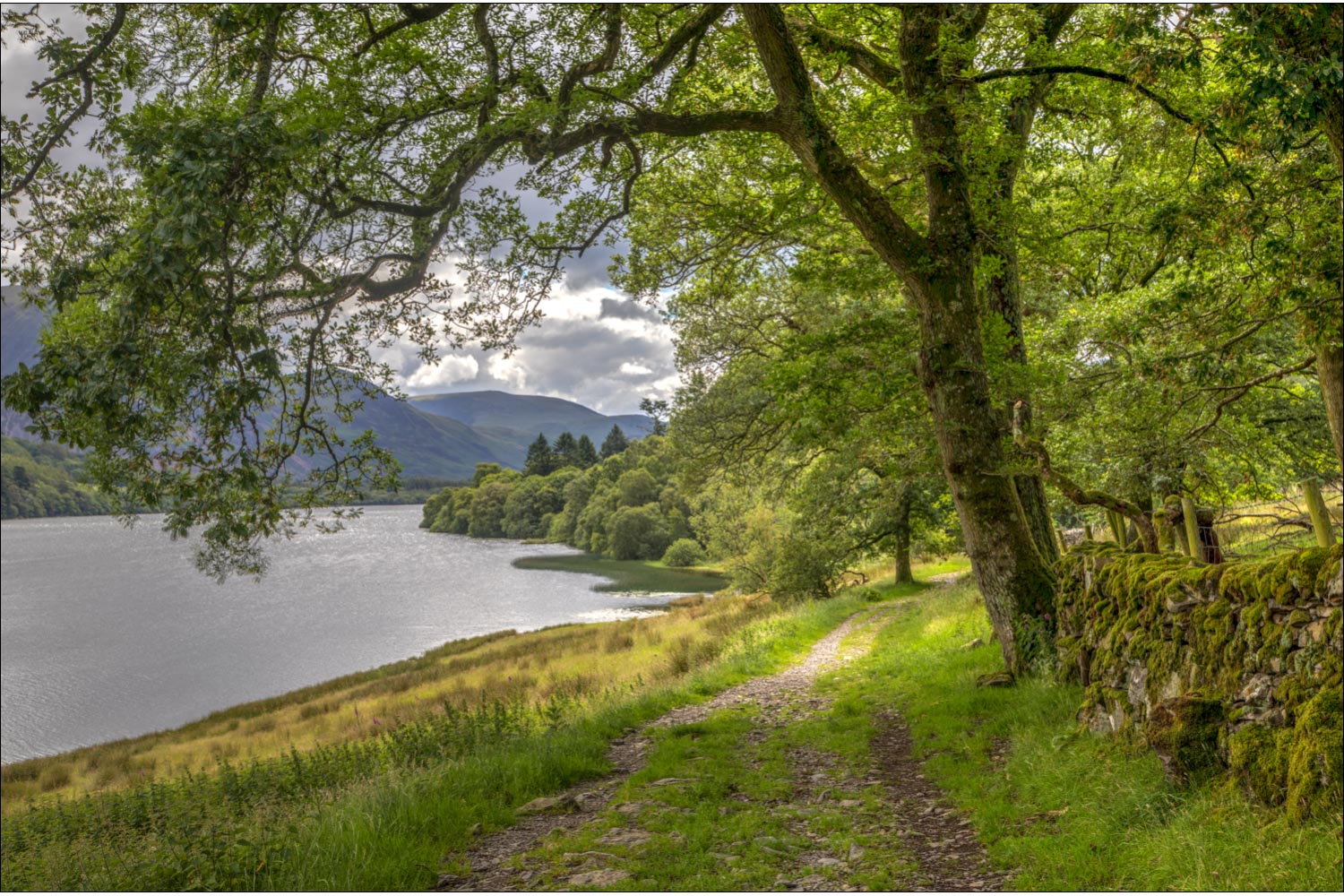
I leave Holme Wood and follow the track back to Maggie's Bridge

The end of the walk is just around the corner
