
Route: Circuit of Buttermere
Area: Western Lake District
Date of walk: 5th July 2020
Walkers: Andrew
Distance: 5.1 miles
Ascent: 400 feet
Weather: Windy, mostly cloudy with a few bursts of sun
At long last the lockdown imposed as a result of the Covid-19 virus has been relaxed. It’s been over 3 months since I’ve been able to add a new walk to the site, and I was raring to go. I’ve missed some of my old haunts, and so decided to revisit one of my favourites, Buttermere
The circuit of Buttermere appears over 20 times on this site and is one of the classic low level walks in the Lake District. The beauty and accessibility of the walk is both a virtue and a problem, in that the path can be too busy at peak times and if you prefer to walk in relative solitude, then it’s best to choose a quiet day and time. I made an early start and thanks to this only passed by a few other walkers during the course of two hours
I parked in my usual spot, the National Trust car park at Long How. I walked through Buttermere village, passed by the Fish Inn, and followed the path to the foot of the lake. I always walk around Buttermere in an anti-clockwise directions in order to keep the best views ahead. After crossing the new footbridge over Buttermere Dubs I set off along the lakeshore path which leads to the head of Buttermere. I was fortunate today, since my arrival at the head of the lake (possibly the most beautiful section of the walk) coincided with some decent light as patches of sun broke through the clouds
After crossing Peggy’s Bridge and passing by Gatesgarth Farm I started the return leg along the other shore, following a recently improved path. Following recent heavy rainfall, the level of the lake was unusually high and the path was flooded in one place. I had to resort to a mini scramble up some slippery rocks in order to keep my boots dry. I then passed through the short tunnel in the rocks near Hassness and continued along the lakeshore path. This brought me back into Buttermere village to end a walk which I could never tire of
For other walks here, visit my Find Walks page and enter the name in the ‘Search site’ box
Click on the icon below for the route map (subscribers to OS Maps can view detailed maps of the route, visualise it in aerial 3D, and download the GPX file. Non-subscribers will see a base map)

Scroll down – or click on any photo to enlarge it and you can then view as a slideshow

Buttermere village. I kept a lookout for red squirrels but was out of luck today

I pass by Cragg House Farm, with the High Stile Range in the background

I arrive at the foot of Buttermere and turn right beyond the gate

Burtness Wood

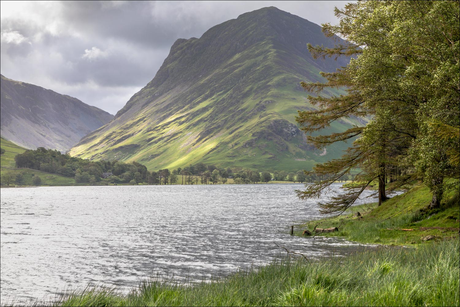
Fleetwith Pike, one of the scenic highlights of the walk, at the head of the lake...


Fleetwith Pike again...


Looking across to Hassness on the other side of the lake

Haystacks top right of picture

I pass by the small plantation of Horse Close

The head of Buttermere

Waterfall in Warnscale Beck

The path to the right leads to Haystacks, but I continue straight ahead

The bothy at the head of the lake, known as 'The White Hut'...


Fleetwith Pike left and Haystacks right

The Alan Skillen memorial bench

Haystacks, seen as I start out along the head of Buttermere

Looking across Warnscale Beck to the White Hut

Warnscale Beck again, looking towards Warnscale Bottom

Buttermere pines beside the very full beck

Gatesgarth Farm

Herdwick sheep

Having passed through Gatesgarth Farm, there's a short road section - the only traffic I encountered were sheep

Start of the path along the other shore of the lake

Looking back to Haystacks and High Crag

High Stile and Comb Beck waterfalls

A view back from the pebble beach at Hassness

Mellbreak beyond the foot of the lake

Hassnesshow Beck

I pass through a rock tunnel, carved out in the 19th century by a Manchester Mill owner

I follow the path along Pike Rigg

Beyond the head of Buttermere now, I head back to the village

Looking across to High Stile and Red Pike

I pass through Wilkinsyke Farm, and the end of the walk is just beyond it - what a wonderful way to end lockdown
